Let's start this weekend weather discussion with a talk about snowmaking because that's what most of us what to read about! The first half of October has been kind of a disappointment for painting our slopes in fluffy water crystals but I'm seeing some promising signs of cold coming in about 10 days. That's solidly fantasy range for doing things like tracking storms and dialing things in, but large scale waveform patterns are more reliable and the recent trend in the GFS has been to make it even colder so that's the right direction. We'll track snowmaking through at least early November like we track storms, but that also means that since it is forecasting we're going to end up turning on our paywall and only allowing our Premium Subscribers to make use of this actionable information.
As far as this weekend goes that storm from last weekend has hardly budged (it's a blocking pattern), but the next system will push it out to sea so that a fresh batch of rain can come in. Unfortunately Saturday will bring heavier rain across much of PA, NJ, CT, RI, and NY Metro,. Sunday is generally a better day, but the southern part of the Northeast will still be clearing out of light rain in the morning and additional mist, drizzle, and poor visibility will wrap around the storm enhancing on the upslope.
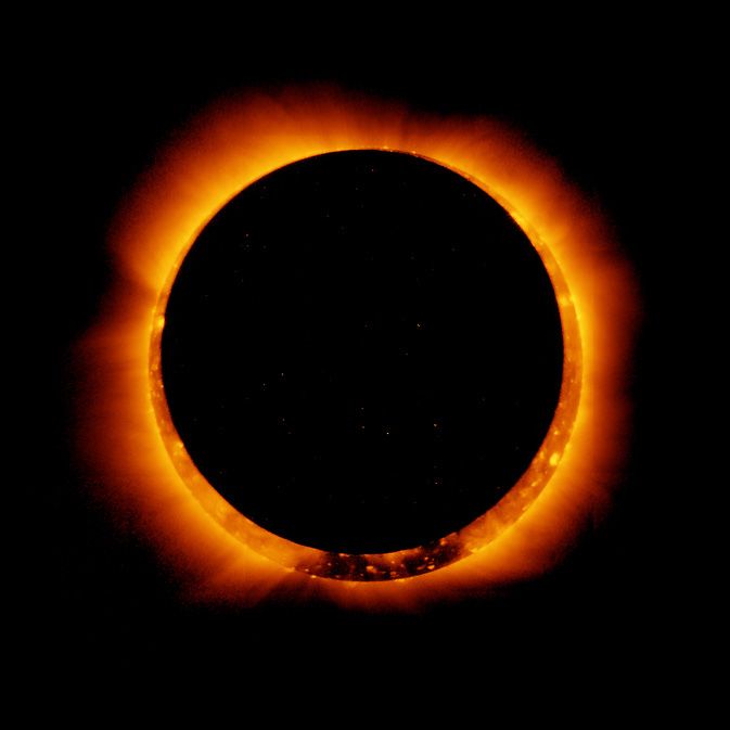
As far as that eclipse goes, fuggetaboutit! Unfortunately totality will be over 2,000 miles away from the Northeast with the SW corner of PA only getting 35% coverage while the NE tip of Maine will see just 10%. Our eyes can't detect these changes, and staring into the Sun to prove us wrong is not recommended. This will be further complicated by a lot of cloud cover and our inability to see through them. The eclipse starts reaching the Northeast in Western PA and NY at 11:51 a.m. on Saturday and will exit the region at 2:40 p.m. We recommend that you find a great place with a clear view and use that time to plan for the next eclipse on April 8th which will have totality in the Northeast.
Please remember to subscribe if you haven't already. It's just $29.99 for an entire year and that's not at all expensive considering the cost of the activities and how being better informed can both save money and make it better spent. The average Snowology follower spent over $5,000/year on skiing or riding last season and better knowing the weather is how you make that money buy you even more, or at times less when the weather is undesirable.
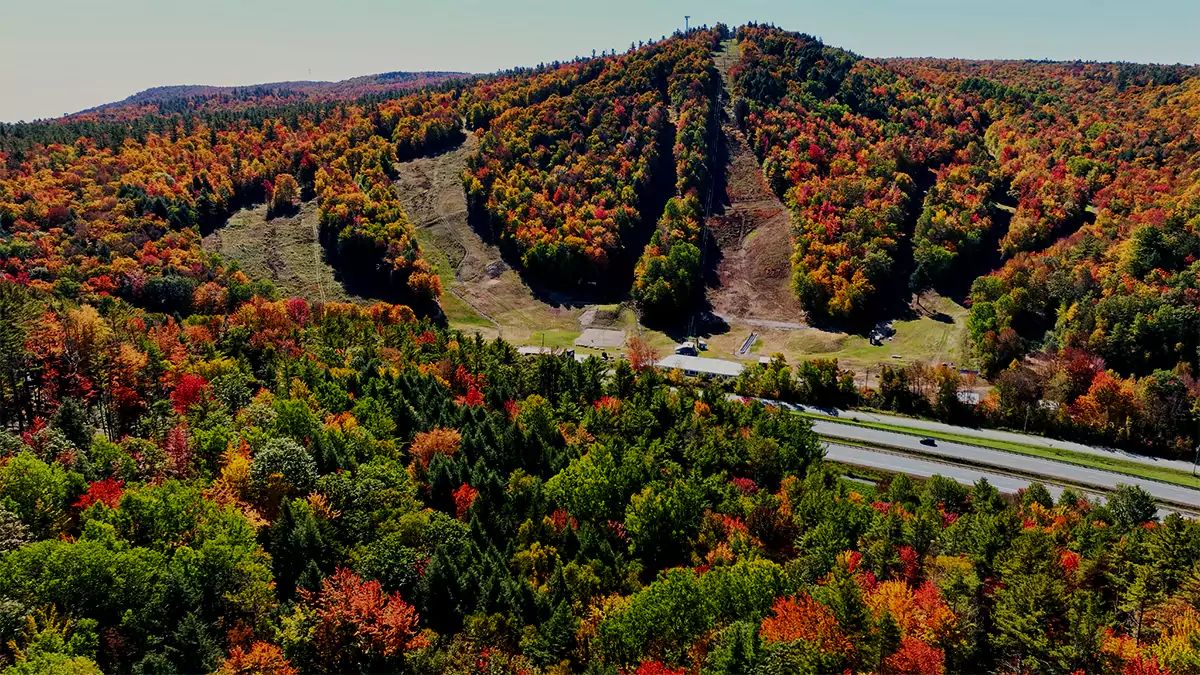
Leaf Peeping
The focus on leaf peeping has now shifted out of the northern areas, and there is danger of being past peak in the areas that the following map shows as peak. Remember that elevation though does affect foliage so if it is already stick season on the mountain, fall may be showing its coat of many colors not far away in the valleys.
The focus now should be on PA, NJ, Southern New England, and southern Maine and New Hampshire. We have the following map from Explore Fall that shows today's estimate of where fall colors have progressed, but take note, this may be slightly conservative on the advance of color.
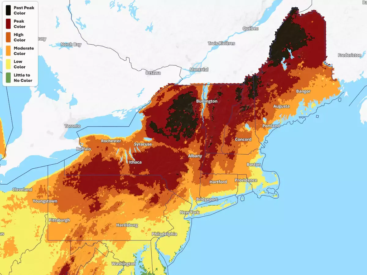
I'm afraid that record precipitation for much of the area where maples are dominant has caused less vibrant colors and combined with temperatures and sun angle we're seeing duller colors and more progression from green to brown instead of peaking appropriately.
Weekend Weather Discussion
We've had plenty worse weekends, but this won't be great. Let's first take a look at the 3-hour precipitation intensity loop from the mesoscale NAM3K model covering all of Saturday and Sunday. If you are trying to figure out the timestamps in any weather model map, we are currently 4 hours behind "z" time which is the same as UTC time. When we fall forward in November "z" time will be 5 hours ahead of our local time under DST. Note that "z" comes from military "zulu" time and is the exact same thing as UTC time.
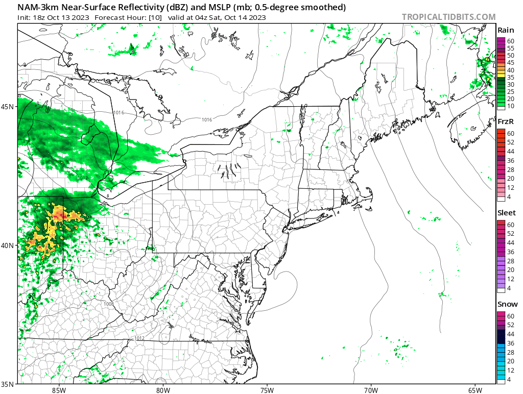
As you can see the rain that wraps back in around the departing storm is not heavy, in fact this model overenhances upsloping precipitation and those very faint green specs are likely no more than fog or mist and it's also a warning sign for poor visibility on at elevation. So while it won't be a washout anywhere on Sunday, the northern areas may not be desirable for viewing broad landscapes and most mountains will not break out of the 40's.
We'll use the National Blend of Models for our Saturday and Sunday quick looks. This model integrates the output of other models as sort of like an average. It's more accurate within 72 hours and when major models like the ECMWF and GFS are not in substantial disagreement. It will smooth out the differences, but it can also smooth the precipitation too much in many cases when differences are present. As you can see, they aren't expecting that moisture on the back end to create actual precipitation, but in our experience there will be some higher up as well as poor visibility in some cases as was discussed in the intro.
We're showing the 12 hour rainfall for both Saturday and Sunday from just 8 a.m. to 8 p.m. to correspond with outdoor activities. We are also showing first the lows for each day and then the highs. This isn't very complicated, it isn't that interesting, and it sure as hell ain't snow so we won't talk your ear off about this one. Those nights are pretty chilly but not yet enough so that it is useful to us.
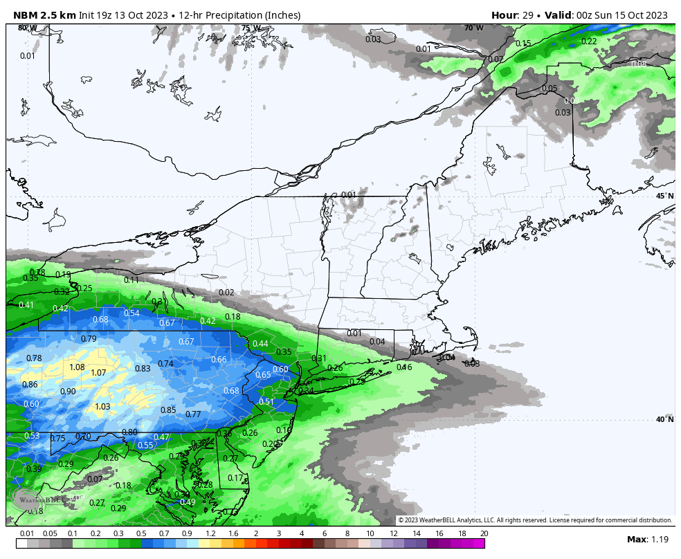
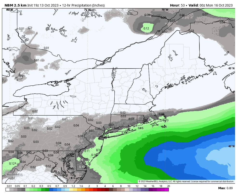
Precipitation on both Saturday and Sunday just from 8 a.m. through 8 p.m.
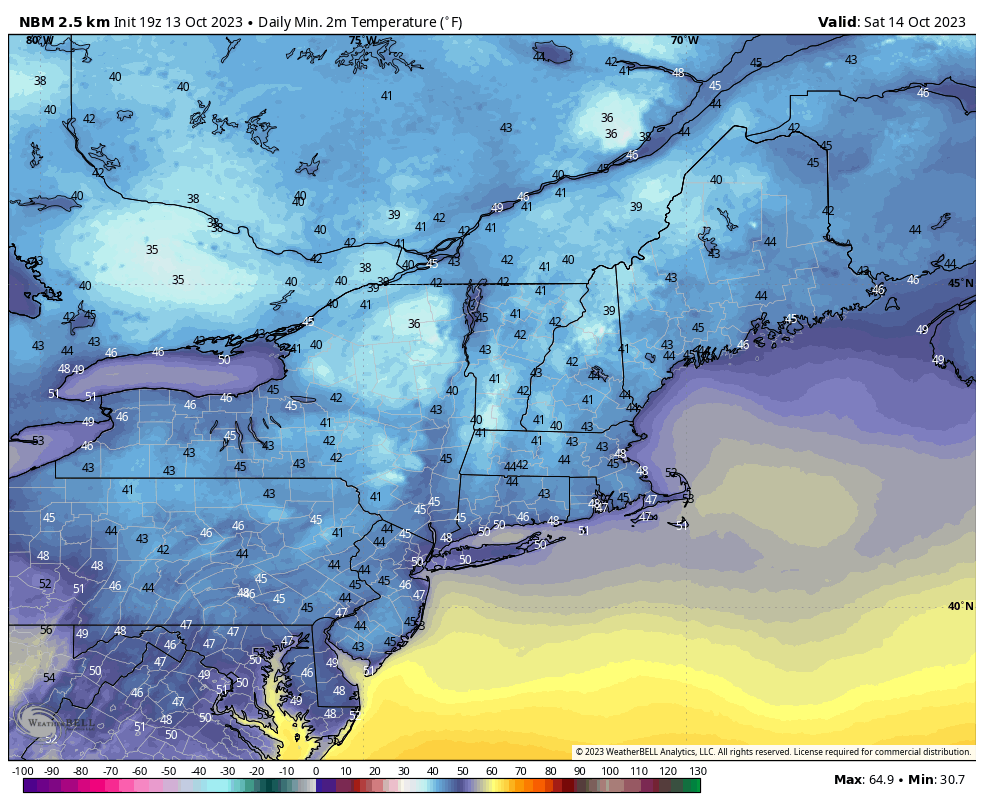
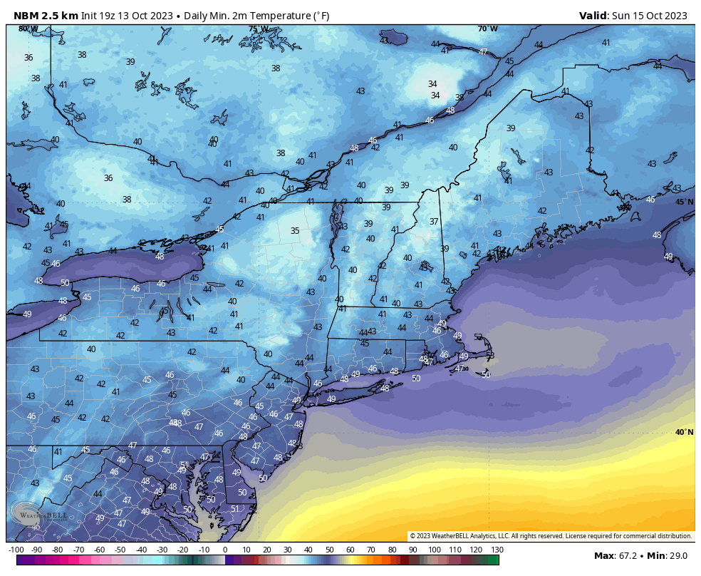
Morning lows on both Saturday and Sunday.
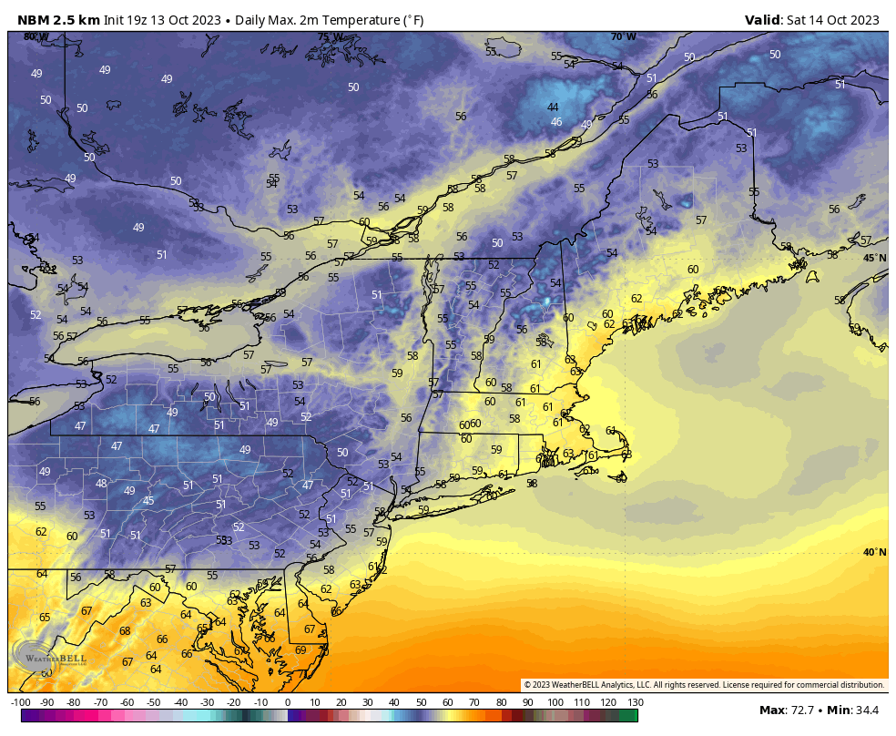
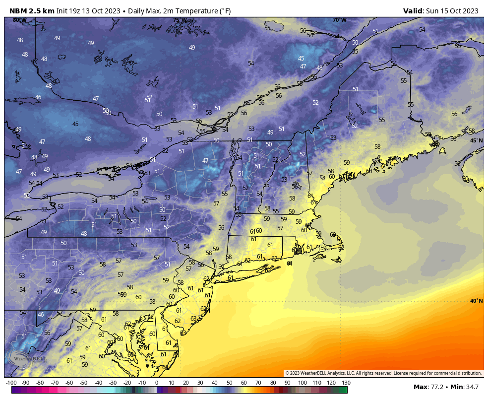
Afternoon highs on both Saturday and Sunday.


Comments ()