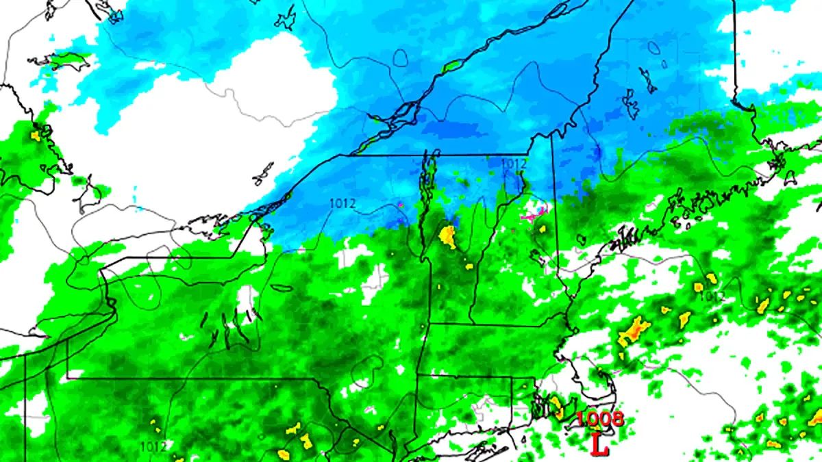
We issued a Storm Watch 3 days ago and are now upgrading this to a Storm Update as we feel pretty confident that +6" of snow will impact a large enough portion of our coverage area starting Sunday afternoon through the end of Monday to justify this as a "storm" as opposed to a light event, but barely. The focus of the impacts will be in the far northern regions of NY, VT, NH, and ME along with the Eastern Townships of Quebec. No one will open for this storm, but turns are likely to be had by the hardcore because that's how we roll in the East!
Premium Weather Coverage Requires a Premium Subscription
Just a quick reminder for those who are not yet aware. Snowology is now offering premium weather coverage only to Premium Subscribers and that includes Storm Updates and other actionable forecasting coverage beyond the next day. Free subscribers have the benefit of being alerted by email to all free content we produce including our Daily Weather Update which covers the next day's weather and a rough outlook, and all other non-weather articles. We will stop sending Storm Updates to Free Subscribers when our Daily Weather Updates start in mid-November however the forecasting below will remain only be accessible by Premium Subscription.
How much does a premium subscription cost you ask? The equivalent of just $2.50/month and it comes with other perks that can save you far more than that. We t̶h̶i̶n̶k̶ know that's a bargain.
Synoptic Overview
We have large trough descending through the Rockies, and a sharp boundary is going to form from the Southwest to the Northeast that will slowly descend into the Northeast. There will be several waves of energy that pass along this boundary which will intensify the precipitation starting on Sunday, but the more notable snow is likely to occur on Monday with the second shortwave that is expected to be stronger.
In our Storm Watch we indicated that the ECMWF, which showed all rain possibly due to the model's over-amping, was likely wrong and we believed the GFS scenario was likely a better solution. Over the following three days the GFS has barely changed while the ECMWF has steadily, though not fully, moved towards the GFS solution.


