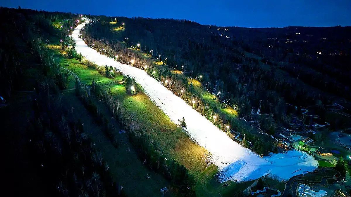
We are still in pre-season mode here and weather updates will be slightly irregular as our focus right now is generally on snowmaking with just two eastern ski areas open for regular operations. This outlook will be available everyone and emailed to all subscribers, however our snowmaking and opening outlook published later today will only be available to Premium Subscribers and it will not be emailed to our Free Subscribers.
We're going to lighten up on the writing now that the season has begun in order to make this easier to digest.
1 Minute 7-Day Overview
If you are looking to ski this week here's a quick rundown of what to expect at both Killington and Sommet Saint-Sauveur (MSS) through Sunday. First off, MSS opted to close Monday through Wednesday this week. During the day today at Killington temperatures will be above freezing and they will see light rain, drizzle, and mist with low ceilings through the day. Both ski areas will dip below freezing in the early evening and stay frozen on Wednesday so we've got our first Ice Coast freezup! Thursday should bring some small accumulations of snow to MSS on top of some resurfacing to help soften the their slopes for what should be a pretty nice day, but Killington at this time may see snow change to sleet and then freezing rain during the day with temperatures expected to stay below freezing all day. Friday should see temps go above freezing at both with some light precipitation, possibly snow at Killington with some possibly decent accumulations further north in Vermont. Saturday will be cooler with snow tapering off on the mountains in the morning and it should stay dry and around freezing at both through the weekend. Monday we have a possible clipper that could also help pull down more cold, though there is uncertainty in the models.
The 7-Day Synoptic View
The two systems described above can be clearly seen here. We have primarily a zonal flow with cold drooping into the Northeast behind these storms. There's a possibility of another system, likely not a big one, come Monday or Tuesday as energy moves southeast out of Canada and interacts with a possible shortwave embedded in the jet stream in the Mid Atlantic. This does not look like the sort of setup that would cause a storm to form early enough to bring copious amounts of snow to us, and it may not materialize at all but we currently believe it will. Here's a 7 day loop from the 0z ECMWF which doesn't see the weak clipper happening next Monday. This sort of screams El Niño as far as the flow goes, but we're getting a bit lucky with some small troughs with cold dipping down behind the storms.
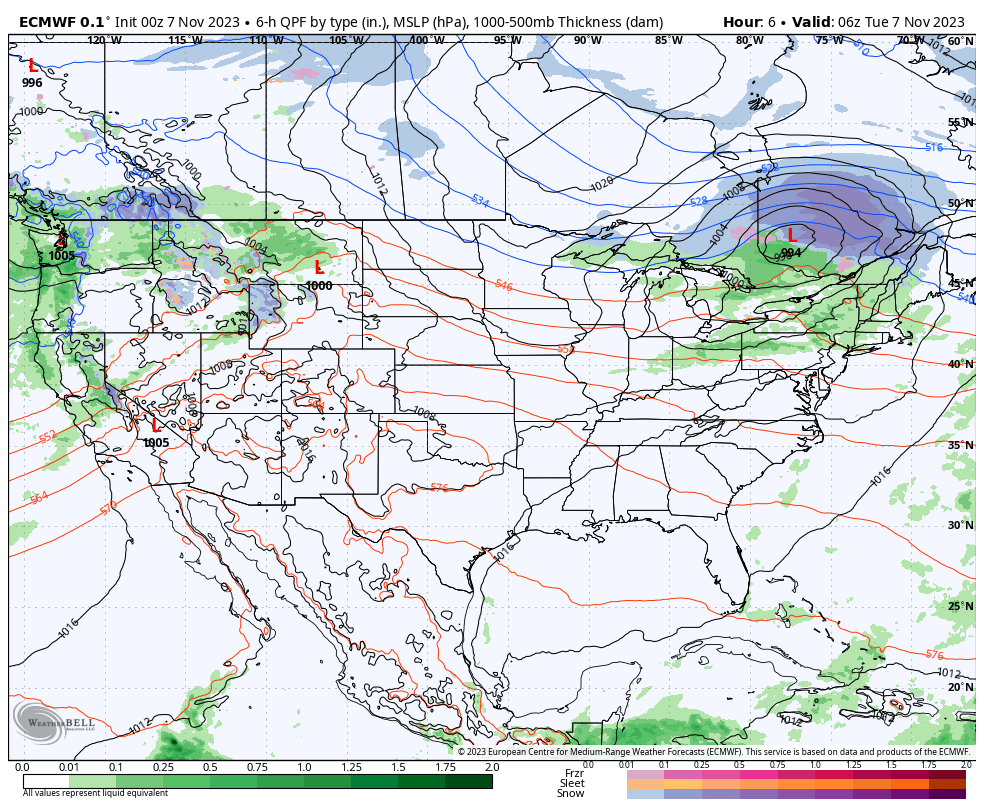
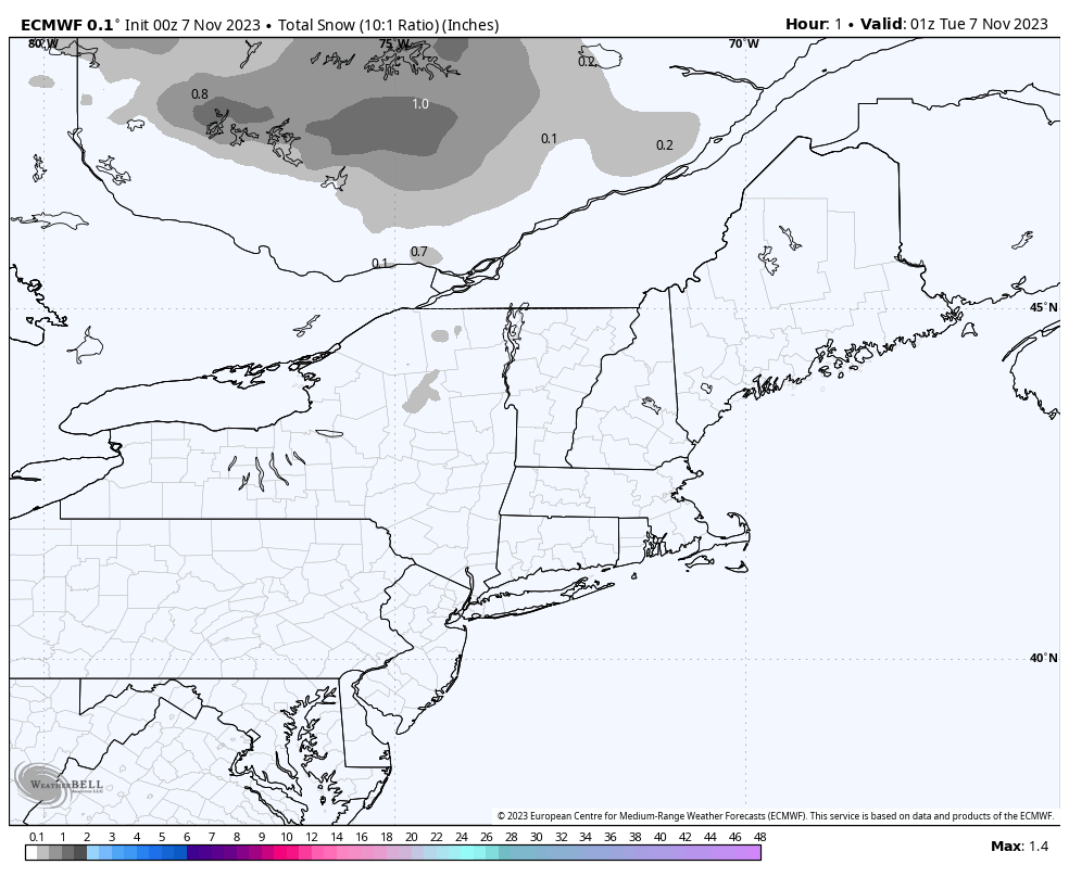
Here's a zoomed in look at the Northeast showing snowfall accumulations from the ECMWF over this same period. The upsloping snow is likely on the low side though as this model lacks the resolution to account for this type of snow and the enhancement on mountain tops plus the model tends to be just a tiny bit warmer. Better detailed mesoscale models only go out about 60 hours.
While natural snow is fantastic to see, we typically don't see Northeast snowpack survive the warmups and start building in earnest until about mid-December. If you want to ski and see terrain expand, you are better off rooting for the snowmakers right now as opposed to expecting a series of extreme early season snowfall events during a strong El Niño. The last time we saw snowpack build in November and early December was in 2018.
Snowmaking and Opening Forecasts Incoming
There will be another article published this afternoon for just Premium Subscribers covering the snowmaking outlook and we will also forecast ski area openings through this weekend as well as projections into the longer-range for who is likely to open by at least Thanksgiving weekend. Our most valuable weather coverage including storm forecasting will only be available to Premium Subscribers for the rest of the season. Our Premium Subscriptions cost just $2.50/month paid on an annual basis.


Comments ()