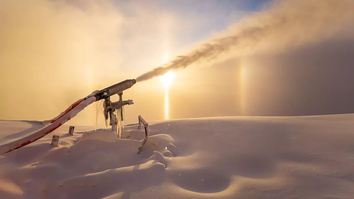
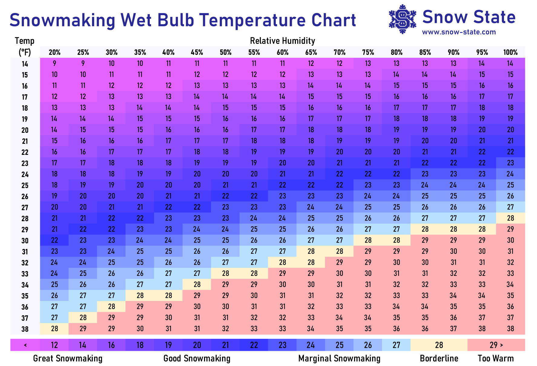
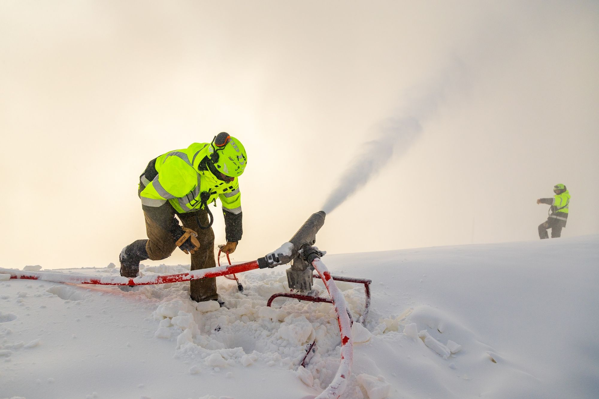
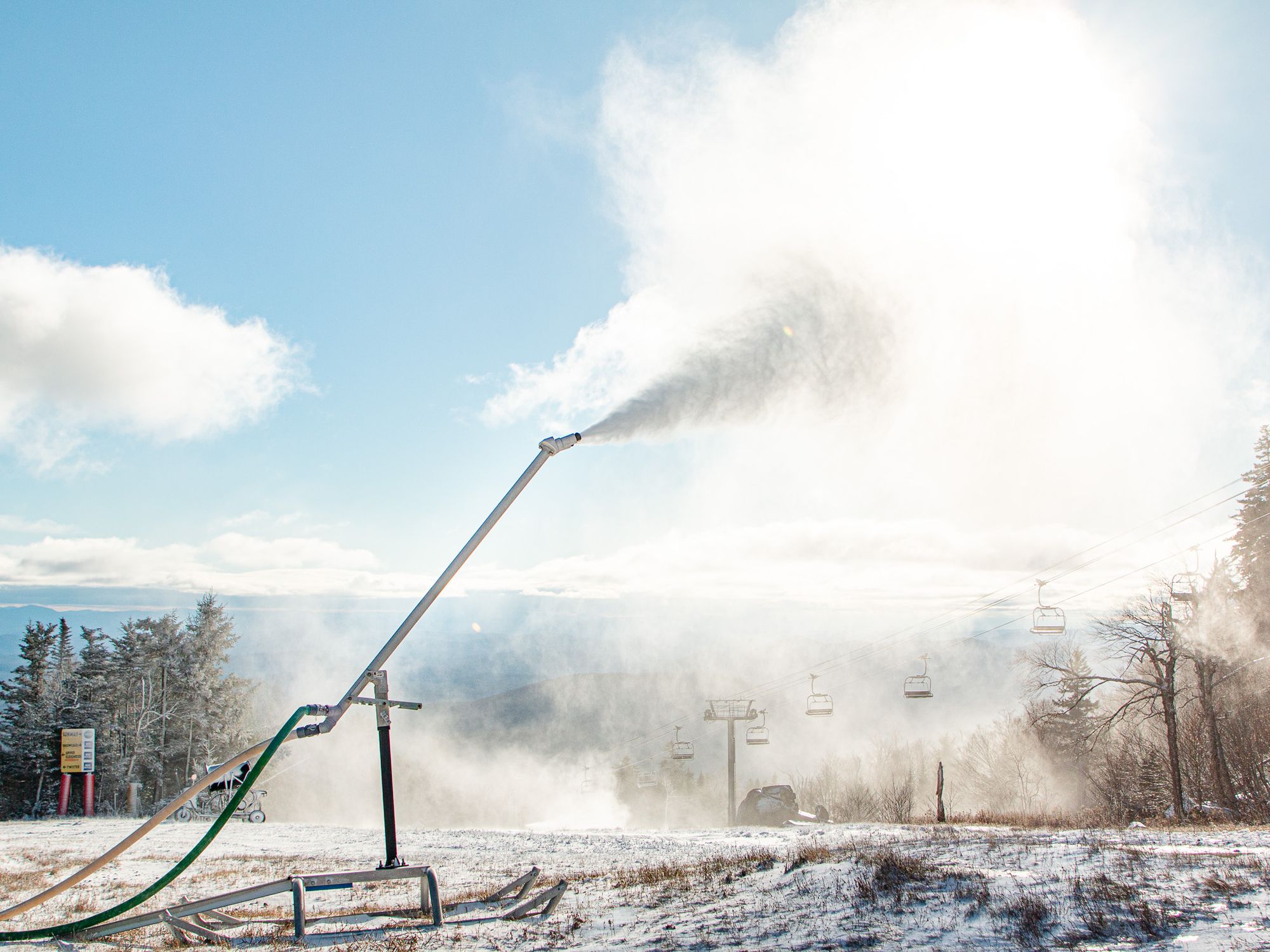
I can hear winter. It's not the snow guns that are roaring at over 120 decibels 60 miles away, it's the popping of my door frames with cold dry air; the coldest night so far this season. With that cold also means good snowmaking production with mountain tops reaching the teens as far south as the Catskills and single digits in the northern regions. This was an optimal production night and one night at 10F worth about 3 nights at 25F. Once your wet bulb temperature reaches the single digits you can crank the guns to 11 and let 'er rip.
Sunday morning we got a peek at some of the newer efforts south of the Albany, NY latitude with Belleayre, Windham, Hunter, Jiminy Peak, and Wachusett all hoping to hop on board the Thanksgiving snow train. Temperatures in these areas generally didn't get much below the low 20's Saturday morning however and largely production was muted at those latitudes.
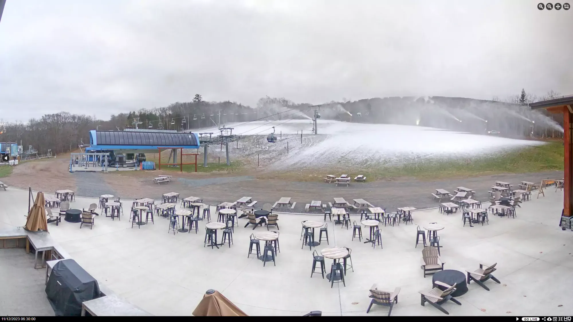
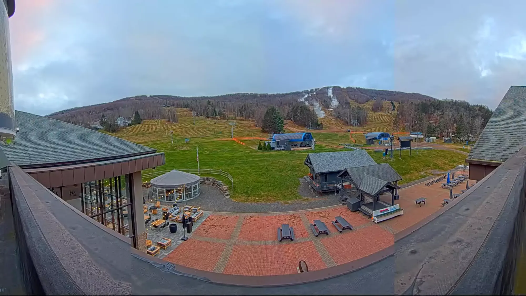
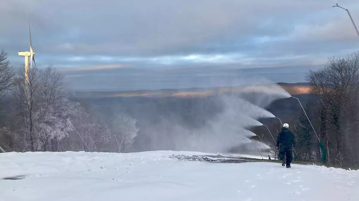
Belleayre, Windham, Hunter, Jiminy, and Wachusett launching winter fireworks.
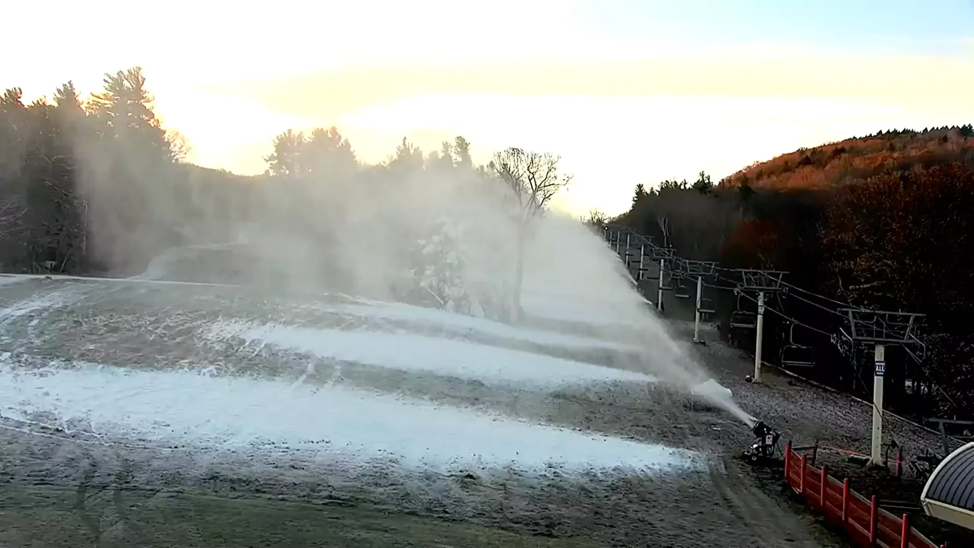
ORDA's three ski areas in New York have implemented some massive improvements of their snowmaking infrastructure in the last few years and it's really starting to show. None of the three jumped on some of the early windows at the beginning of the month, but starting on last Tuesday night Whiteface lit their system up on the summit with Paron's Run, then Gore came online starting Friday night and are working on Ruby Run, Showcase, Tahawus, and The Arena, and then Saturday night Belleayre finally got some temps and lit up Deer Run, Peekamoose, The Crossing, and their Discovery Base area. It used to be that these three could only make snow on one or maybe two runs at a time so this is clear evidence of all of the investments and hard work they have done launching the state-owned and operated ski areas into the upper tier of snowmaking capabilities in their respective climates.
These are likely the biggest snowmaking investments in the Northeast that we've seen in at least the last 5 years. Their standard opening day is always Black Friday, however these three are the most likely in the Northeast now to move up their opening dates so keep your eyes on them! Starting early helps fulfill one of ORDA's primary missions to support economic and social benefit. Making extra profits by delaying for fuller demand is not part of their mission and that makes them and other state-run, munis, and nonprofits unique.
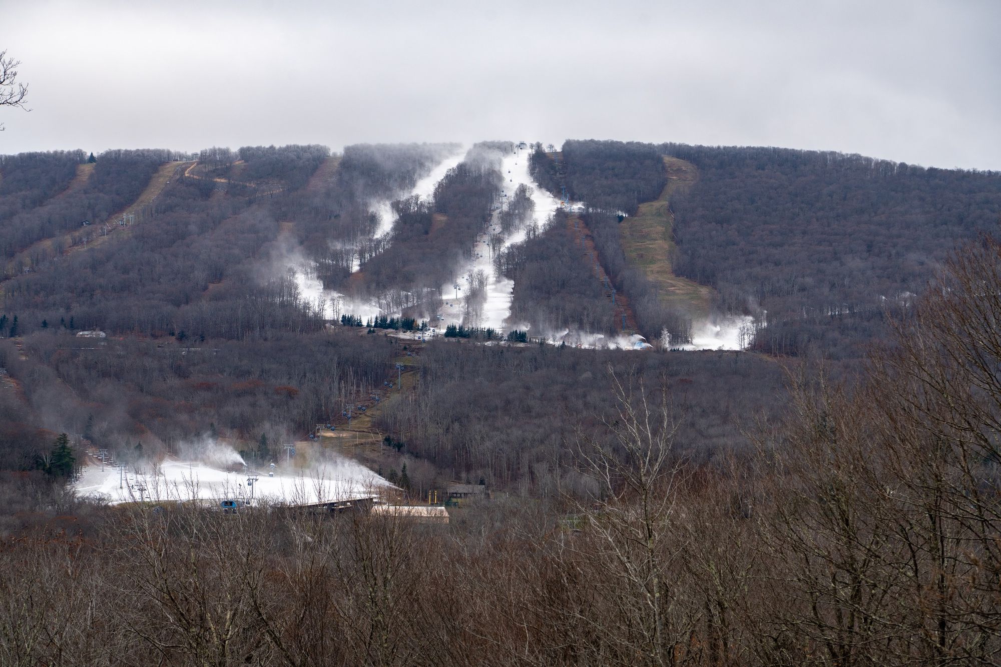
Whiteface, Gore, and Belleayre photos from their social media feeds.
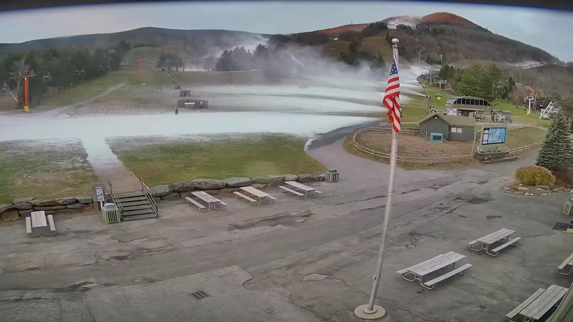
Snowmaking elsewhere north of the Albany latitude was also happening and seeing great production. Sunday River, following delays due to the some water pumping challenges and needing to open significantly more terrain with less snow gun density, has now announced that they will open on Jordan this Tuesday with what looks like possibly up to three trails top to bottom. This is later than initially expected but they are going to have by far the most terrain available and they will keep that lead at least until natural snow changes the equation. Take note, their early season at Jordan operating plan is different from what you are used to. You must know before you go. We also expect Bretton Woods to open as early as Tuesday on one trail. I'll detail our opening projections at the bottom of this article for our Premium Subscribers.
This Cold Window Is Almost Over
Here are the temperatures shown in Celsius to highlight the freezing level from this morning's 0z run of the ECMWF covering Sunday at 8 p.m. through Wednesday at 8 p.m. Note, the times shown in "z" are UTC time, and under Standard Time the East we are 4 hours behind UTC.
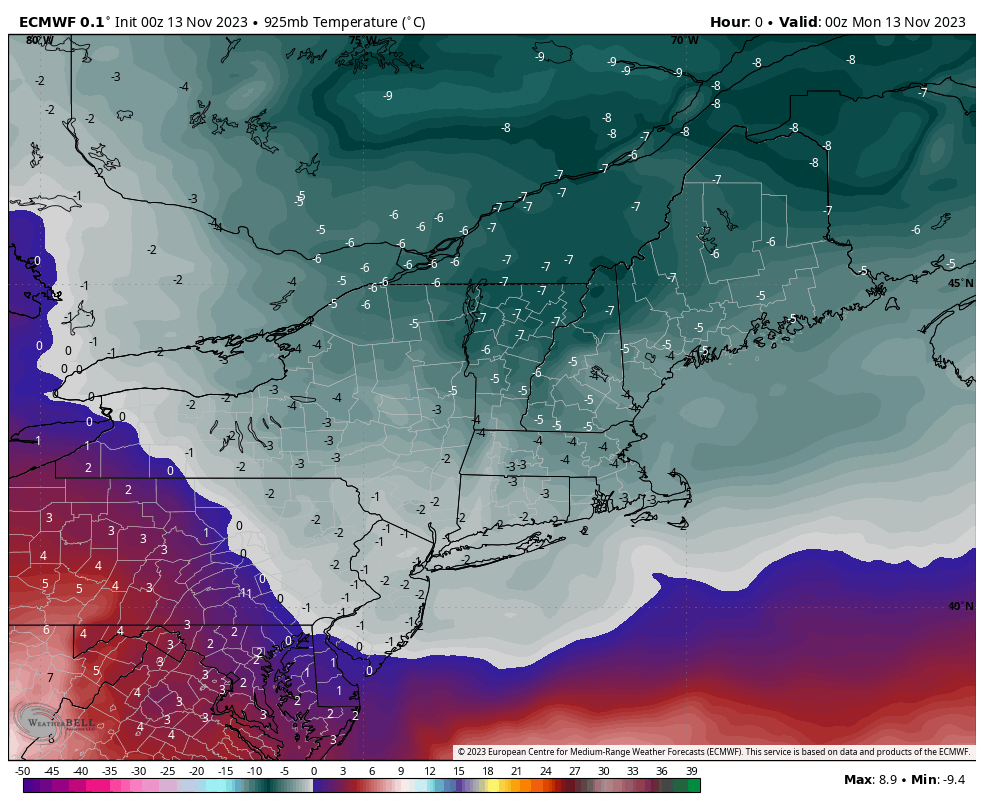
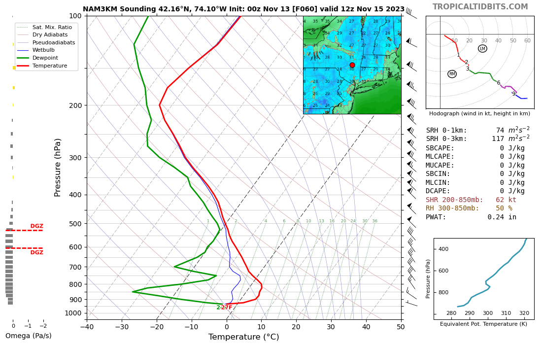
The coldest temperatures are on their way out this morning, but production should keep going through the day in most areas north of Albany before the Monday night cool down with a weak shortwave that will likely drop up to around 4" of fluffy snow on the Green Mountain Spine with lighter amounts elsewhere. Monday night's temps will moderate, cutting off snowmaking for some until Tuesday when some reinforcing cold comes in behind the small storm. Tuesday night looks like a pretty severe inversion however with still air and mostly clear skies allowing the cold to sink into a very shallow layer. This sounding for Wednesday morning shows approximately where Hunter Mountain is located. The gist of this is that production will be greatly reduced after this morning, and even cut off for times despite forecasts that may keep nearby towns chilly while the mountain tops rise above freezing.
The Next Cold Hit Arrives Around Saturday
I covered the possibility of another cold hit before Thanksgiving in our last update. There has been some sort of storm bopping around in the models for days, but now that we are 5 days out confidence starts to increase and it looks pretty good right now!
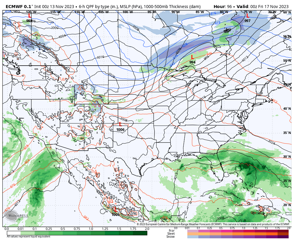
This is how the ECMWF sees this storm right now. There's a low pressure system that is curiously high on the trough in Canada that helps that trough dig deeper into the Northeast where it then phases with tropical energy into what is probably a snowstorm for Eastern Maine and the Maritimes. That will also help to drag even more cold air into the Northeast, and further south than seemed likely just a few days ago. This will cause some ski conditions issues for those who are open with a flash freeze not long after the rain and probably some wind issues in Northern New Hampshire and Northern Maine as early as Sunday. I'll cover that in a subsequent, but wind hold forecasts among other things this season will only be available to Premium Subscribers.
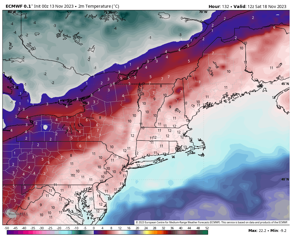
This is what the ECMWF currently sees for temperatures from Saturday morning through Wednesday of the following week. While this covers a period that stretches into the fantasy range for modells, the large scale patterns are highly likely to produce some lasting cold, just not necessarily to the degree shown or in the same scope.
This cold hit should allow some leeway for the aggressive to get open before Thanksgiving. Unfortunately the outlook for Pennsylvania and New jersey remains dim for making Thanksgiving, but there is a chance if this next cold hit deepens.


