This is our first Weekend Outlook of the season. These will be published Friday AM and will cover Saturday and Sunday's weather with extra focus on what is most notable. Weekend Outlooks will be available to everyone, but only subscribers will get the articles in email. Premium content like our own snowfall, precipitation type, wind hold forecasting, and other things may appear within these articles and will only be available to Premium Subscribers if it does.
We are also be offering Weekend Previews every Wednesday AM, however starting in December these will only be available to Premium Subscribers in order to give them advance notice to help them plan for the weekend.
If you are not a Premium Subscriber yet, we are currently offering a 10 Day Free Trial for Premium Subscriptions, and later today we'll be publishing a daily Storm Updates for the Tuesday-Wednesday storm that should bring some snow and mixed precipitation to the region.
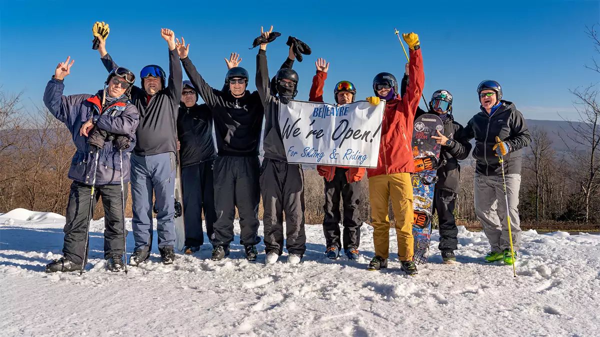
Who and What Is Open This Weekend?
As of today we will have a total of 8 ski areas open for the season in the East including Sommet Saint-Sauveur, Killington, Sunday River, Bretton Woods, Okemo, Stowe, Sugarloaf, and Sugarbush. That will likely be the entire lineup for the weekend. Both Stratton and Loon were aiming for opening this weekend but base area temps muted snowmaking for them and they both decided to push until next Wednesday. Note, Killington is not yet top to bottom. They are working on opening Snowdon but the snow guns won't likely come back on until sometime Saturday PM.
All open ski areas are currently offering between 1 and 3 full runs (not trails, those are generally inflated), and it is unlikely that trail counts will grow this weekend. Opening weekend and early season weekends with limited terrain can see densely packed trails which require good full slope awareness and tight lines in order to avoid trouble. It's also a really good idea to dial it back yourself when the trails are busy. There's lots of ski season left to enjoy after all.
Most ski areas are advising against beginners coming, but those who are not include Okemo who has their Open Slope area, Sugarbush who is operating from Gate House which is primarily green terrain, and Bretton Woods is offering one green trail off of Zephyr. Those are your best bets with children this weekend, but I can't guarantee crowding or conditions will be accomodating.
General Weather Overview
There haven't been any notable changes since the Weekend Preview issued on Wednesday except timing is now more dialed in with the rain departing faster on Saturday as well as a faster refreeze than modeled earlier, and this will present some conditions challenges especially after today's warm spring-like conditions followed by a bit of rain. The possibility of changing over to snow on Saturday is now also off the table outside of a little burst at the tail end. Sunday we have a pretty weak disturbance passing through that could accumulate snow primarily at Stowe, Sugarbush, and Killington during the day to help with the frozen slopes. I don't see any wind hold risk this weekend since the coastal storm will be bit too far away and fast to create issues on the back end. Saturday's crowds might be muted by the early rain, especially in NH and ME as it is likely to persist beyond open. Hardpack, a refreeze, and trail crowding should be your primary concerns this weekend and all of that will be covered in a bit more detail below.
Precipitation
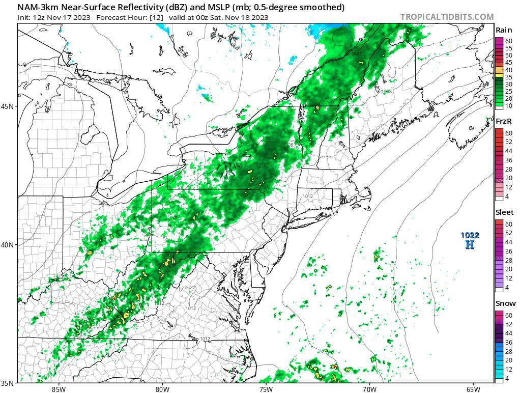
We have a mixture of rain and snow on Saturday and then a weak disturbance on Sunday which won't be worth chasing, but where it falls will help with the frozen terrain. The following loop covers 7 p.m. Friday through 7 p.m. Sunday from today's 12z run of the NAM3k. Remember to subtract 5 hours from the time shown as "z" during Standard Time if you are looking closely at the times.
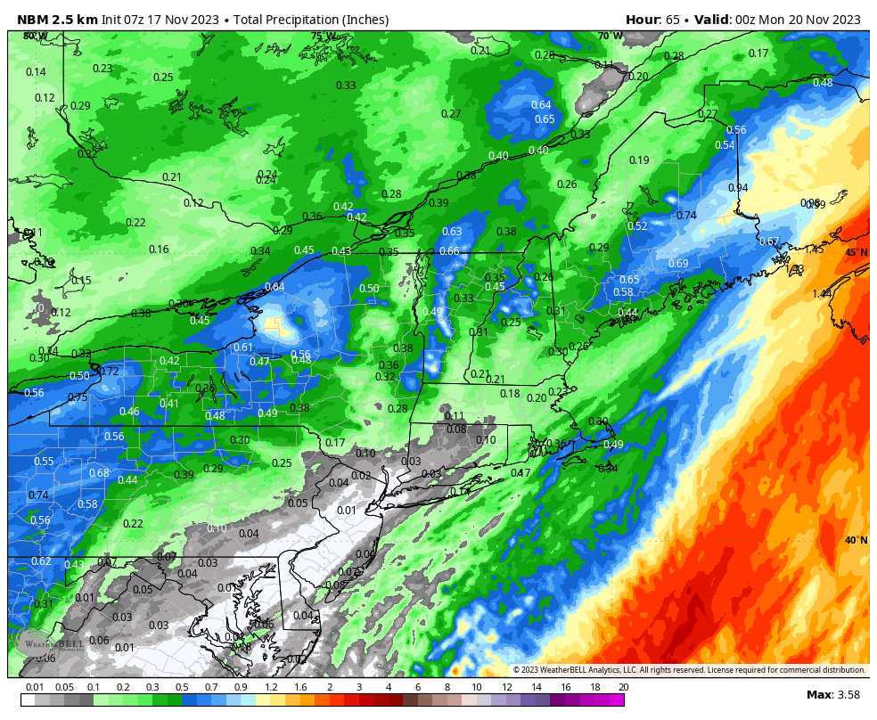
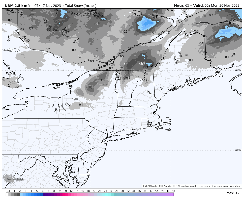
Here's a quick look at the precipitation totals through Sunday evening. Note that I like to use the National Blend of Models because it shows Canada unlike NWS forecasts. Although the NMB was created to aid in NWS forecasting, their human forecasting is generally better. The snowfall map is probably a little on the low side for what will come during Sunday, but we're talking just an inch or two in Northern New York and Vermont.
Saturday Detail: Rain and possibly snow will clear Northern Vermont before open and should be exiting Southern Vermont ski areas by about 9 a.m., Bretton Woods should clear by about 10 a.m., and Sunday River and Sugarloaf by about 11 a.m. The last hour of precipitation may flip to snow, especially at elevation, but I don't expect any notable accumulations at ski areas.
Sunday: There's a weak shortwave that will be moving southeast through the region with a focus on Northern Vermont during the ski day. This is a pretty spotty system so some variability in the focus and intensity should be expected. Right now I would expect about an inch at Killington, 1"-2" at Sugarbush, and 2"-3" at Stowe. I don't expect measurable amounts at any other open ski area. What is important about this snow though is that this will be day 1 of the recovery from the melt and rain so slopes will get skied off, but even just very light persistent snow does wonders for edge hold. It should be a pretty decent day in Northern Vermont if the snow confirms.
Temperatures & Surface Conditions
There's going to be a flash freeze on Saturday and the timing is not great in the Northeast. The combination of very warm temps today with up to an inch of rain with a late freeze and limited terrain for opening weekend is something I would strongly recommend avoiding. Frozen slush corduroy is a nasty surface requiring very sharp edges, good skill, and empty slopes. Skied off snow that then freezes during the day can cause slides that are hard to self-arrest on. Mix this in with the possibility of crowded trails and it could be super no bueno. BTW, your weather app won't tell you that 😎
The following loop shows temperatures from 7 p.m. Friday through 7 p.m. Sunday.
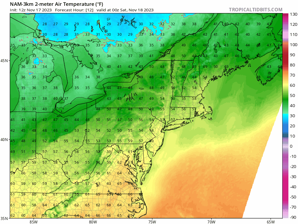
Temperatures will not get that far below freezing during the ski day Saturday, so it is possible that things don't fully firm up and become icy at some ski areas, Okemo being the least likely to freeze but possibly one of the most crowded. I don't suggest rolling the dice on the temps coming in warmer because it will be bad if it doesn't. Sunday will be a better or at least safer bet for what to expect.
Saint-Sauveur should set up early enough for them to groom fully frozen and give you something to push around, but I'm most worried about Stowe opening flash frozen, followed by Sugarbush, and Killington, Sugarloaf, Sunday River, Bretton Woods, and Okemo seem likely start to freeze by at least 10 a.m. from the top down. Lower pitched terrain will be much more friendly if it refreezes after open since such terrain rarely gets skied off. I'm not sure that anyone who is open on Saturday besides Saint-Sauveur will be groomable when fully frozen, but if anyone is that would be Stowe.
Knowledge Is Not Becoming a Human Bobsled on a Crowded Trail!
-- Matt


Comments ()