Well, I can't say that I love the chances of anyone staying all snow for this one, but many will net additional base in the very least. Basically we're going to get a storm intensifying in the Gulf of Maine, and where it tracks is going to have a big impact on the Whites and Longfellows in terms of whether or not it will change to rain after an early morning dump of intense snow.
Elsewhere it just won't stay snow, but right behind this system is a cold front with a multi-day back-end event with both upsloping and lake effect snow that will likely drop over a foot in isolated areas off of Lake Erie, and probably over 18" in isolated areas off of Lake Ontario. It's important though not to confuse that snow with what you will see in the morning because many areas will see snow, then rain, then snow some more which is a much different experience than if it remains snow.
Minor Storm Updates and Back-End Snow Updates will contain mostly free content, but wind hold, snowfall, and precipitation type forecasts and my own recommendations will be in a paywalled section for just Premium Subscribers. Premium Subscribers can ask questions also on all of our posts. If you want to trial a Premium Subscription for 10 days, just click on that button below!
Storm Overview
Minor Storm Update #1 included a synopsis of how the storm forms so we'll skip over the basics except to point out that the storm starts becoming organized over the Delmarva Peninsula and then tracks near the Northeast coast while intensifying. Intensification does help keep the cold wrapping back in on the north and west sides of the storm, but the track is changing and the low level jet that is pumping warm moist air at the lower levels is also concerning.
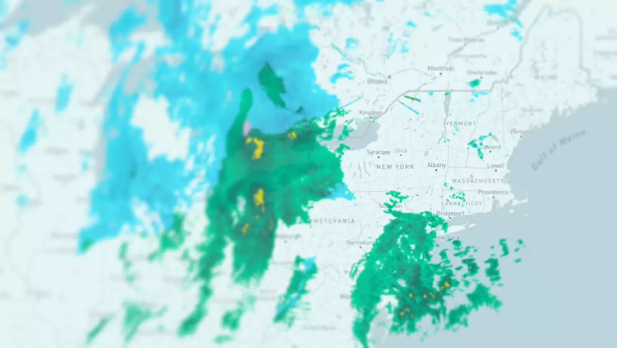
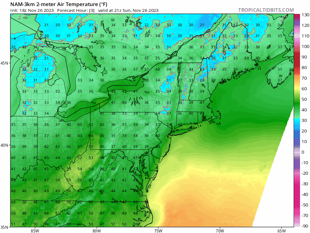
Let's take a look at the 24 hour simulated radar from today's 18z run of the NAM3K showing 4PM on Sunday through 4PM on Monday as well as the surface temperatures for the same time.
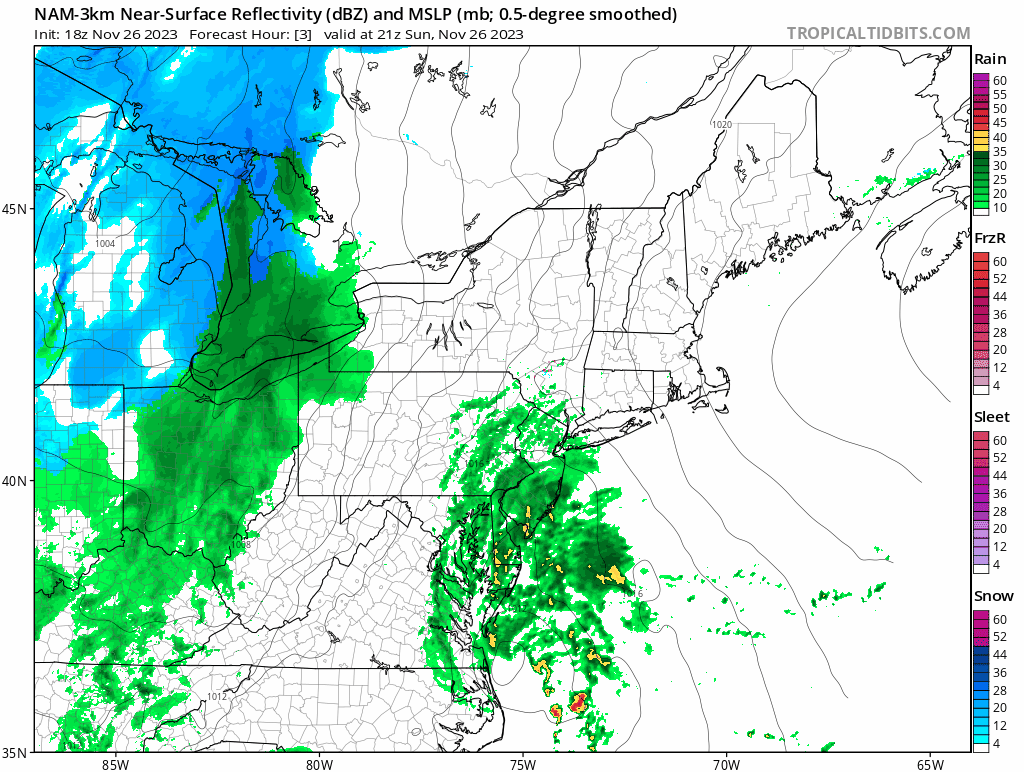
I'm afraid to say that yellow echos in the NAM3K simulated radar are not intense snow, but it's only a hair away. What's changed from yesterday? Well the first simulated radar capture below comes from yesterday's 18z run of the NAM3K, and the second comes from today's 18z run 24 hours later.
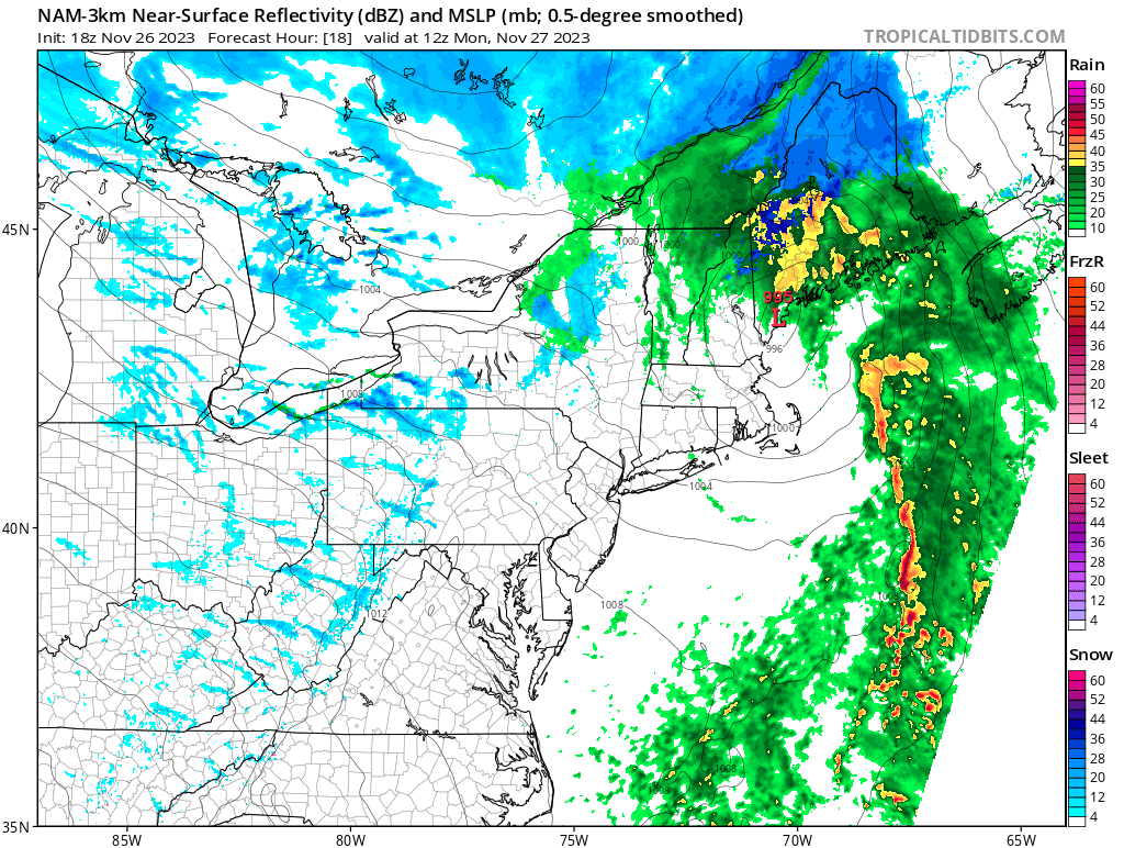
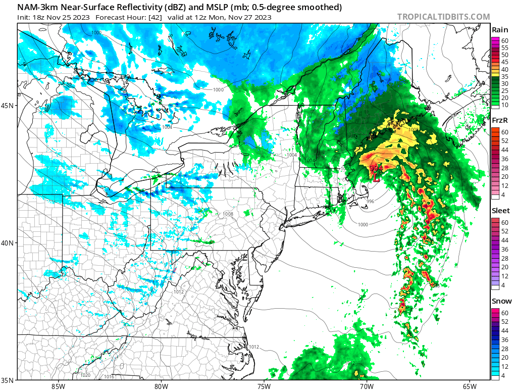
That surface low has shifted north by about 100 miles, and that's a sizeable jump. I'm afraid that other models are also seeing this shift so it is very likely to happen. There is warm air encircling the low out to about 100 miles or so and if it gets too close to the Whites and the Longfellows, it may switch to rain for a bit, and potentially pretty heavy rain. Those yellow echos are rain echos. I'm not writing off all snow, but it's a leading possibility and I'll dig into that in the Premium Subscribers section.
One last note of importance for people who like to use NWS maps. They forecast snow from 60 to 72 hours out, they don't give any detail on what may fall at what times, nor do they track freezing rain or rain (NWS adds sleet into snowfall totals). The only place on this map that really shows just the Monday storm is Maine, and the two offices are in disagreement. There's back-end snow showing in VT, NH, NY, and PA, but NWS offices often don't fully forecast the back-end snow until after the front-end passes despite falling within the 60-72 hour range. This map doesn't show the rain in between the front end snow and the back-end.
Maps are nice, and this one is often useful, especially when there are no changeovers happening nearby, and the NWS is great at what they do, but in this case it won't give you much help on on Monday. I won't either unless you are a Premium Subscriber and so here comes the paywall like it or not.
If you want an increased level of insight into what matters for skiing and riding, this is the only place you will find it broadly in the Northeast and on a regular basis and in order to do this I have to make money. $30 bucks a year is cheap for what Snowology provides but I want to grow our membership more than our yields.


