This alert went out by email at 6AM to Premium Subscribers in order to give our customers the fastest intel we could, and then at 7:30AM it is being published on our site, sent to free subscribers, and shared on social media.
This was a big forecasting miss for the eastern ADK's and also Vermont from Stratton to MRG as many mountains have stayed snow from base to summit during the bulk of precipitation. It's the good type of miss however with more snow than expected. We're hoping some of our Premium Subscribers can come down with a cold and call into work today.
Here are the operating ski areas that stayed primarily snow along with estimates of snowfall in the upper 2/3rds of lift serviced terrain that were made at 6AM. Please check the ski areas for their official numbers.
Tremblant: 4" (webcam estimate)
Saint-Sauveur: 5" (nearby webcam estimate)
Gore: 6" (webcam estimate)
Whiteface: 3" (webcam estimate)
Mount Snow: 3" (snow stake, mixing occurred)
Stratton: 6" (webcam estimate)
Okemo: 9" (snow stake, possibly snow on stake before storm)
Killington: 7": (webcam estimate)
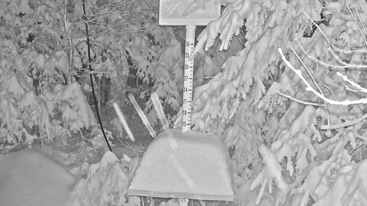
Sugarbush: 10": (snow stake, note, 3" was on mid-mountain stake before storm)
Stowe: 4" (snow stake, probably +1" for off-camera High Road plot)
Smuggs: 5" (based on Stowe)
In the Eastern ADK's and Vermont it will warm a bit above freezing in the AM and misting or drizzle is possible along the Greens so snow will mank up and packy before the afternoon when the cold air will dry things out and freeze them back up. Note, the extra snow in Vermont east of the Greens will probably help keep temperatures a little lower than expected yesterday. Snow reflects sunlight of course.
The change in how the storm was modeled did cut off some of the moisture northwest of Montreal and that probably lowered the snow totals there.
Pay attention to open terrain if you are looking to take advantage of this snow. Sugarbush may have received 10", but they only have the Gate House Quad scheduled to run. If this opens any terrain today it will probably be on the North Ridge at Killington, otherwise you are still likely to be stuck on snowmaking terrain. Also for the uphillers out there, many ski areas are still prohibiting uphill travel due to snowmaking operations and limited terrain. It's best to follow the rules since no ski areas are making any real money by allowing this access so violating rules can result in more restrictions and possibly unintended accidents and injury.
New Hampshire and Maine
Unfortunately the change that helped the Eastern ADK's and the Green Mountain Ridge to stay snow is not beneficial to NH and ME. The low is tracking even further inland and pushing changeovers in these areas.
Wildcat and Sunday River will likely changed over to rain up to the summit prior to 7AM. Sugarloaf is hanging on to snow from just above their base and it is dumping on Skyline at this moment, but that warm push will likely win out there by 8AM to end with a bit of rain before drying out. Bretton Woods likely stayed snow higher on the mountain, though they get shadowed from coastal flow. I assume that the final forecast in Update #2 will largely confirm in NH and ME. Anything beyond light precipitation should clear out of Sugarloaf by 9AM-10AM. Open ski areas in NH and ME will probably stay above freezing until late in the day.
What Happened?
Radar last night showed what looked like a mesolow (small low circulation) forming in the lower Hudson Valley of NY. This wasn't modeled by any of the models available to me at 5PM yesterday.
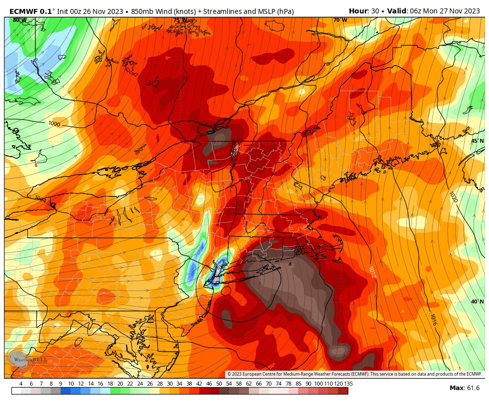
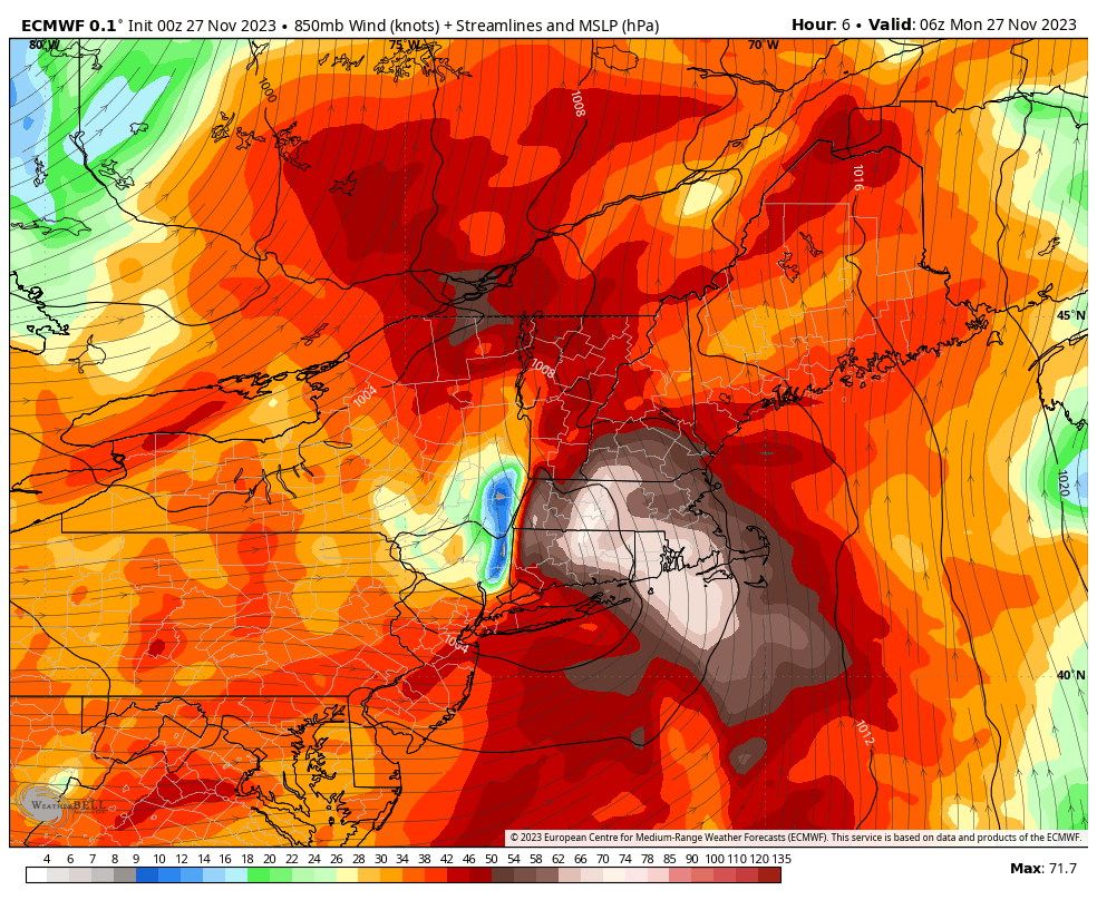
This was only evident in the afternoon models yesterday if you looked at wind at about the 850 mb level (about 4,800'), and it was supposed to be near the coast rather than so far inland. It's clear now that this feature is what the models were starting to pick up yesterday with a shift north in the track of the surface low. Here's what it looked like in the 0z ECMWF from yesterday vs. the 0z run from today which best corresponds to the radar capture. Both show 1AM as modeled at their respective times.
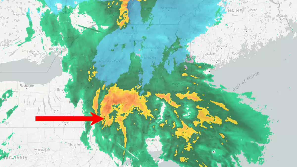
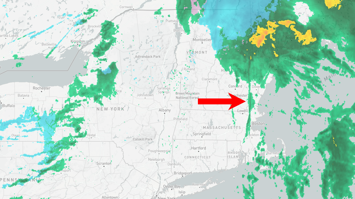
Even the ECMWF didn't show the heavier precipitation nor did it show the circulation of this feature around midnight. This feature though was still there as of 5AM however and it kind of looks like an Norlun Trough which can dramatically enhance precipitation. Norlun Troughs are like long skinny lows. Here's the 5AM radar capture. That's not an artifact, it's there.
Basically whatever changed likely increased the rate of precipitation in parts of Vermont and the Eastern ADK's creating more dynamic cooling which kept temperatures just cold enough for ski areas in those regions to stay snow. There's also the possibility that this mesolow or Norlun Trough helped reinforce the cold air or slowed the advance of warm air over the Eastern ADK's and Vermont. I'll actually be asking around out of curiosity to figure out what happened.
Anyway, if you can get out to hunt this, share some photos!
Knowledge Is Powder!
-- Matt


Comments ()