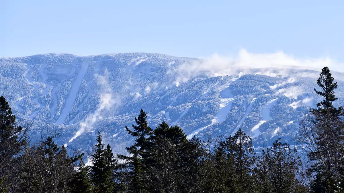
We have a bit of a tricky weekend coming up because there's a lot of great snow in New York and Vermont right now, but we have a light rain/snow mix coming in three waves and marginal temps that could end up falling on either side of the equation in northern areas. Warm/wet fresh powder is very sticky. Raining on powder and then freezing up can be icy of course. Snow that gets a chance to cycle warm and cold before getting warm again can break the stickiness. So venturing to where the pow has been plentiful could be a bad call this weekend, though the jury is still out and we'll examine that carefully. On the flip-side, we have a bunch of ski areas who will definitely be above freezing and don't have copious fresh pow and may stay dry, and those would be safe bets. Lots of openings by Saturday!
Let's first take a look at what the ECMWF shows for Friday through Sunday at present.
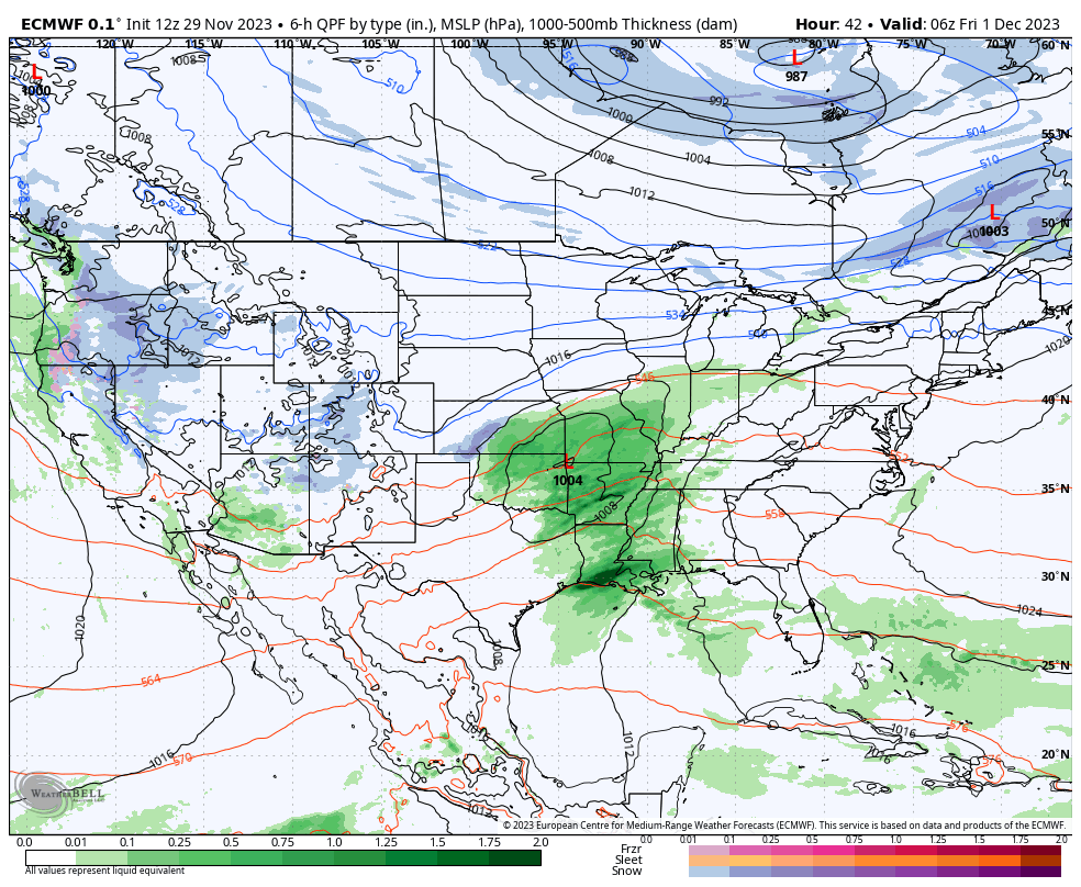
There is a boundary sitting near the US/Canadian border with a weak shortwave traveling along it during Friday, and then another during Saturday. At the end of the loop you can see yet another system starting to form for late Sunday into Monday, but modeling is not yet consistent with that system and it may or may not be impactful on Sunday.
Now let's take a regional look at the temperatures, this time in celcius in order to highlight the freezing level. This comes from the National Blend of Models (NBM) and covers Friday through Sunday. Again, Sunday's weather is highly uncertain and this will be discussed later in this article.
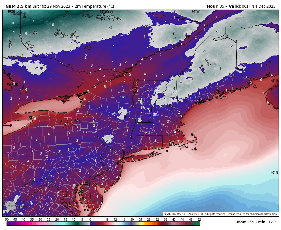
Generally the NBM is pretty close to reality, but the NWS is forecasting temperatures about 5F colder in parts of Vermont and New York at night where there is substantial fresh snowpack which will throw a bit of a curveball into what the models are showing. During the day NWS forecasted temps are running about 2F cooler for the same reasons.
Friday Overview
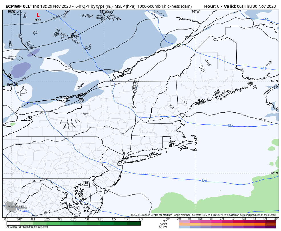
On Friday Killington, Sugarbush, Stowe, and Jay Peak will definitely have some natural terrain open, and possibly Smuggs, Bolton Valley, Burke, Sutton, and Owl's Head. Friday however likely ruins the powdery fresh snow as temps will start the day generally above freezing and warms from there. Light rain will start in the western regions around open while drizzle and mist are possible near the Canadian border and also on the mountains of Vermont. That light rain looks like it will reach Vermont and Massachusetts by 2PM.
Conditions where there is plentiful fresh powder will likely be sticky. Gore, Killington, Sugarbush, Bolton Valley, Stowe, Smuggs, Jay Peak, Burke, Sutton, Owl's Head, and Mont Orford are where I'm most concerned, but elsewhere my concern would mostly just be the flats getting sticky on Friday. I'm pretty damn sure the fresh snow will be sticky on Friday. I would actually recommend targeting ski areas on Friday outside of the ones mentioned because of the threat of sticky snow.
Here's what the NAM3K is showing for all of Friday currently. We're talking generally 1/10" to 1/2" of rain on the mountains, but there is some hope for snow at elevation.
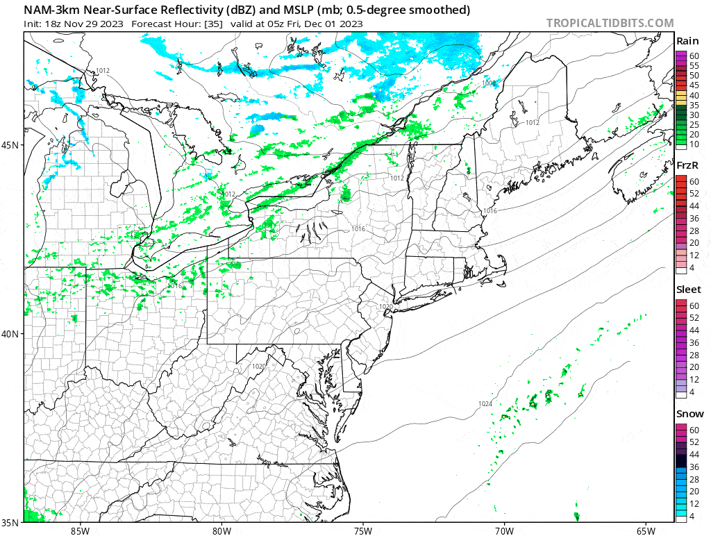
This is the type of system where it can snow above freezing and as I mentioned earlier, the fresh snowpack may hold down temps a little more than is modeled, especially while it is dark. We need Friday evening to produce snow instead of rain for natural snow conditions to be good for the weekend, or we need the weekend temps to freeze overnight and then rise during the days, which may not happen.
I think there's a better than 65% chance for Friday evening to produce fresh snow at latitudes from Killington and north. That snow would provide a nice surface on top of the compacted snow from Friday which will likely freeze up overnight.
Saturday Overview
We have our second shortwave coming in Saturday with precipitation in New York by open and reaching Maine by close. This is even lighter than the first with only up to 1/4" of water content falling. I expect that latitudes from Killington and north will generally get snow above 1,500', but temps are marginal and this could come in warmer. This is just an early heads up.
Here's a 1-hour precipitation intensity loop of the ECMWF showing all of Saturday. Note, I select both models and modeling websites for various displays of what may be the most optimal to show which is why you see various presentations of the same model at times.
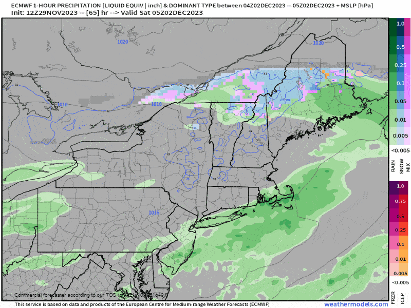
I do expect some shifts in this, but just within 50 miles north and south with where the precipitation goes. Let's take a look at the 8AM and 4PM temps from the NBM also.
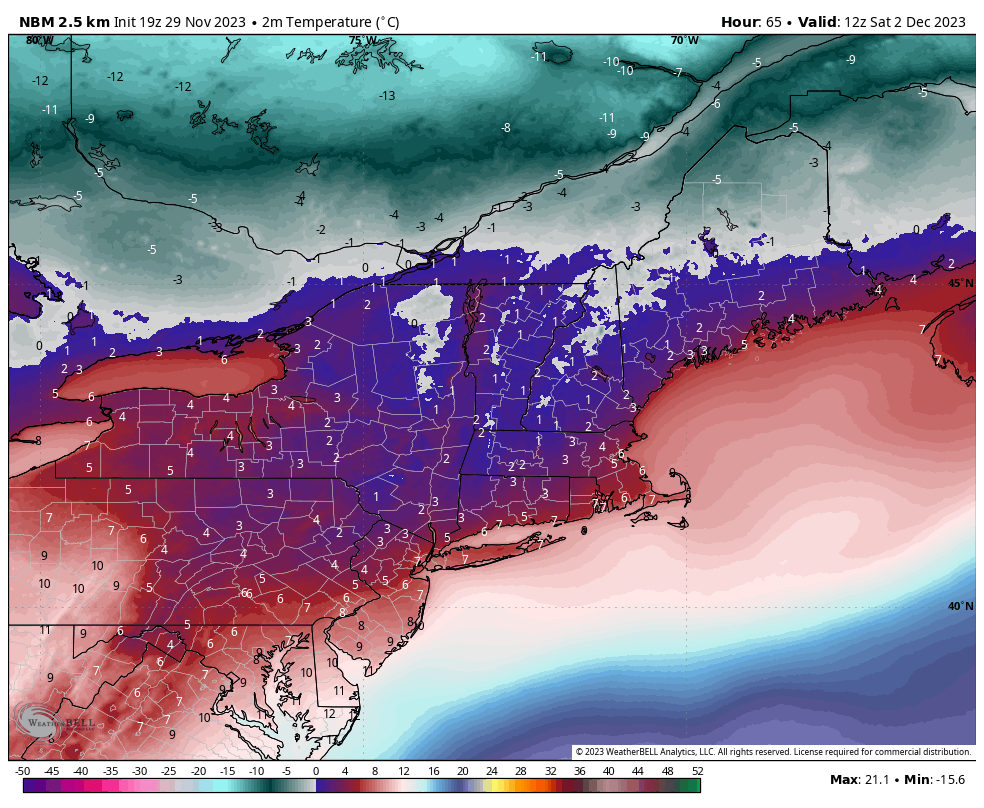
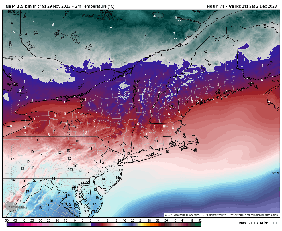
Note, the NBM temperatures may be a little too warm still and the NWS is again lower than the NBM likely due to snowpack influences which not all models handle well.
Where it isn't frozen and not raining, Saturday will be excellent. We have a ton of additional openings this weekend and many of those ski areas will dodge the rain on Saturday and be above freezing. We just have to keep our eyes on that precipitation in the coming days, but it won't be heavy. There's potential for both greatness and getting skunked in Northern Vermont. If they stay below freezing then they need that snow from Friday night and again on Saturday, otherwise they need to freeze and then warm above freezing again. The forecast is so borderline that I can't say with certainty whether you should go hunt the natural snow or not this weekend, I just know it will be safer in warmer and dryer areas to the south.
Sunday Overview
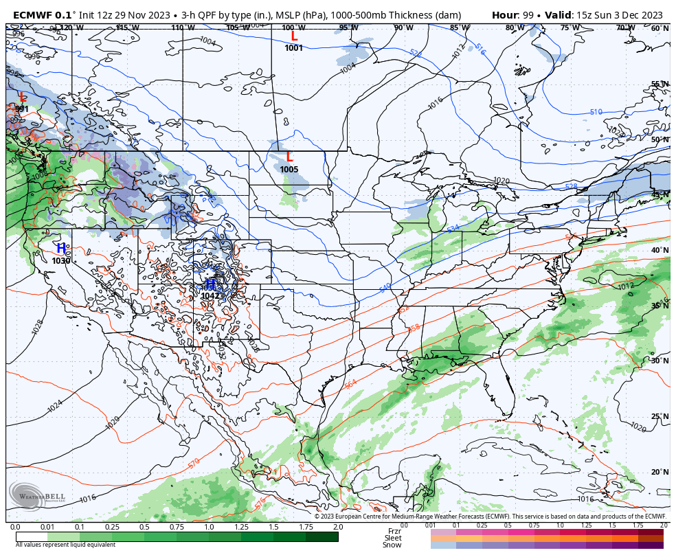
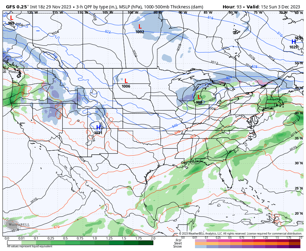
Sunday morning we will probably see a little lingering snow at open nearer the Canadian border that will exit in the AM, but there is major disagreement in the models for what could happen on Sunday depending on how the Sunday/Monday system develops. The following two 3-hour precipitation intensity loops show Sunday at 1PM from the ECMWF and then GFS. Again, exact same time and less than 4 days out.
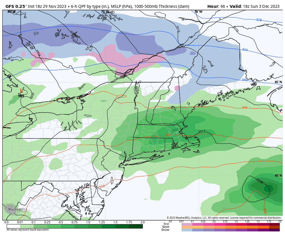
The major difference in the models is whether or not a surface low forms in the Midwest late Saturday. This isn't an issue with the ECMWF over-amping at 3+ days, it's just a question of when a digging trough will spin up a low. The GFS says it will happen Saturday evening, and the ECMWF sees it happening Sunday evening with a different piece of energy. That low over Lake Michigan in the GFS is what would cause the warmer weather and extra rain as it will push the cold air boundary north and also pull in some extra moisture from the ocean in advance of it. If that doesn't form Saturday evening then Sunday should be mostly dry with temps similar to Saturday and a pretty good day mostly.
I've looked into the ensembles for both models and support for the Saturday spin-up in the GFS is tentative. So I lean 65% towards something similar to the ECMWF with a mostly dry Sunday and temps similar to Saturday.
If the ECMWF is correct, then we may see some snow on Monday!
I'll be issuing a Weekend Outlook on Friday and this should all be figured out by then.
-- Matt


Comments ()