This is generally too near term for a storm watch but models are in terrible agreement for what happens just Sunday and Monday and there is potential for greatness that this can't be ignored... just in case. Models are having issues sorting out multiple weak shortwaves that are headed towards the Northeast, which is why we still have disagreement. We'll upgrade this full storm coverage it looks like we'll see +6" on a widespread basis, but there is a stronger chance right now of this being covered as a minor storm with isolated winners south of the border. Northern Maine and Northern New Hampshire are the most likely to benefit even if this doesn't turn into a larger storm. If this storm does flop for the Northeast, it will likely be beneficial to many of Quebec's ski areas on Monday.
The Basic Setup
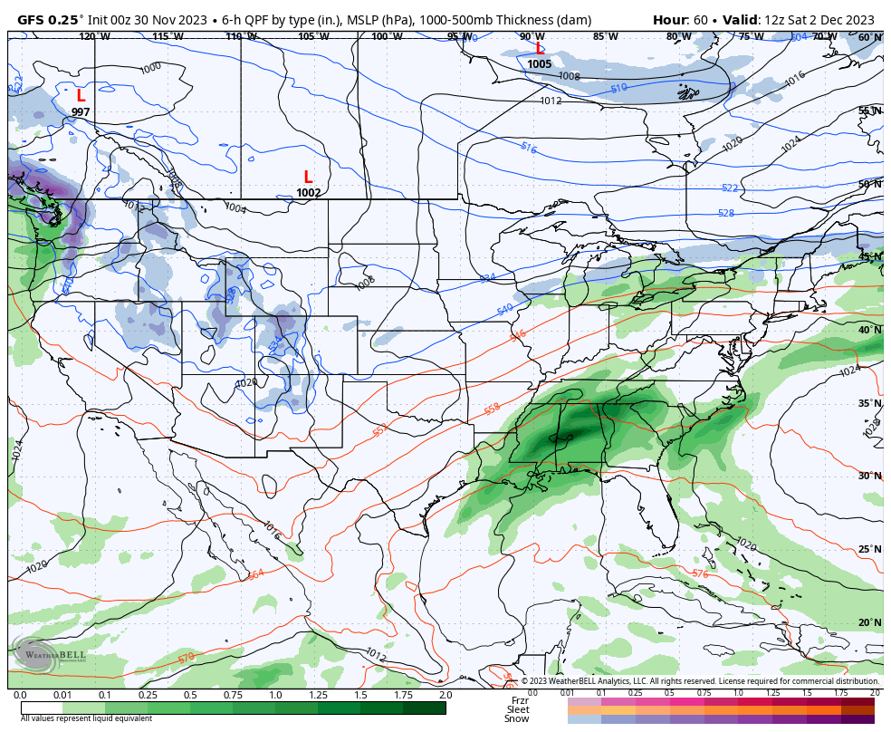
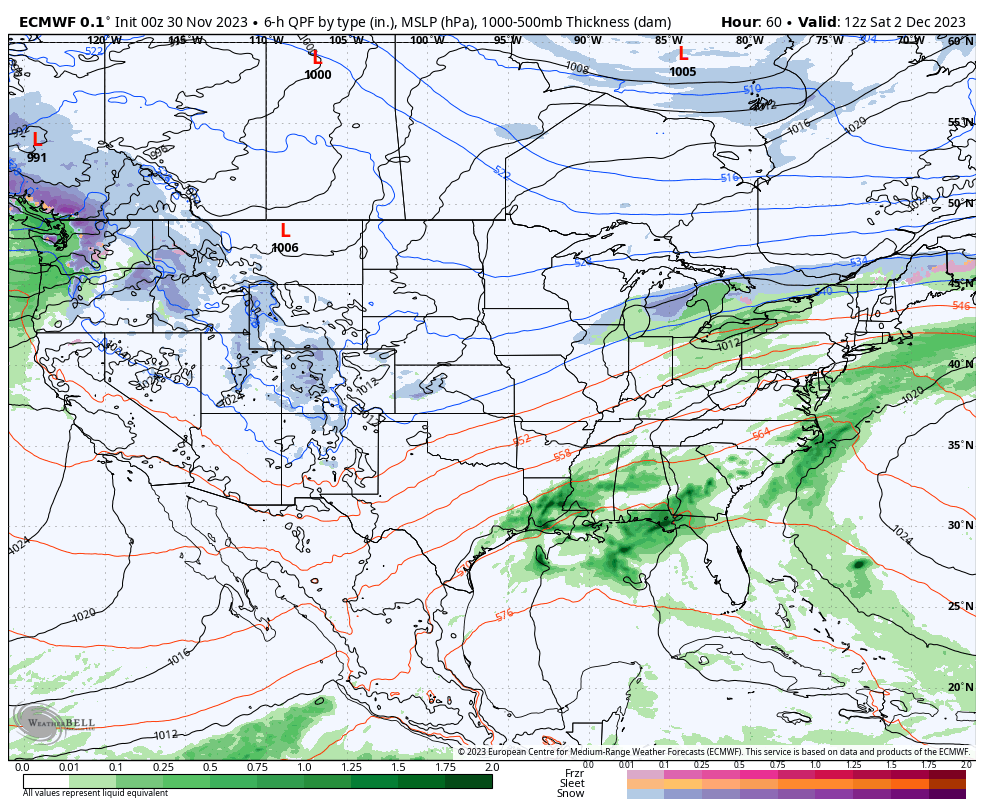
Come Friday the cold air will lift out of the Northeast and a boundary will park itself along the Canadian border with multiple weak shortwaves traveling along it on Friday and Saturday which will bring both rain and snow. That boundary is at approximately the location of the color shift from reds to blues in this thickness map which essentially measures the density of the air in the lower ~20,000 feet of the atmosphere. Colder air is of course more dense, and the 540 mb level on this thickness map is the approximate demarcation between where rain or snow will fall at sea level, and the jet stream is typically just south of this boundary.

I already covered Friday and Saturday in the Weekend Preview issued yesterday, but what happens Sunday and Monday is still an open question.
I generally use three medium-range models for tracking storms and all three have different solutions right now. I'm going to briefly step through all three, including the ensembles for each, and discuss my opinions and what is unique.
Ensembles are basically variants of the deterministic models. Each of the three major medium-range models has an ensemble version which run a range of varying data inputs as well as code for handling the physics. The ECMWF has 50 such ensemble members, the GFS has 30, and the GEM has 20. When the deterministic models are shifting all over or in disagreement with each other, it's helpful to dive into the ensembles in order to at least gauge the strength of the preferred solution for each model.
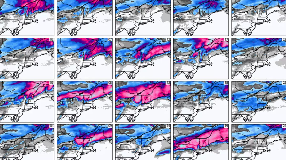
GEM (Canadian)
I currently prefer this solution to the others, which would result in scattered light rain near the boundary on Sunday and then snow at higher latitudes on Monday as that boundary sinks south. This loop covers Saturday through Tuesday morning.

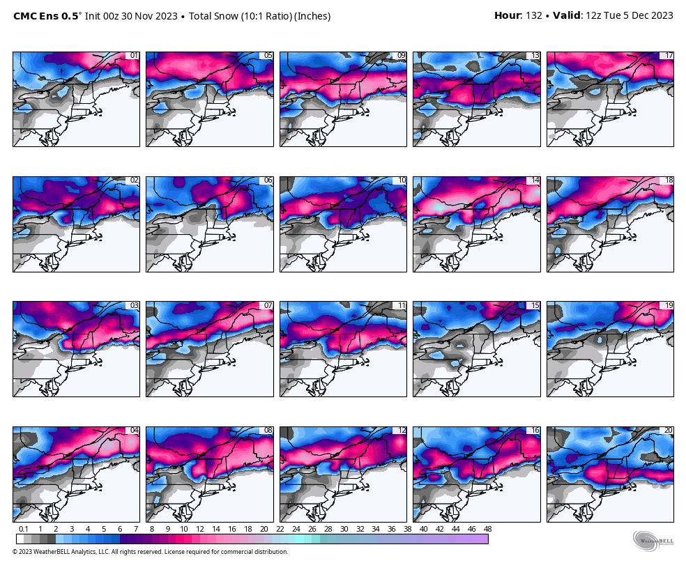
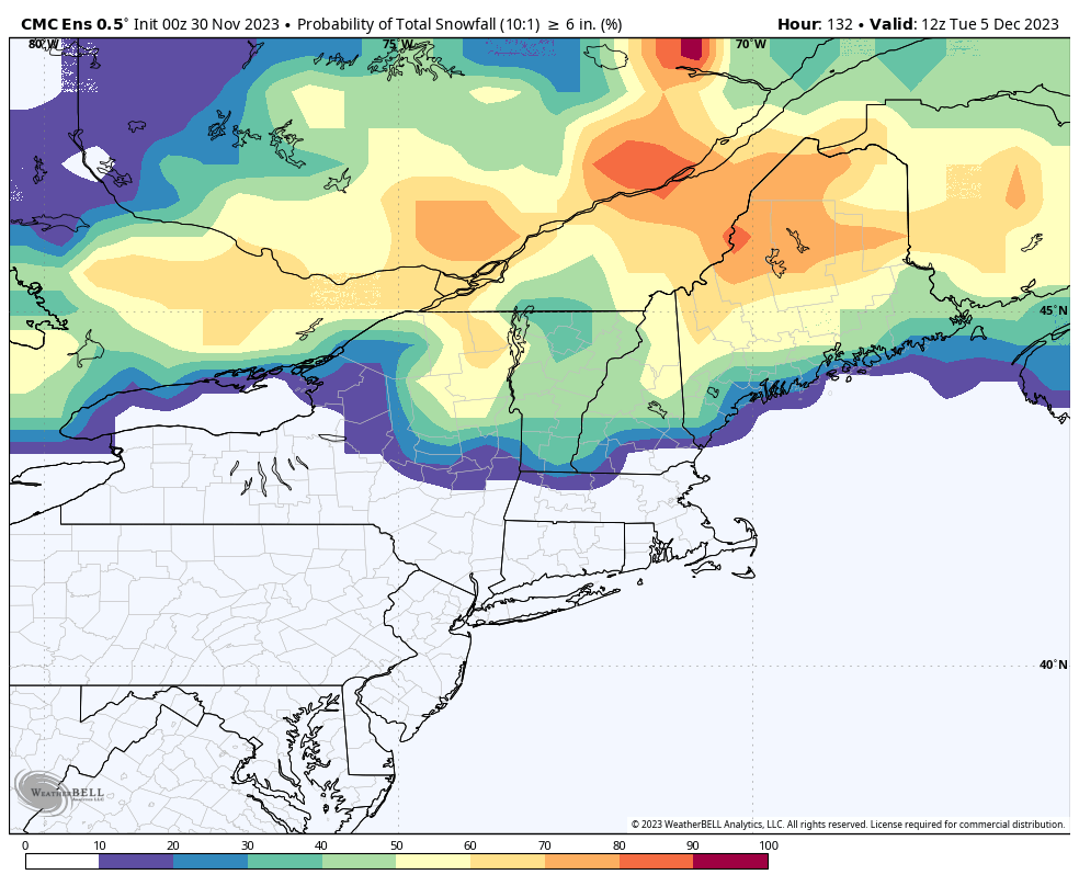
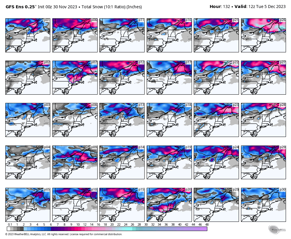
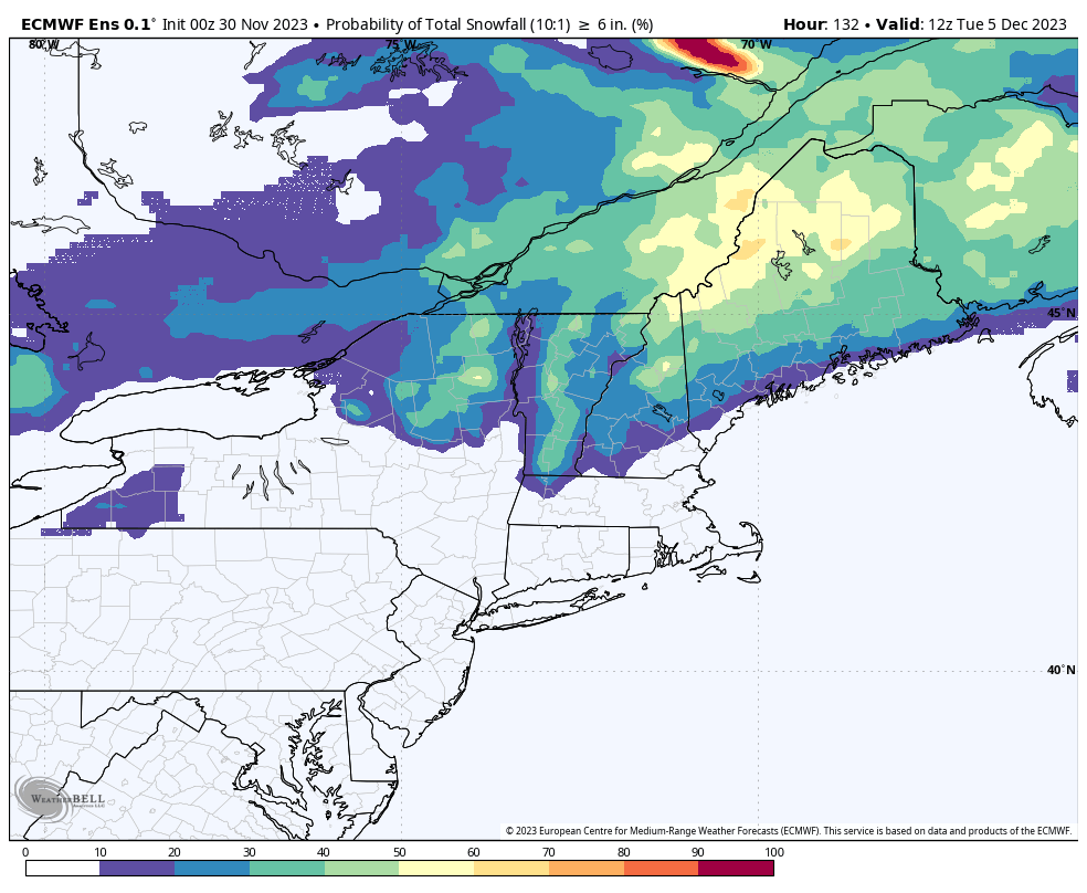
We can see a storm form Sunday in Iowa and move up the boundary. There are also a couple of shortwaves in the Southeast which will move parallel to the boundary, but about 250 miles south of it. The second coastal shortwave will phase with the energy along the boundary and pull the circulation to the Gulf of Maine. Here are what the GEM's 20 ensemble members currently show for snow through this same time frame as well as the probabilities of >6" of snow.
GFS (American)
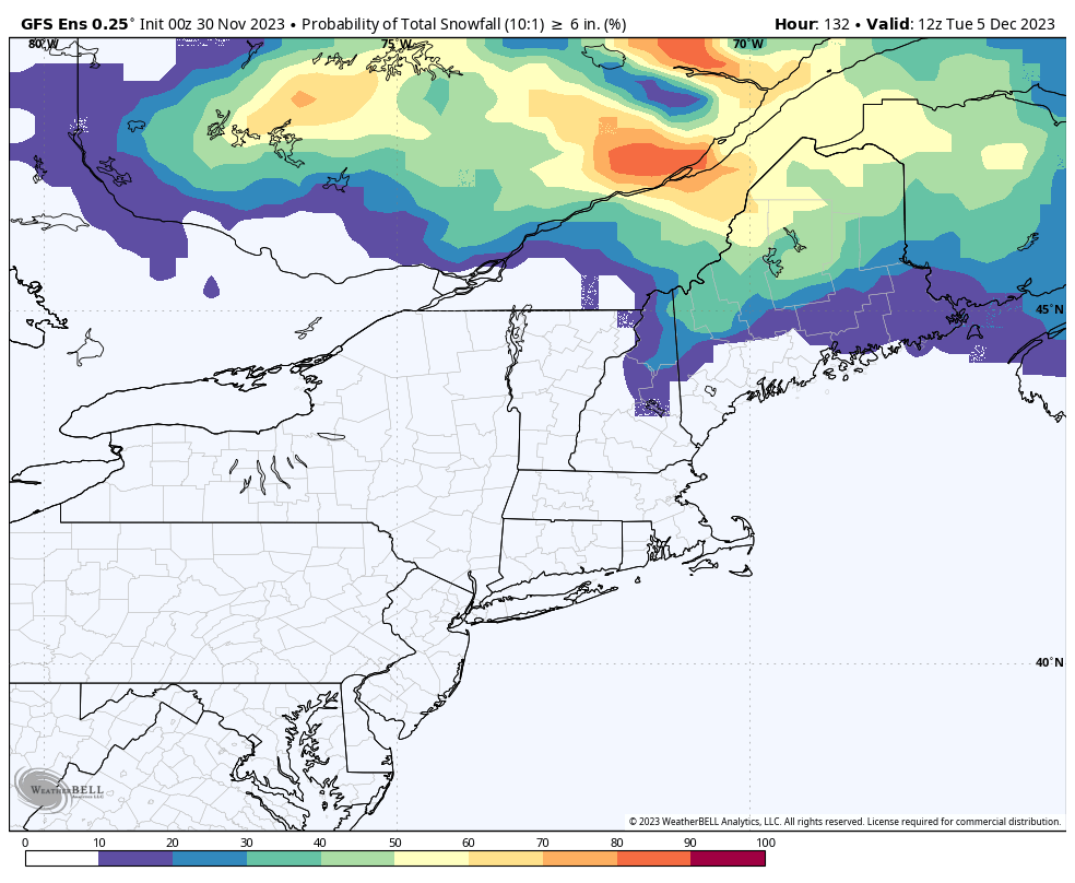
The GFS is the only deterministic model that favors a somewhat strong low forming and traveling along the boundary, and that produces the warmest result of all since the storm would push the boundary north ahead of the storm with southerly flow. This also would result in separation of the energy traveling along the boundary as well as near the coast. This is the wettest solution for Sunday, and the least snow modeled of the three. While I consider this to be pretty unlikely, the GFS is generally well skilled at this range.
We see a storm forming early Sunday and moving along the boundary, but only very weak interaction with the second coastal shortwave and the storm fails to get drawn near the coast as a result, and the solution is also warmer. Ensembles for the GFS however are all over the place so despite the deterministic GFS favoring this general solution since Wednesday morning, probabilities suggest we are likely to see a change today. As things stand right now however, this model hates the prospect of snow outside of a late phasing with the coastal energy which could put the Whites and Longfellows into play.
ECMWF (European)
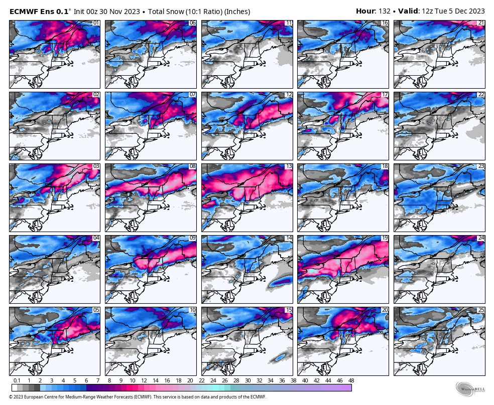
I hate to bet against the copious snowfall maps that the ECMWF puts out sometimes at +3 days out, but it is generally the right call because the model tends to over-amplify Northeast storms at this range. This model shows the most support for a stronger coastal low and more snow inland.
What the ECMWF sees is a much stronger low forming around Missouri and then making a jump to the coast to merge energy and moisture with the more southerly shortwave allowing the storm to amplify more and giving it a ton of moisture to work with. All of the other models show the boundary shortwave too far from the Atlantic to make that jump. Here's what the first 25 ensemble members show for snowfall and also the probabilities of +6" of snow. Strangely the oz deterministic run of the ECMWF shows snow in the Catskills and Berkshires which has little support in the ensembles and that is yet another indicator that a big storm is unlikely. The ensembles however show the more northerly focused storm has plenty of support and that would probably look similar to the GEM if so.
Final Word
I do expect that we'll have a much better idea of what will happen within the next 24 hours. I will likely cover this as a Minor Storm if my instincts are correct and a solution similar to the GEM model roughly confirms, but I would really like to be wrong about this one and cover it as a bigger and more impactful snowstorm.
Knowledge Is Powder!
Matt


Comments ()