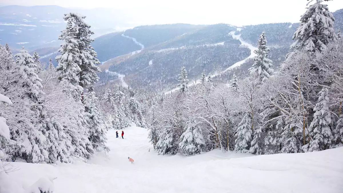
We had a glorious week of snow following a surprise over-performance in Vermont and parts of the ADKs in the last storm and then a nice push of very fluffy snow through Wednesday, but today the powder party comes to an end. Friday will see everyone warm above freezing and then we have a series of three precipitation events starting Friday evening, then Saturday AM, and then Sunday AM. Yes, we are going to get a storm on Sunday and Monday, and I will start Snowstorm Updates today!
This weekend is going to have a little bit of everything from rain to snow, sticky snow, and a refreeze. This is a lot to communicate while covering 50 ski areas, but with the help of summary graphics this may be one of the shortest updates yet!
Saturday Forecast
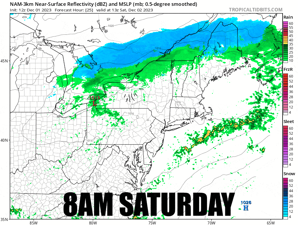
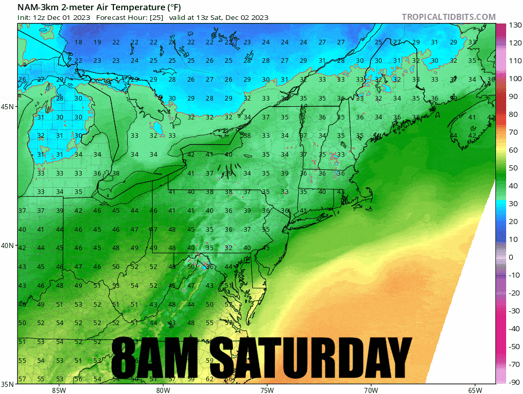
Saturday's two concerns are light rain near the Canadian border and sticky snow. When you get over a foot of fresh pow that then warms above freezing and gets rained on without dropping below freezing, that snow is highly likely to become extremely sticky. There are going to be a lot of people traveling to Northern Vermont looking for a pow party and getting stopped in their tracks. My concerns are in Vermont from Killington and north, plus Holiday Valley, Bristol, Whiteface, Saddleback, and Sugarloaf. Sticky snow is definitely possible at other places which netted 6" of snow starting Monday, especially on the flats.
The precipitation likely starts as rain and in N-VT changes over to snow near noon and then a refreeze begins in the northern areas. Precipitation will generally be pretty light, likely not surpassing .25" on Saturday. I don't expect trails to become icy before the end of the day except maybe near the summits.
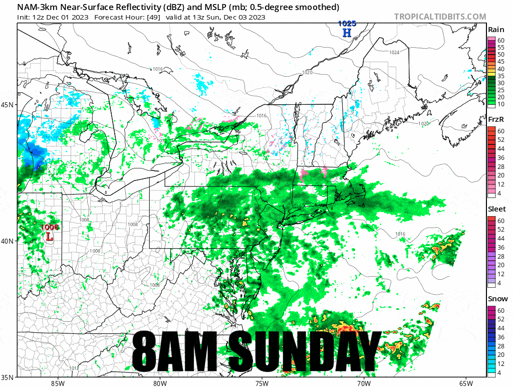
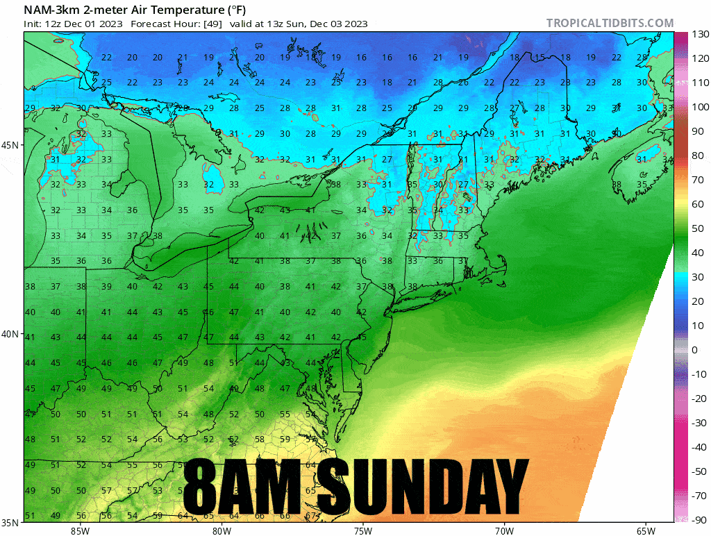
Let's take a look at the simulated radar and hourly temperatures during the Saturday ski day from 8AM to 4PM from today's 12z run of the NAM3K.
Here's our Ski Conditions Forecast identifying all of the primary conditions that are likely to be seen.
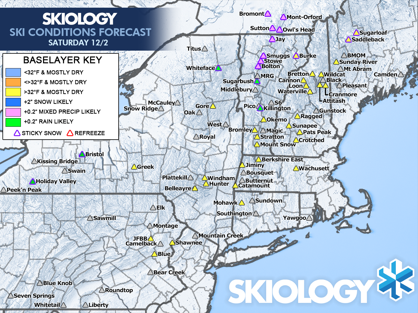
On Saturday you will generally you'll want to be in one of the yellow areas where sticky snow is not signaled, and remember there is still risk in some other areas mentioned above which were not indicated on the map.
Sunday Forecast
North of the Albany, NY latitude flash freezes overnight are likely, but this is also where snow in the PM is most likely. South of Albany we are likely to see rain by open.
Due to strong disagreement on timing, temperatures, and types of precipitation, Sunday's forecast may not be highly accurate. I am certain however that there is a storm incoming starting Sunday that will likely bring snow to N-NY and Northern New England and rain elsewhere. I'm going to base my forecast primarily on the NAM3K for Sunday's forecast at this time. While this model is still adjusting, it seems to have a reasonable solution to the storm.
Saturday evening also sets up the start of the refreeze which might firm up all ski areas in N-NY and Northern New England. We do again have substantial model disagreement still regarding the scope of the refreeze. N-NY, N-VT, N-NH, and N-ME are most likely to freeze up over night. S-VT, and S-NH are less certain to refreeze overnight. Freezing up after two warm days and rain will produce some very icy conditions where it happens, at least until the snow hits. You will need sharp edges in those areas on Sunday. I can't stress enough the need to learn how to sharpen your edges when things like this happen in the Northeast.
Sunday to start the day we also likely will see rain in all other open areas, though it may be spotty at times. The intensity of the rain and where it is heaviest is also an open question due to a lack of decent model agreement.
Let's take a look at the simulated radar and hourly temperatures during the Sunday ski day from 8AM to 4PM from today's 12z run of the NAM3K.
And here's our Ski Conditions Forecast for Sunday as it stands right now.

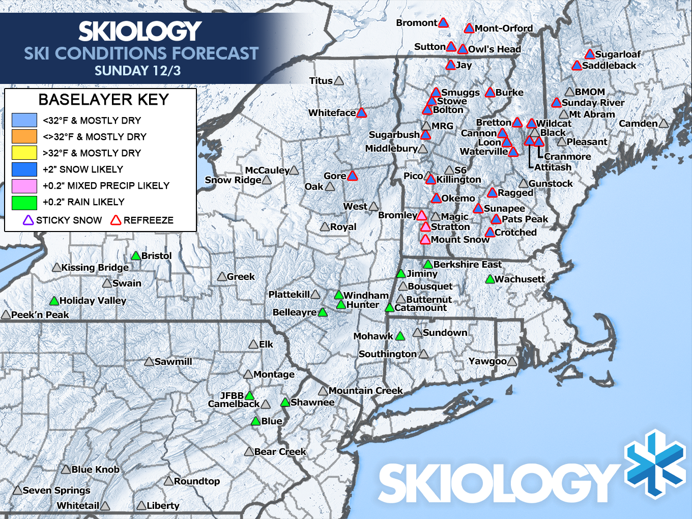
It's too early to tell if there is a decent location for a good day with the combination of challenges and variability in the forecast. Areas that stay above freezing are likely to get rain, and areas that freeze up are likely to stay icy until the snow hits, and we're not exactly certain when that will happen quite yet.
Knowledge Is Powder!
-- Matt


