I kind of sort of think I have a handle on how this is going down, but there are two variables left that cause me some pause and will affect where exactly the snow will pile up and how much of an issue wind will be on Sunday ahead of the rain.
It would be a really good idea to get your turns in by at least Saturday in most of the region because the landscape is going to change at many mountains, especially in New England where the natural snow was piling up. A flip to snow however in this storm will probably save some snowpack and make it nice enough, but this won't widely be the case.
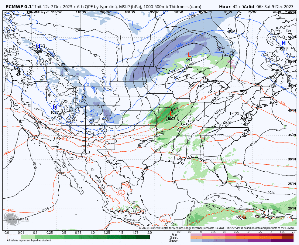
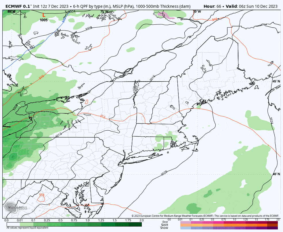
Models have mostly coalesced presently on essentially what you see in this ECMWF loop above covering Saturday through Monday. This could be both worse and better depending on the strength of the larger low that spins up. The stronger the low the more the moisture will be thrown back behind the cold front for snow to fall, and the earlier that happens the further to the southwest the snow will stack up.
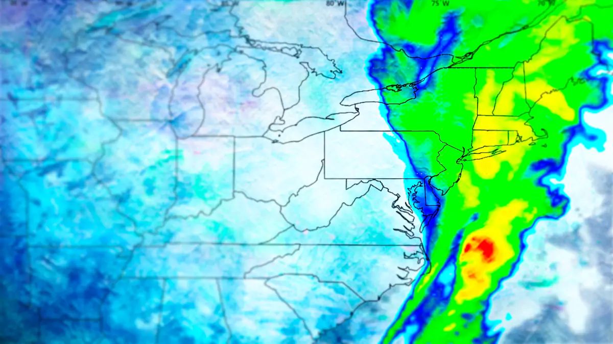
Unfortunately for the most part the rain is easier to figure out. Everyone gets rain to start, even up to the Saguenay area of Quebec. We're talking about 1" to 3" of rain generally speaking, and a lot of those totals in New England will be at the upper end of that range. That's going to suck in so many ways and what it does to the snow deserves some attention.
I'm going to discuss the following topics below the paywall for Premium Subscribers:
- A more detailed overview of the storm.
- Where some bonus snow could save the day (week).
- How much rain will fall and the effects on snowpack.
- Where to go on Sunday with rain, wind, and conditions issues.
- Monday's widespread wind issues and bonus pow hunting.
Detailed Overview
The ECMWF and GFS are presently modeling similarly and the ECMWF has lost it's over-amping bias now it seems. That's good because it's a superior model with the finer details once track and intensity are no longer an issue.
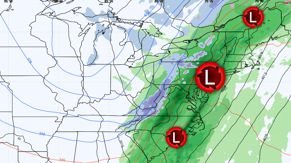
Here are two loops that tell the story of how this storm is likely to roughly evolve. The first is the ECMWF 6-hour precipitation intensity loop and then surface pressures, both covering all of Sunday and Monday.
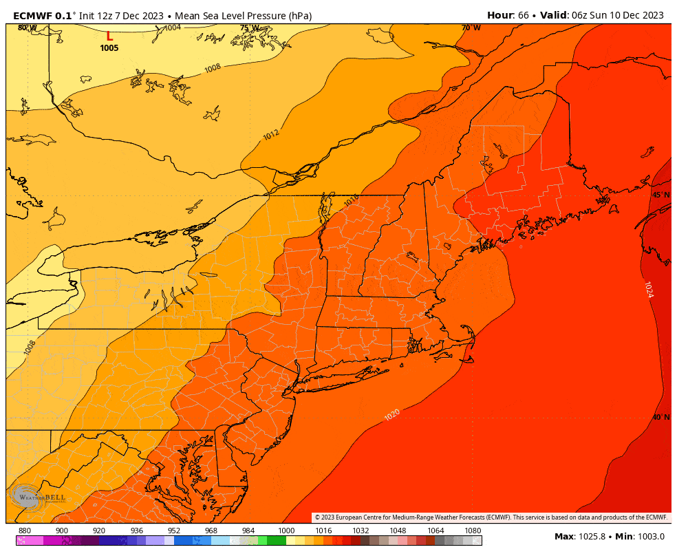
The surface pressure map shows which of those lows spins up stronger. When one of the lows becomes stronger, generally highlighted in green in the second loop, that's when more moisture gets thrown behind the cold front and falls as snow. While models are in good rough agreement on this currently, ensembles show enough variability to matter. It seems the low really wants to feed off the ocean near NYC around midnight Monday morning, which is an attractive spot, so that's why this is the leading solution and plausible.
Let's however look at three different runs of the ECMWF over the last 24 hours to demonstrate the variability in snow based on the strength of the low. It's notable, and this is why confidence is only average at best right now.
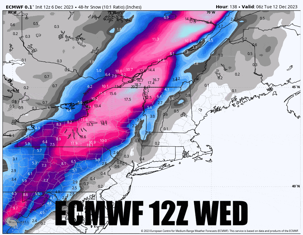
Basically, the earlier and stronger that low forms, the further west and deeper the snow will fall. At the high end 2 feet of snow could fall, and at the low end only about 6" of snow might fall. I'm leaning towards the middle where the consolation prize following some heavy rain will be 6"-12" of snow in parts of WNY, CNY, the ADK's, and the Northern Greens, the Eastern Townships and up towards the Quebec City region, plus maybe the Catskills or even the Poconos.
I don't see much opportunity for this to notable benefit areas not mentioned. New Hampshire and Maine ski areas likely get virtually all rain out of this. How much rain? Well this map in shows all of the water that will fall, and you can take off about an inch from under where it snows heavily.
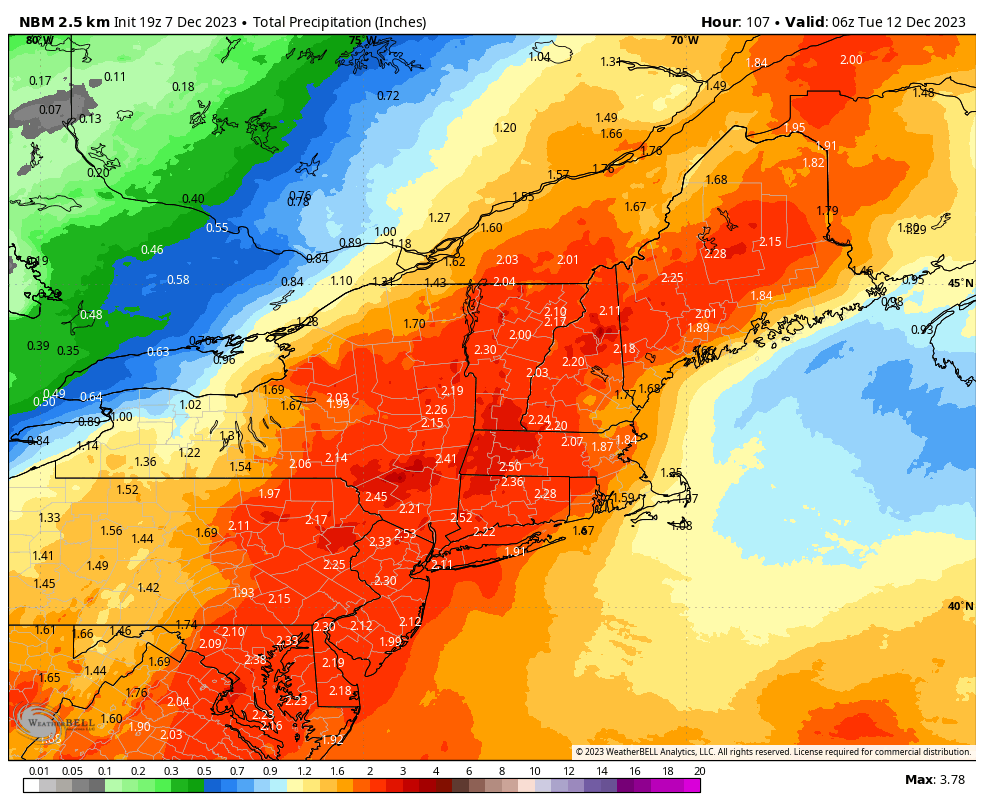
This will crush the snowpack and also do some notable damage to snowmaking terrain where it doesn't flip to snow early enough, and that's most everywhere outside of Northern New York, Northern Vermont, and parts of Quebec, but they're not guaranteed by any stretch. This likely causes flooding issues too.
This will close natural terrain and melt much of it away in New Hampshire and Maine. It may also close some trails that had thin cover from snowmaking all over. It may also close some ski areas until they can make more snow, and the picture generally doesn't look great in Southern New England, PA and NJ outside of NEPA where they have more time under the guns.
I'm hoping that Whiteface, Titus, Sugarbush, MRG, Bolton Valley, Stowe, Smuggs, Jay Peak, the Eastern Townships, and maybe Burke can be saved from snowpack decimation with a healthy topping of fresh. Elsewhere hope is maybe too optimistic.
Sunday Planning
Sunday right now may be a safe ski day in parts of New England especially east of the Connecticut River. West of the Connecticut River in New England may only be dry in the AM. Further west fugetaboutit, in fact I expect many in NY, NJ, and PA to shut down for at least Sunday. Target places like Ragged, Sunapee, Gunstock, Wachusett, probably Berkshire East can sneak in there. If you go further north then Sunday will a full melt of fresh snow and it will likely be sticky, but some of that snow has been covered in snowmaking which should be OK.
The southerly wind in front of the rain will be challenging and I think a good number of upper mountain lifts will go on wind hold during Sunday. I'm mostly concerned with peaks over 3,000' that don't have a ton of similarly large mountains to the south. Lower level wind seems like it may not pick up as rapidly. Here's a map of wind speeds at about 4,800' showing 1PM on Sunday.
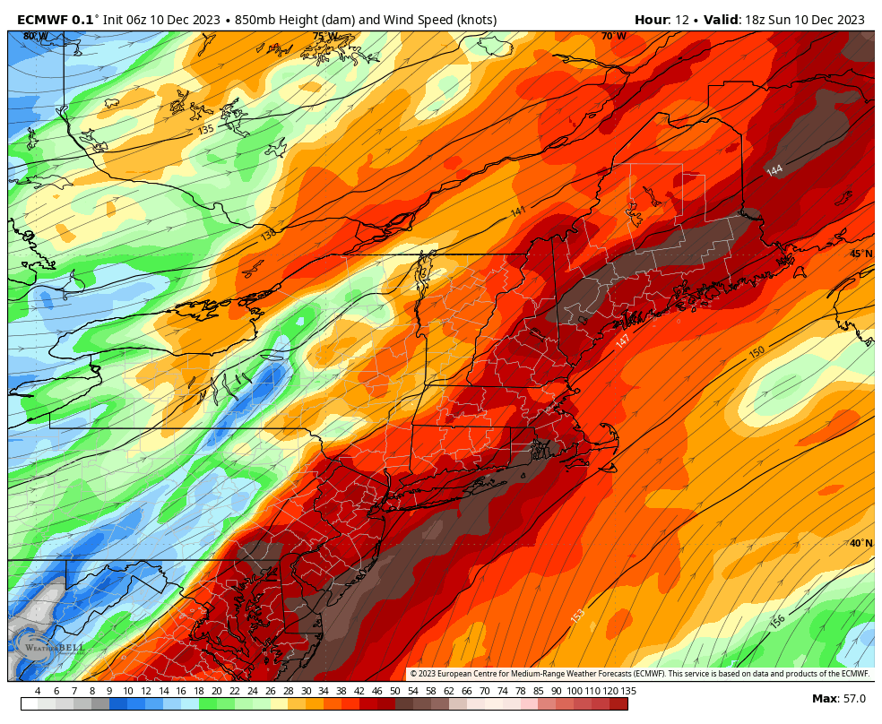
3,000' mountains under the maroon colors are where I'm concerned, and especially so under the browns. Again, NY, NJ, and PA just don't make sense due to rain anyway.
Monday Planning
Monday may be pretty damn hard to hunt due to the wind, so delaying until Tuesday may be the right call. Wind will become westerly behind the cold front and blow hard across the entire region. Let's take a look at some wind gust speeds in lower resolution.
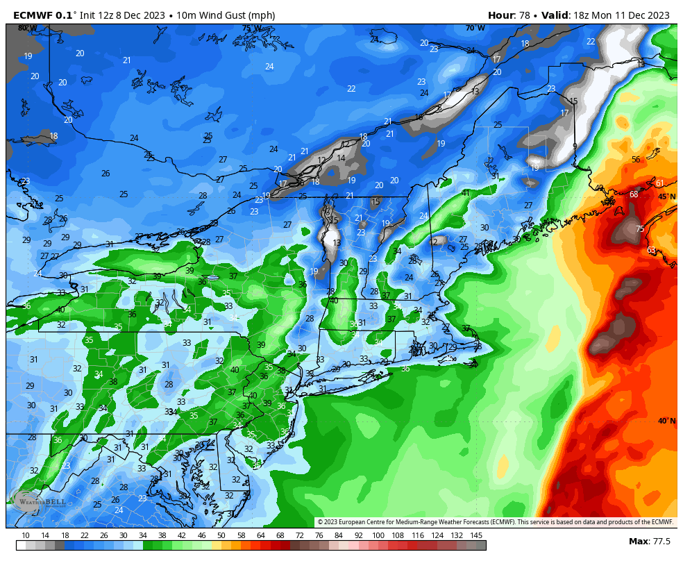
Anywhere that you see green and a 3,000' mountain, there's going to be some notable concern for wind holds on Monday with the exception of a handful who have terrain shielding them from the west. This is also going to shift the new snow that falls which probably also gets shifted from the first part of the storm. Jay Peak skiers and riders will know what I'm talking about. It will probably be in the trees and on the edges of trails.
Tuesday may be the optimal time to look for something to hit, but the landscape will look pretty bleak where it didn't snow. We do have a couple of northerly tracking clippers on Wednesday and Thursday which should help a bit in the recovery.
Knowledge Is Powder!
Matt


Comments ()