This likely isn't the type of storm we want to see but I'll come right out and say that I slightly favor this storm missing most of the Northeast at this time which is why I waited a couple of days to issue this storm watch. There is however a decent probability of a full-on washout and only the slimmest chance of a notable snow event for part of the Northeast. Right now weather apps likely look awful though for next Monday and Tuesday because that's what all three deterministic medium-range models presently show.
After getting pretty lucky in the last three storms (there were far worse alternatives modeled in all three), I'm hesitant to check to see if there's another ace up our weather sleeve to at least split the pot again, but 5 days out with this setup there is a chance of something fantastic, but a worse chance than in those other storms.
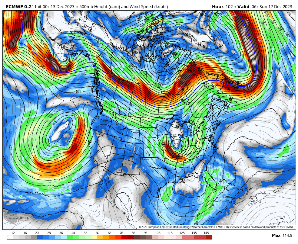
Despite being just 5-6 days out at this stage I have very little confidence in the present modeling because this storm features two different cut-off lows, one of them evolving in the Gulf of Mexico with some tropical characteristics. Cut-off lows never occur within the main steering flows of the atmosphere and they meander around very unpredictably. Cut-off lows just drift in the ocean of the atmosphere until a current comes and picks them up. There's also tentative entanglement with two different troughs which creates even more unpredictability. Small adjustments in that regard can cause notably different outcomes, in fact let's take a look at both the GFS, ECMWF, and GEM modeled 500 mb pressures early Tuesday from the latest model runs to show just how different all three are.
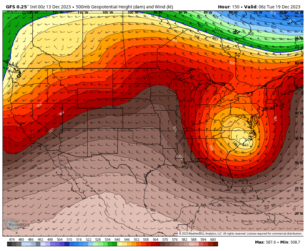
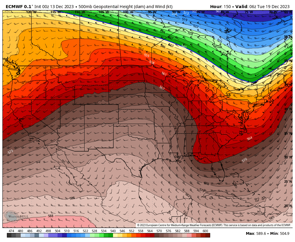
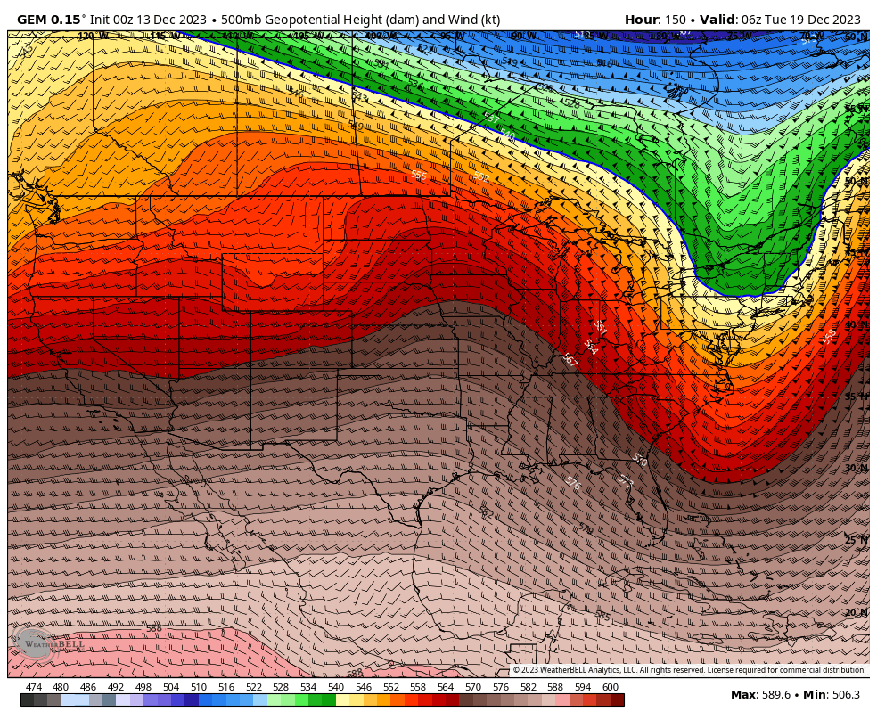
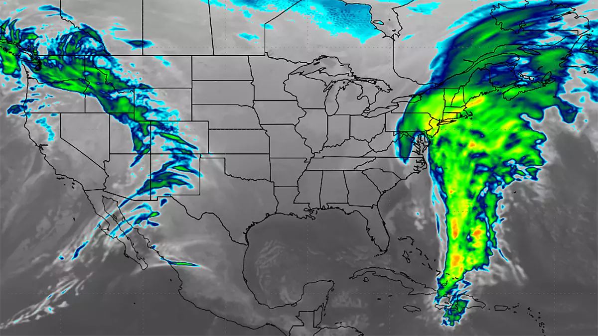
The results here translate to precipitation that is horrendous, to really bad, to mostly bad in that order, but like I said, I doubt the modeling right now and there are plenty of other alternatives including a miss.
It's going to be super hard though to see a mostly snowy solution in December when the polar jet stream is cutting across Canada. We need the roulette ball to drop in the green this time for there to be a lot of snow and we are better off betting on a miss at this time.
Storm Watches and early Storm Updates can be a bit more wordy and exploratory as we can't do point forecasting with any degree of skill at such a distance. My coverage becomes generally shorter and more determinist as we get closer to events. This I believe is a nice balance of content types with appropriate timing.


