I'm not going to lie, this is possibly the worst winter rainstorm that I have seen hit the Northeast in 6 seasons of coverage, though 3 years ago in 2020 we had an awful one that followed a record breaking snowfall that dropped over 40" in parts of PA, NY, VT, and NH only to see all of it melt by Christmas with the addition of a wet slide at Belleayre that damaged their lodge and other slides were reported at Mount Snow also that day. We may well see problems again with many ski areas subject to unobstructed onshore flow receiving from 3" to 6" of rain by the end of today. This is bad news and I don't like covering rain in the winter for obvious reasons. Snow of course brings more excitement, stoke, and sells more subscriptions for Snowology. I'd say I'm moving to Canada out of frustration but I'm afraid they're going to get royally kanucked too.
There will be some winners in the far western areas of the Northeast where they will net some additional base, and there's a snowfall map for Premium Subscribers in the Recovery section.
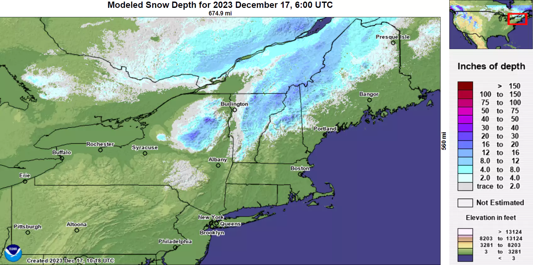
Unfortunately we were trending above average on natural snowpack generally from the Killington latitude and north, but that's going to change. Yesterday the Mount Mansfield snow stake was showing 38" of snow, but that's also going to change. This is what modeled snow depth looked like yesterday morning and the mountains themselves do generally trend higher.
I'm going to cover both the washout and the recovery, and yes, we will recover. The recovery part will only be for Premium Subscribers.
The Washout
Let's start off with a 36 hour simulated radar loop from the NAM3K showing Monday through noon on Tuesday. There is some back end snow and we'll get to that in the recovery part.
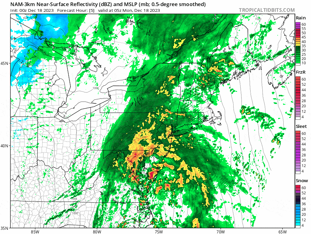
If that looks like a lot of friggin rain, it is. The worst of it will be in Eastern Pennsylvania, Eastern New York, and New England. Let's take a look at what the National Blend of Models (NBM) shows for rain.
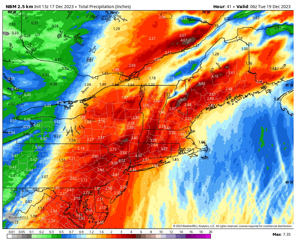
NWS forecasts are a little more reserved as the mesoscale models do help pump up the NBM a bit in the mix, but don't underestimate the effects of upsloping with rain as they are pretty much the same as what we see with snow. It's hard to choose winners here as 2" of rain in some of the more terrain shielded spots of the Northeast is hardly a win. This will decimate most natural snowpack as well as many trails that have less than a foot of snowmaking depth on them. Those who haven't yet opened in some cases will be set back to square one. Quebec doesn't fare much better unfortunately as the upslope from the St. Lawrence will also wring out extra moisture and all of the glorious snowpack in the Laurentians from Tremblant to Saguenay is going to take a severe beating.
Wind is also an issue and many of the ski areas who chose to stay open today will not be able to run their upper lifts and things like water bars and pooling will also create issues. Whoever manages to operate in this gets a prize honestly, but the ones staying open are only doing so because they have lodging guests and basically never close for weather until they are forced to do so. Here are maximum modeled gusts through 4PM today.
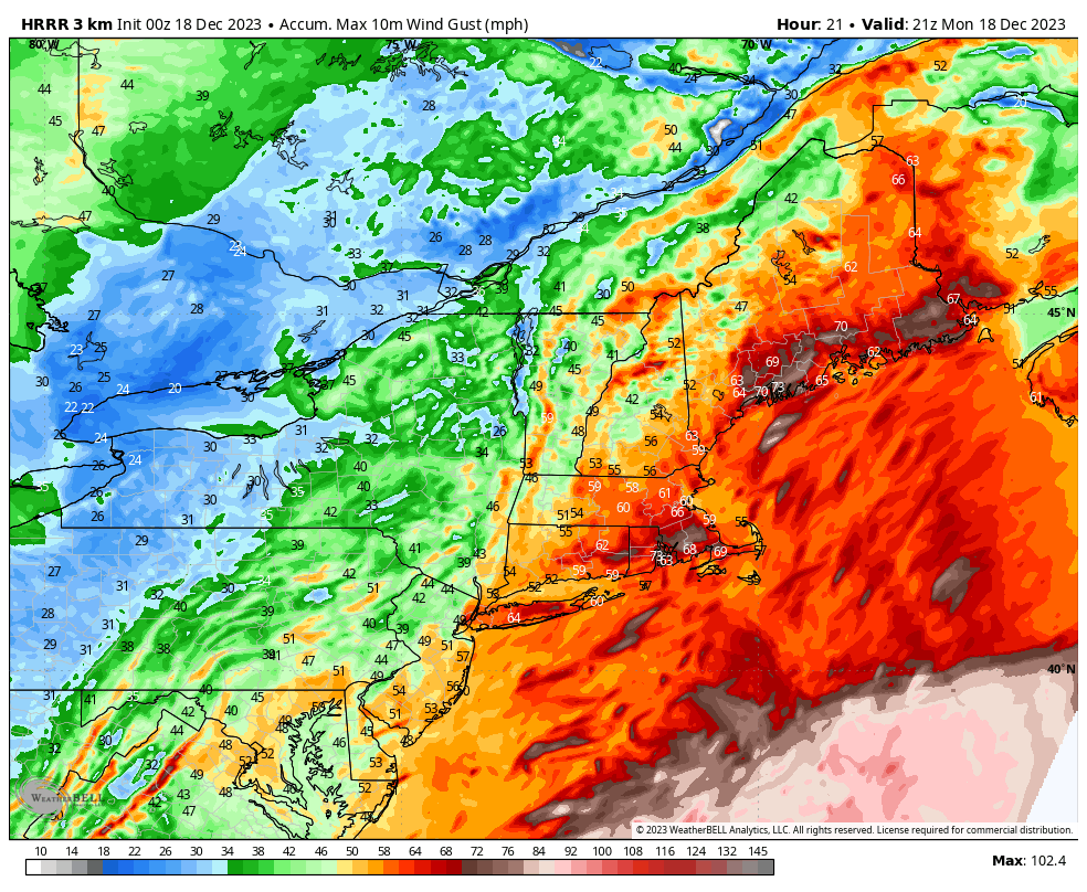
Things are going to be spicy in New England to say the least. With the addition of heavy rain we will likely see widespread power outages and some flooding. Combine that with damage to snowpack and damage from runoff, we are likely to see some ski areas not make it open on Tuesday either, and it could be worse in some cases. This is a bad storm on every front.
Many small and even medium sized ski areas will likely stay closed until at least Friday so that they can focus on rebuilding their terrain and dealing with some of the aftermath. Thankfully we have some snow and cold weather behind this storm and we're going to cover that next.


