I keep seeing ski areas and ski associations sending the message that ski resorts still have snow. They do of course, though it's getting a bit dicey in some spots and will vary from trail to trail and resort to resort. They're trying to avoid extra phone calls and of course boost business during one of the three holiday periods. Traffic is down of course, which to skiers and riders is not a bad thing. Traffic will pick up this weekend but it will remain below normal levels and that's unfortunate for those who rely on skiing and riding for their livelihoods. There is time however for this season to shine again; lots and lots of time.
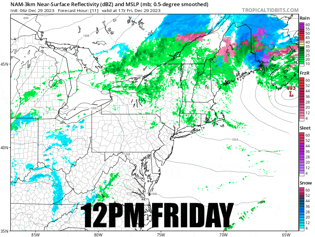
This weekend things will start to freeze back up, plus some snow will come as the rain moves out, and conditions are going to get a bit tricky in spots as things transition back to winter temps and surfaces freeze, though many will remain carveable through the weekend if you are smart enough to not go big. This is where it really helps to apply the weather to the conditions on the ground in order to determine what it means. I'll do my best to help people understand what to expect and maybe where to go if they have options.
Let's start off with a simulated radar loop from today's 6z NAM12K covering noon today through noon on Sunday and then behind the paywall I'll take apart the snow and the effects of the refreeze on both Saturday and Sunday.