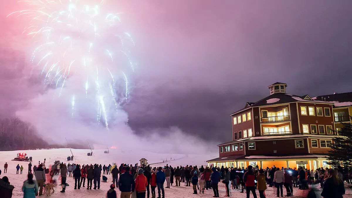
The last two weeks in the Northeast has been pretty damn bad for snow lovers with both rain and warm temps. Many ski areas barely made it through the holiday weekend in fact, but we received a little bit of snow to make things look white again and freezing temperatures finally returned.
"The Week Ahead" is a potential new feature of our coverage which is being debuted here. It will cover in light detail the impactful weather across the Northeast from Monday through Sunday in order to help people prepare for what may come. Active winter weather is of course difficult to forecast for more than 3 days out so this is only meant to be a rough guide.
I'm going to step through three different aspects of the weather for the next week in order to give everyone an idea of what to expect. We'll start with the Active Weather Outlook, then the Temperature Outlook, and lastly the the Weather Pattern Outlook which will be more detailed and a bit more technical. For the time being at least we will keep this probable weekly feature free for everyone to view, though that may change.
If you find this valuable and are interested in storm coverage, conditions, and operational insights, then you may want to take advantage of our free 10 day trial. A full 12 months of coverage costs about the same as a sandwich and soda at a large ski resort and provides multiple discounts in our Snowology Club that can save more than the cost of the subscription.
Active Weather Outlook
We'll start off with a 7 day loop of the 6-hour precipitation intensity from the GFS and then briefly discuss active weather on the days it is expected. The two major features of this next week appears to be a near miss on Thursday, but there is growing model support for a strong coastal storm on Sunday.
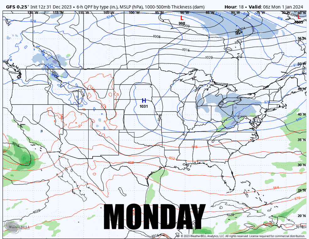
MONDAY: We have a clipper that will affect mostly W-NY and W-PA with potential for a powder day in the Alleghenies.
WEDNESDAY: A weak disturbance in a trough will bring breezy conditions along with some lighter lake effect and upsloping snow on the light side. W-PA, W-NY, N-NY and N-VT most likely to show accumulations.
THURSDAY: A storm is likely to form in he Southeast and track up the coast, but is likely to swing wide of the Northeast with mostly minor effects. I've been tracking this for many days and it hasn't yet hit enough confidence for a Storm Watch and is trending worse. Lake effect and upsloping snow will likely intensity a little and more widespread light snow is expected.
FRIDAY: Behind the storm there is a possibility of some lift-threatening winds, but this currently looks like a minimally threatening event.
SATURDAY: A little bit of lake effect is expected and a brush with a storm up in Quebec may bring some light snow to northern areas.
SUNDAY: There is strong potential of a coastal storm tracking through at least part of the Northeast during all of Sunday. A Storm Watch is likely to be issued for this Monday morning. Presently the environment looks conducive for some heavy snow on a widespread basis. This is 7 days out so there is plenty of opportunity for a notable change. Probabilities of a notable storm impacting at least part of the Northeast are above 50% but I have some concern it could swing too far south.
Temperature Outlook
The snow guns already started up on Saturday, and last night we saw them blasting widely and they will continue to do so at least at night for most ski areas as far as the eye can see confidently. There's a good chance of almost every closed ski area being open by the following weekend. Without an existing natural snow base and man-made snow getting thin, snowmaking temps are in fact the most important thing for the ski industry at this time. Given that we just saw over 5' of snow practically disappear in a week while snowmaking terrain largely held on, that should hopefully be enough proof that temperatures are king for at least the first half of winter.
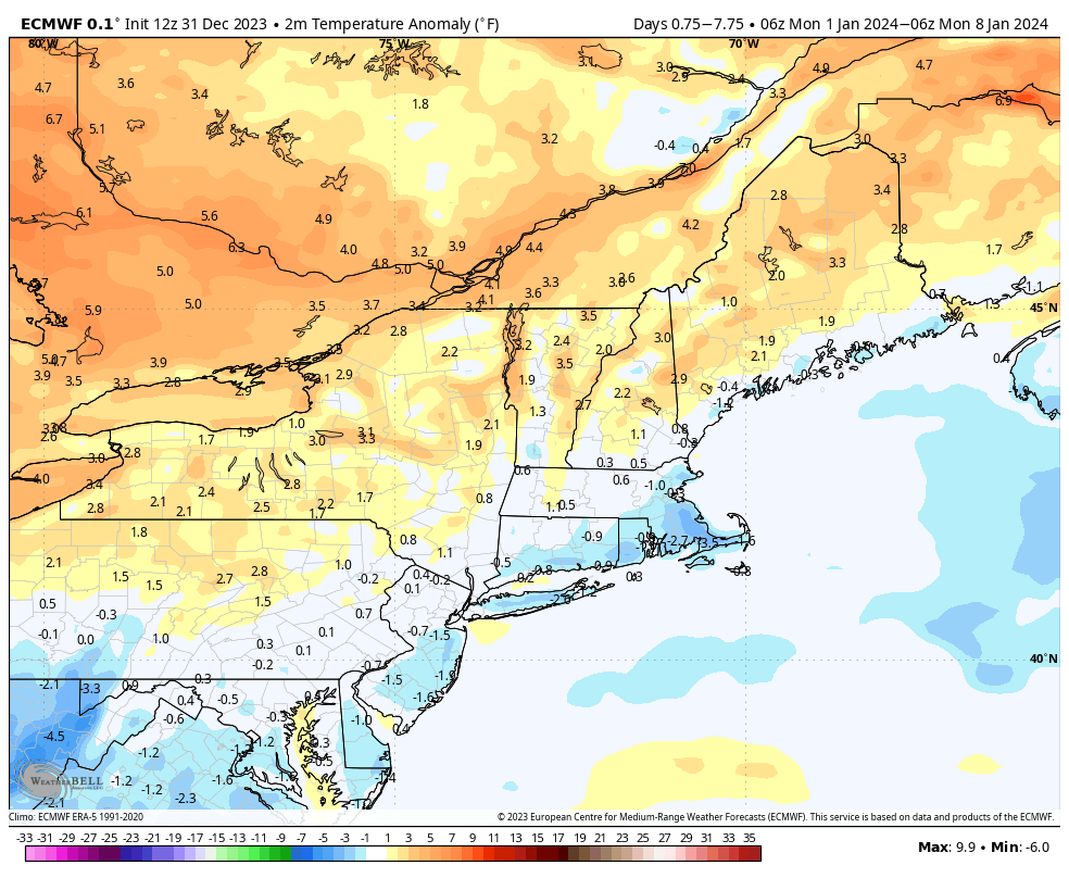
Temperatures for the week are expected to range generally from average to 4F above average with many of the mountainous regions seeing average temperatures. The lack of snowpack and warm lakes are some of the primary drivers to warmer temperatures at lower elevations. Here's a view of the temperature anomalies from the ECMWF for Monday through Sunday.
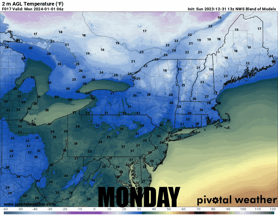
This loop shows temperatures every 6 hours for Monday through Sunday according to the National Blend of Models. The further out we go, the more variability we can expect to see, though a lack of notably active weather until Sunday suggests this is likely to roughly confirm until then.
Weather Pattern Outlook
I've been seeing all sorts of forecasters talking about a "pattern change", however the main pattern driven by El Nino with a strong southerly shifted Pacific Jet and split flow over North America is essentially still there, it's just not going to suck quite as bad for the next week as multiple other positive shifts happen, and they may continue following this week with varying results.
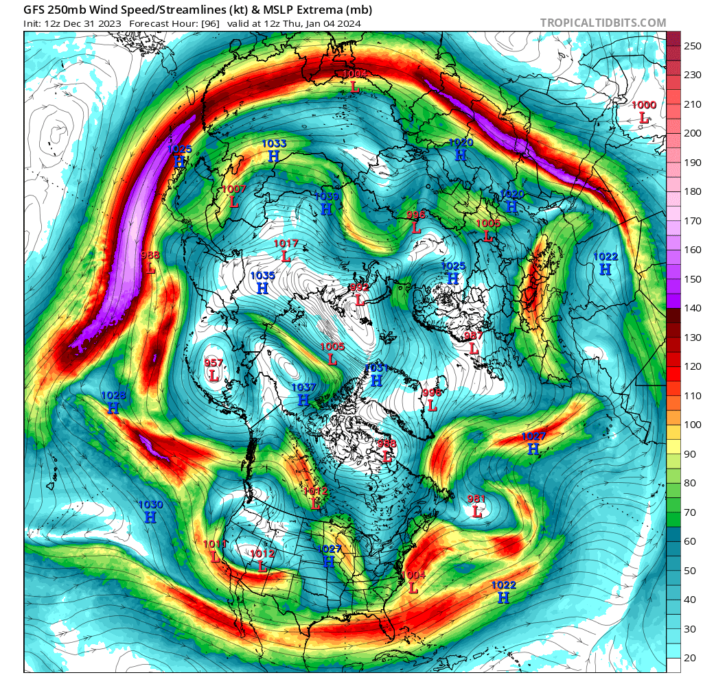
What has been causing warmth has been a Pacific Jet extension where the Jet Stream becomes stronger as it exits Asia and then reaches mostly across the Pacific without a more typical wave pattern. This pushes warm Pacific air deep across the continent and the split jet in North America has been causing a lot of mixing and mild temperatures, chaotic storm tracks, and weaker storms. The Pacific Jet however is starting to see wave breaks in the mid-Pacific and that's a good sign for the time being, however there isn't necessarily a signal that suggests this can't come back. Here's what the Jet Stream will look like on Thursday morning.
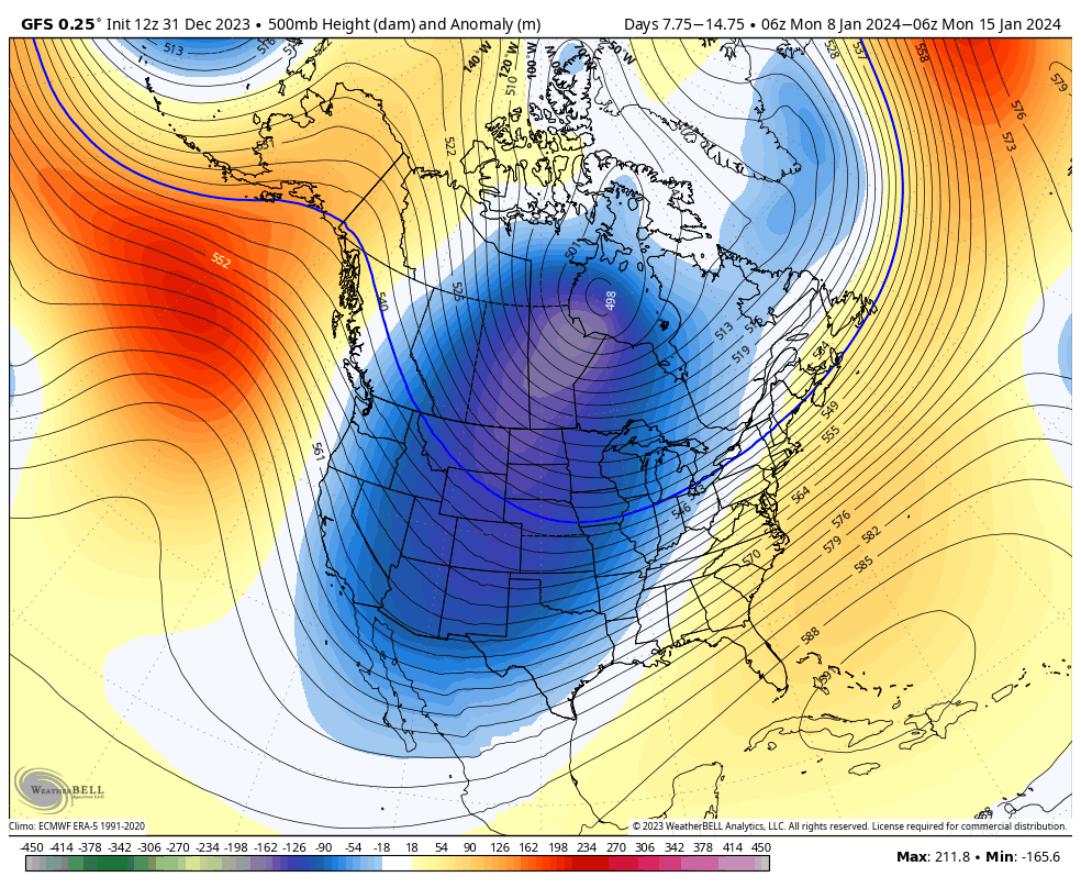
The 500 mb level anomalies over the next week show a return of WNW flow over the Northeast which is how we get near average temperatures generally. The driver for this is both a weaker Pacific Jet and the rebuilding of a low pressure circulation over the northern part of the Hudson bay. The low pressure anomalies further south are representative of the general storm track which is also very El Nino-ish and if we miss that Sunday storm it probably impacts the Mid Atlantic instead. The storminess in the Southwest is also indicative of an El Nino track.

The following week's 500 mb anomalies point to a different storm track and deeper cold in parts of the country as the Hudson Bay circulation builds and shifts southwest. This location will bring cold to the West and Midwest but it could cause roughly average temperatures in the Northeast and a storm track that may favor cutters, however Arctic air this far south can create monster storms if they go coastal. Note the ridging in the Gulf of Alaska, that should help keep the Pacific Jet from screaming and warming us up again.
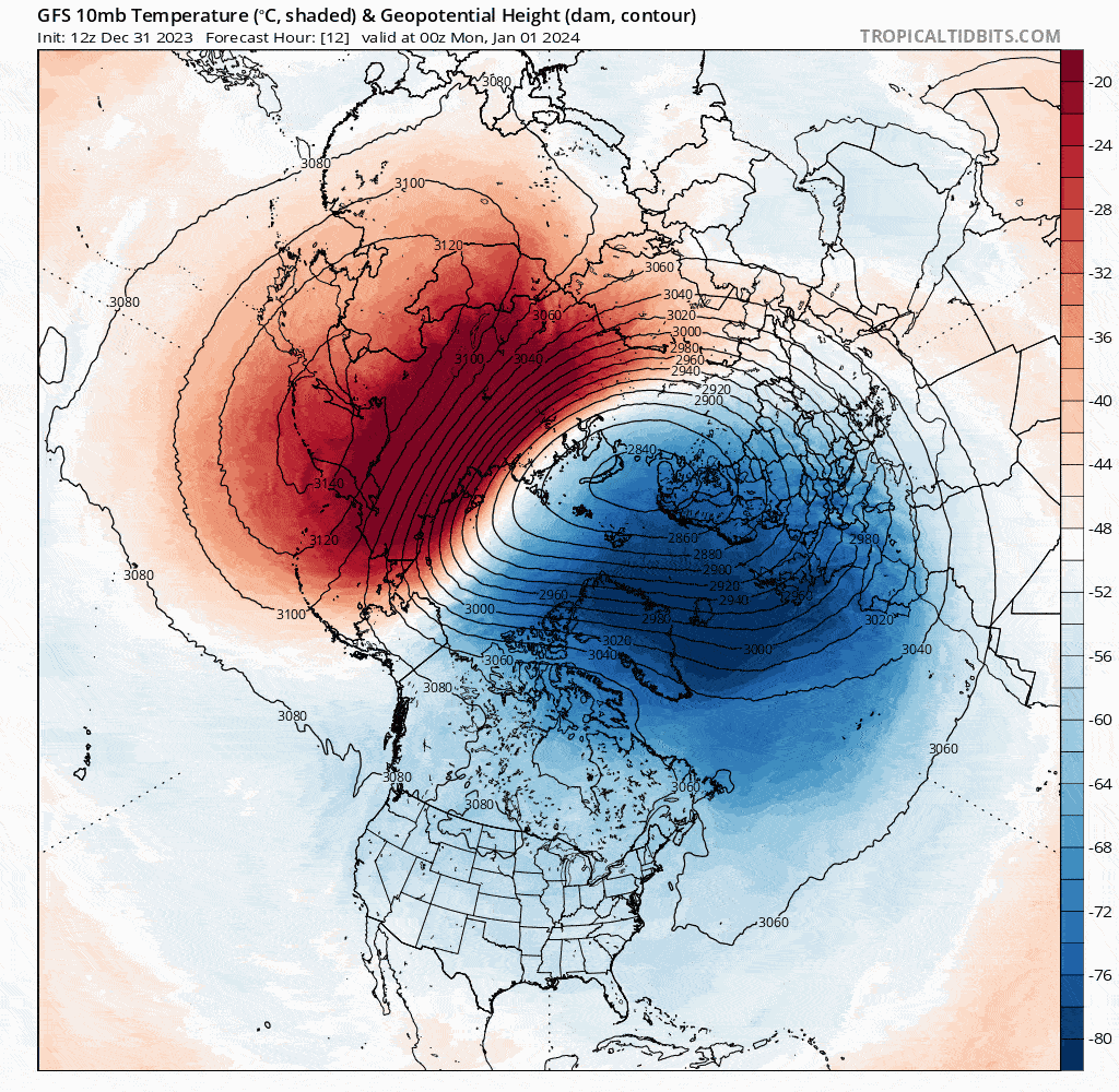
Lastly let's quickly talk about the stratospheric Polar Vortex. A "Sudden Stratospheric Warming" event (SSW) is starting right now over Asia as warm air will ride up over the Himalayas into the lower levels of the stratosphere at the same time the Polar Vortex is shifted into Asia. A strong Polar Vortex keeps cold air locked in at higher latitudes and also helps strengthen the Pacific Jet. A weak Polar Vortex tends to let cold air leak to lower latitudes and lends itself to things like a more wavy and stormy jet stream, and also a higher likelihood of blocking patterns which can be advantageous for the Northeast when we get Greenland blocks. This won't split the vortex or push it much off axis, but it will weaken it a fair amount which could help us get through the tail end of strong El Nino effects which tend to start becoming less influential during January.
It may seem counterintuitive to many that a weak Polar Vortex means colder weather, but in the Arctic it actually tends to mean warmer weather as the cold shifts south with a weaker circulation. This is always a positive sign, however cold does not evenly drop to lower latitudes and we still need appropriate 500 mb flows to keep us in the cold and in the storm tracks. I'm hopeful for a pretty good January after a disastrously warm and rainy December.
Knowledge Is Powder!
-- Matt


Comments ()