I hope everyone is full, settled in for the holiday, and excited for what is to come because the ski season is starting to crank into higher gear with at least 26 ski areas operating in the East by Saturday with ski areas open 5 states plus Quebec. We even have some packed powder up in the Whites and Longfellows.
I'm going to cover the weather this weekend, which is mostly uneventful outside of temperatures affecting conditions. I'm also going to cover the people factor, because of course "People Are A Condition", and while we might not mind packing in around the Thanksgiving table, we would all prefer a little bit more space while out on the slopes.
I'll start out with who will be open, then go into the weather with a focus on temperatures and conditions, and finally I'll share some tips for where I might go this weekend to ski or ride. One more thing, you should definitely look at those snow reports before heading out, many who are open are low on terrain and still advising that conditions and/or terrain are not appropriate for beginners. That's not a carte blanche to charge down the slopes either because it is a holiday and families with children will be out too.
Who's Open This Weekend
We have a lot of open ski areas as of Friday with a few more to join the ranks on Saturday. Here's a list of everyone that I am aware of as of Wednesday evening who announced.
|
NEW
HAMPSHIRE Waterville
Valley - Opens Saturday Loon Bretton Woods Wildcat Cranmore NEW YORK Windham Belleayre Whiteface Greek Peak -
Opens Saturday Gore - Opens
Saturday Hunter - TBD MAINE Sunday River Sugarloaf |
MASSACHUSETTS Wachusett Jiminy Peak VERMONT Mount Snow Stratton Bromley -
Opens Saturday Okemo Killington Sugarbush Bolton Valley Stowe Smugglers'
Notch Jay Peak -
Saturday General Public QUEBEC Tremblant Saint-Sauveur |
There are a couple of things to add. Jay Peak will be open to the 'devoted' on Friday for passholders and those who snagged a free ticket. Powder Ridge turned on their refrigeration powered snowmaking machine and will be having a rail jam on Friday.
I noted on Sunday and Monday that there was a lot of effort and maybe excess optimism seen in some who were making snow south of the Albany, NY latitude, and that if they didn't already have some snow at their base they would not make it. That largely confirmed I'm afraid and many in fact pulled the plug on this weekend's plans.
A handful are going to make it who did have snow on the ground and Windham who didn't have anything at their base until Sunday night is going to give it a go, though it is thin and gappy down low and needs a comb-over. Hunter actually looks better than Windham this morning, though they have choke points and thin spots along with a lot of demand among the Thanksgiving weekend demographic. They stated that they will reassess after pushing things out this morning. They could open, but it depends on their standards and traffic expectations. Greek peak appears to have done their calculations better and managed to get what looks like solid cover back to their lift after starting just last week. They're flexing with their new snowmaking upgrades and they seem to have put just enough snow where they needed it to make 2 full runs back to the lift.
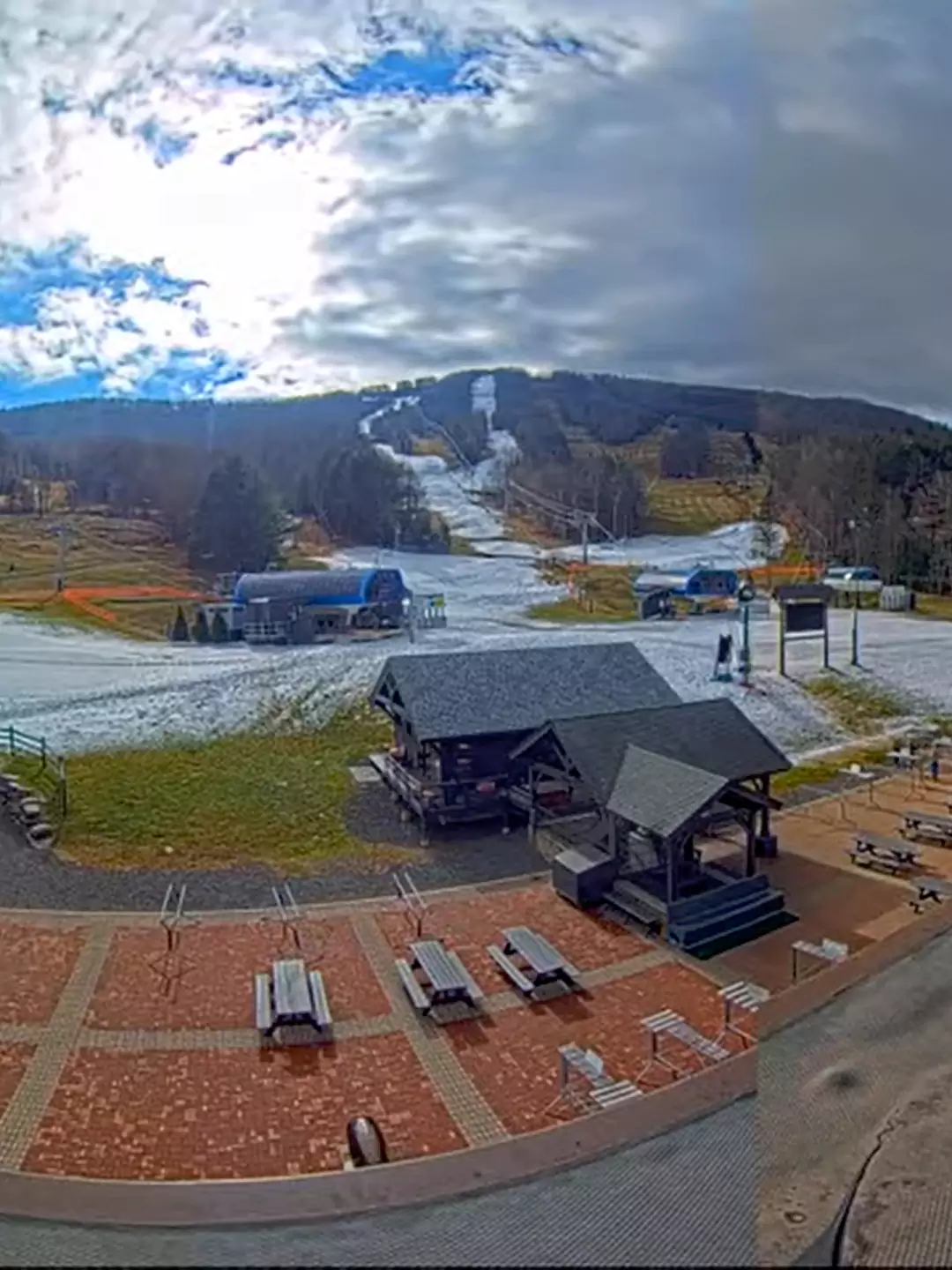
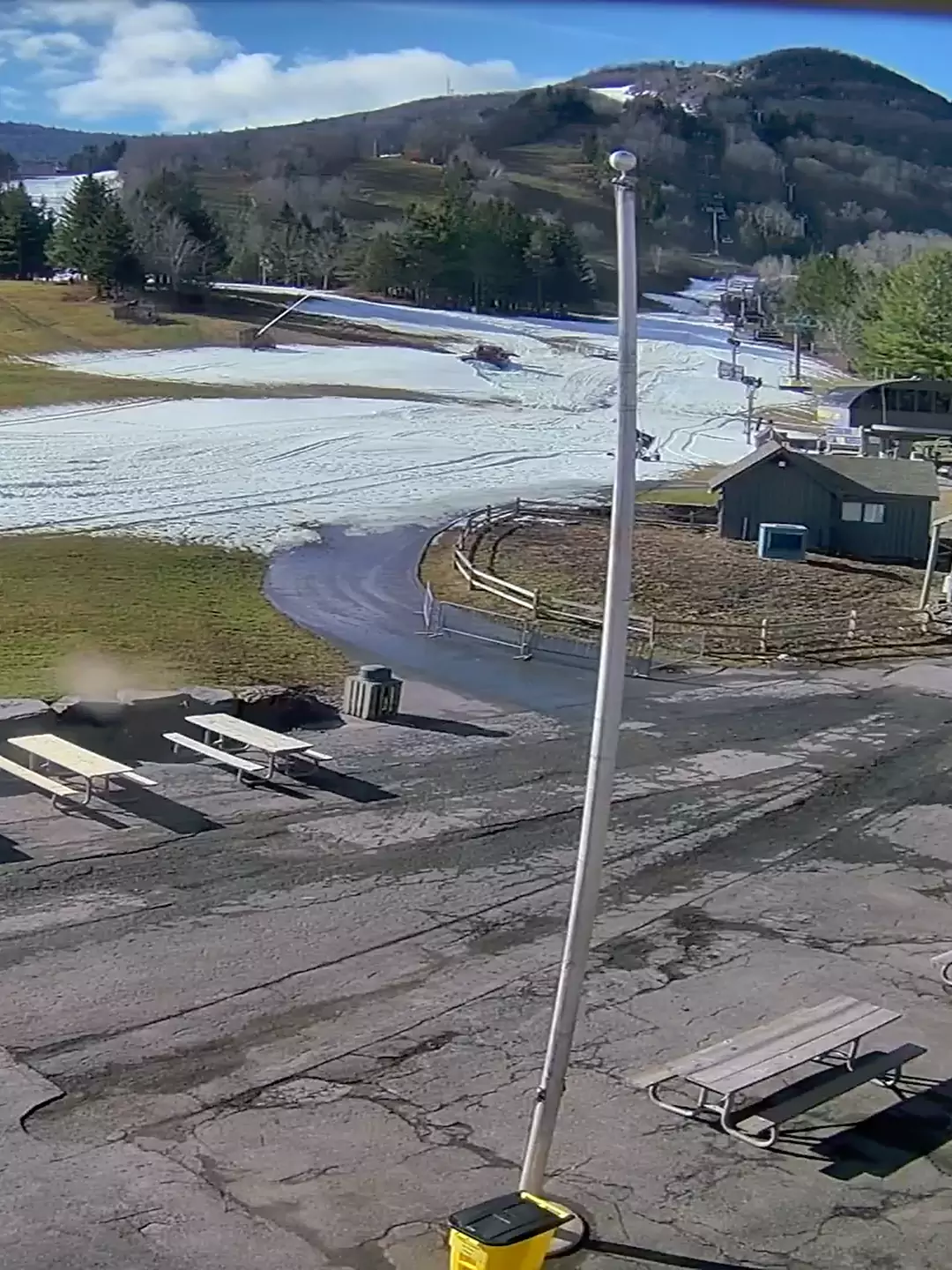
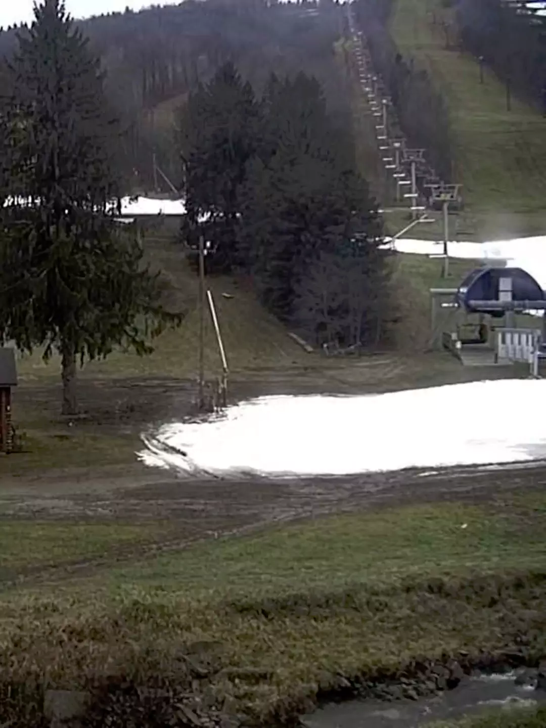
Windham, Hunter, and Greek Peak as of this morning.
Wachusett and Jiminy Peak were the other two south of the Albany latitude who will make it open on Friday for the weekend. They both had made snow before the window that started Sunday night and that made all the difference in the world. This Thanksgiving is as early as they come and temperatures for the first 3 weeks have been generally average to slightly below average, but those averages have been creeping up of course with global warming. Dear Northeast, consider yourselves lucky!

Weather and Conditions Outlook
I won't bore you with a ton of details here with non-active weather. Tonight we have little bit of moisture and wind that should add up to a couple of inches on the upslope in N-NY, and N-VT plus a little lake effect that could help pretty up Greek Peak by Friday. Aside from that and a bit of breeze on Friday and Saturday, it's an uneventful weekend for stuff falling on us.
Friday Overview: Most ski areas warmed and were rained on during Tuesday's storm and today almost everyone will melt at least at their bases. We do have cold air coming in Friday morning, but it's poorly timed. It can take up to 5 hours under the 32F for melty snowpack to firm up in the cold, and when groomers hit that while still slush, it can become washboard ice. It seems that is going to be a bigger issue in more northern areas lower on the mountain, while some others could see problems from top to bottom. Friday has potential of being pretty rough with a combination of icy conditions, limited terrain, and excitement to go skiing. Hopefully ski areas will primarily groom the limited terrain as close to opening as possible. Here's a loop of the NAM3K showing the progression of temperatures from midnight Friday through 4 p.m.
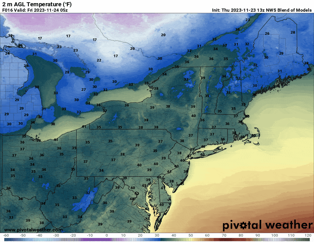
I'm least worried about Friday's conditions at Whiteface, Loon, Bretton Woods, Wildcat, Sunday River, and Sugarloaf due to temperatures along with the effects of the last storm. Wachusett will stay soft though, and Jiminy Peak is borderline for refreezing on Friday.
Snow guns will turn back on widely by sometime on Friday, and that should help fill in the gaps at places like Windham and Hunter by Saturday morning. Saturday would probably be when Hunter will open in my estimation, and we'll probably get that announcement by Friday morning if they will.
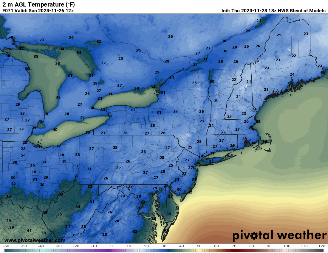
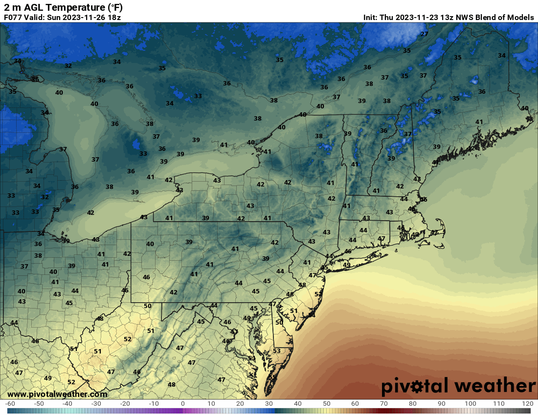
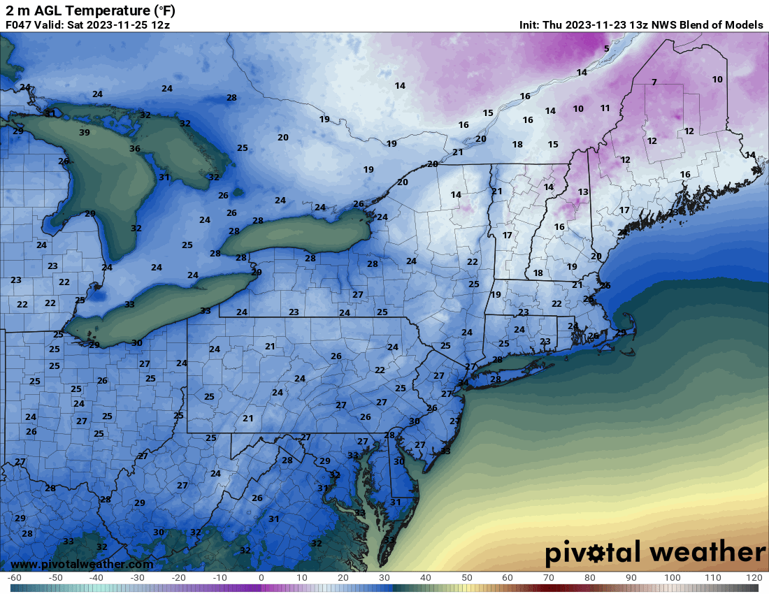
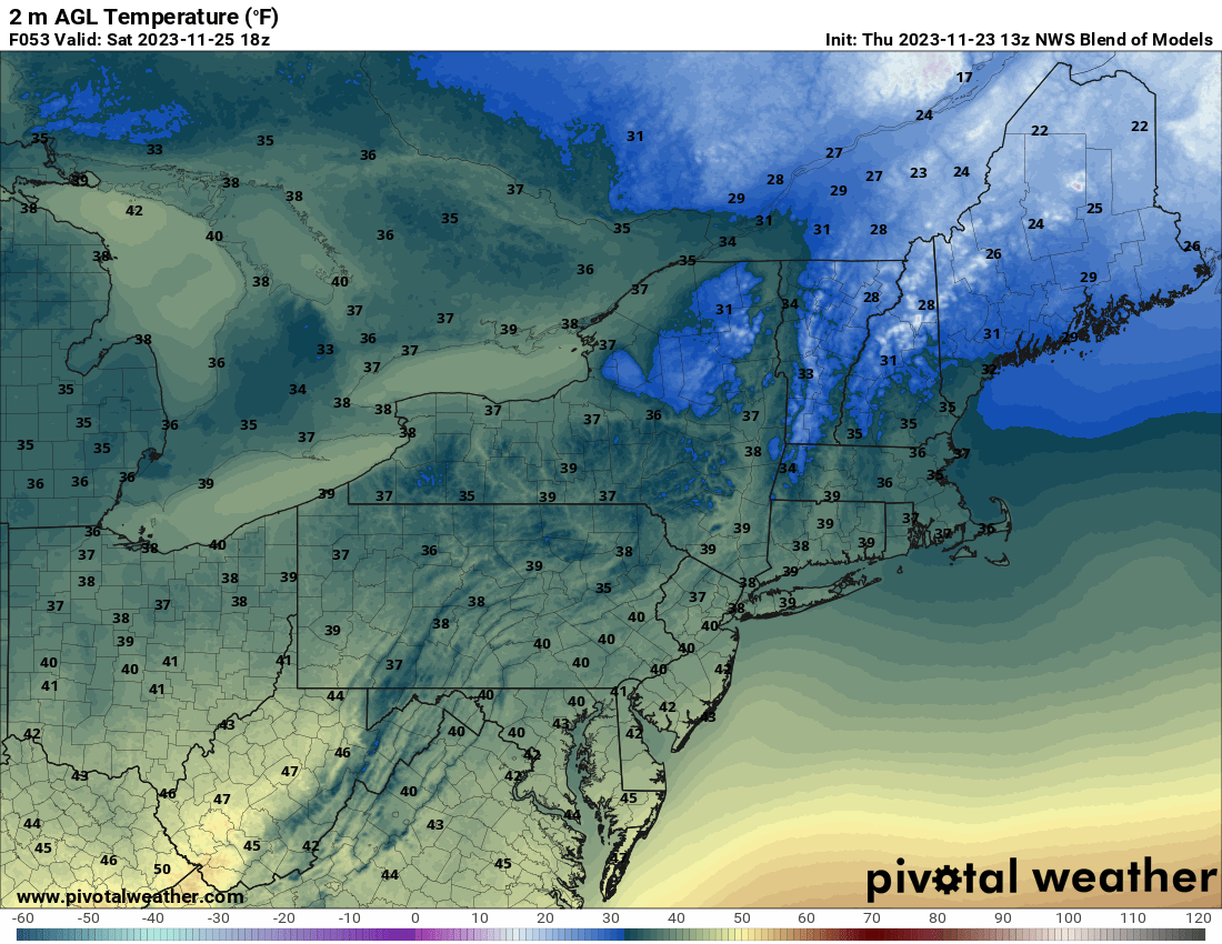
Saturday Overview: It will be pretty cold to start the day, so bear that in mind. We're talking teens at the bases in Northern New York and Northern New England along with a stiff breeze, but the afternoon should warm up nicely and also soften the slopes south of Albany. Here are the temperatures for Saturday at 8 a.m. and 3 p.m.
Sunday Overview: Sunday is going to be a pretty typical November day with everyone frozen to start the day, and conditions should continue to improve with grooming. Afternoon temperatures will be pleasant with softening mostly south of Albany again, but the afternoon may bring a little bit of edge back to parts of Vermont at least down low. Here are the 8 a.m. and 3 p.m. temperatures for Sunday.