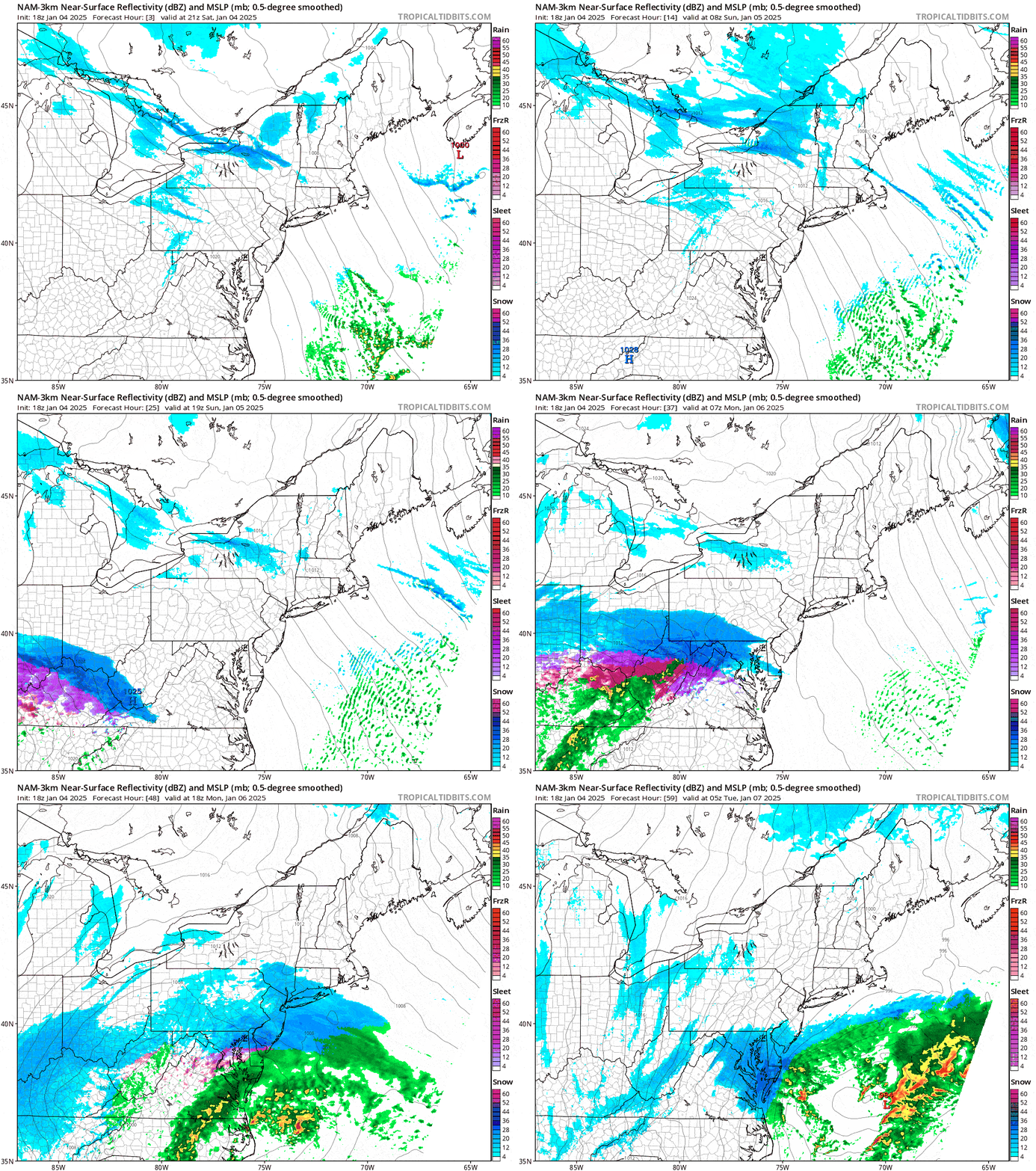
Here's an update covering the snow that remains from this back end event through Sunday as well as wind issues for Sunday, and also the storm coming Monday for the Alleghenies. Here's a simulated radar showing 4PM Saturday through Midnight Tuesday morning.

The intro is a bit short, and I'm going to speed through all of this but with sufficient detail. I'll cover the Snowfall Forecast as well as the Wind Hold forecast for subscribers. The only notable change is some increased risks on Sunday for wind holds as well as detail on timing, and also more detail on the Mon-Tue storm that will brush the Northeast with up to a foot of snow in the Alleghenies.


