Ugh. That's not a sign of disappointment, that's a sign of low confidence. This isn't super uncommon from about 72 hours out as the short-range models are generally beyond their skilled range, but models are bouncing around like a kangaroo on a trampoline with a pogo stick. I'm about to break out the chicken bones to forecast this as a matter of fact, but I do have a snowfall forecast to share, and I feel decent about it and I've left room for some bumps if things shift positively or confidence improves.

What's changed? Well, it's technical, and I'll share why, though I've generally been trying to avoid the deeper-dives in the last 3 days of forecasting. We're certainly getting a storm of course, but the distribution of snow is uncertain and things are changing with one new element, something I call a 'kicker'. Early on this storm looked bigger with a trough providing it with energy and then along came a second storm that started digging its own trough not that far behind it. That works like a see-saw and it stole the amplification from the storm, weakening it, but not throwing it off course. Over the last three days that second piece of energy has been catching up to the primary storm and it's just close enough now to transfer energy to it and help it grow into a bigger storm south of New England. This seems to be shifting the track slightly south, but it also will slow the storm down as it combines energy and amplifies it.
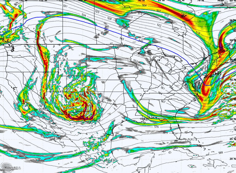
This loop shows something known as vorticity at the 500 mb level which is about 20,000' up in the atmosphere. In simple terms this is energy for storms.