I've held off on covering this because I didn't want to rain on the weekend pow party. Yeah, yeah, yeah, the doomsdayers have been talking about how this storm is going to ruin everything, but it won't. We are getting a cutter, a storm that tracks up through the Great Lakes and puts us in the warm sector of the storm. It's just a big ol' cutter.
We do have plenty of cold to start, and despite the strength of this storm it's going to have trouble scouring out the cold air. Cold air damming will allow the storm to drop lots of snow at first in many parts, but the cold air will eventually fail. Then we'll be in a warm slot that is mostly dry on Wednesday, and then wind shifts to the west and things will freeze right back up and we will likely get a really nice back-end event with both lake effect and upsloping to bring softness back to some of the snow. We'll be OK, in fact the back-end may be glorious! Some will get up to 3" of rain, and some will likely get up to 2' of snow out of this by Friday. I kid you not. This is a base-building storm for many! Oh, and Quebec may have some stay all snow with over a foot of it falling.
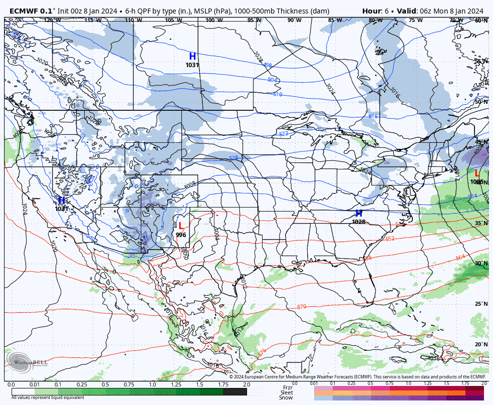
Let's look at the wide vide from the ECMWF covering Monday through Friday to set the rest of the coverage up.
I'm going to cover the precipitation, both rain and snow. Wind will be fierce, and I'll cover that too. And that back-end, I'm going to cover that as well, but that coverage is limited to Premium Subscribers.


