Here's a partial and rough storm postmortem. As predicted, with the changeover from snow to rain everywhere snow reporting in many cases reported settled measurements as well as base measurements. The high winds and extra heavy snow has resulted in closures, lift issues, and delays.
Some ski areas are likely staying closed today in order to rescue their new snowpack from being crushed into a firm surface that would become ice when it refreezes. Saddleback, Sugarloaf, Cannon, Pleasant, Middlebury, and Jay for instance are either closed or have very limited lift access at this time. They will ski sooooo much better after the new snow drains and freezes back up. Even if they could operate, lying fallow before the holiday weekend is a good move.
The variability in the snow reporting was pretty extreme. Bretton Woods for instance reported 12" but Cannon which is about 10 miles away reported just 3". That's the type of differential that measuring rained on snow at the base vs. pre-switch snow at the summit would make.
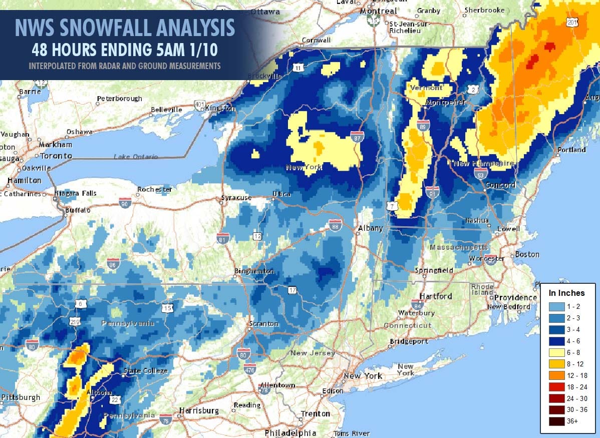
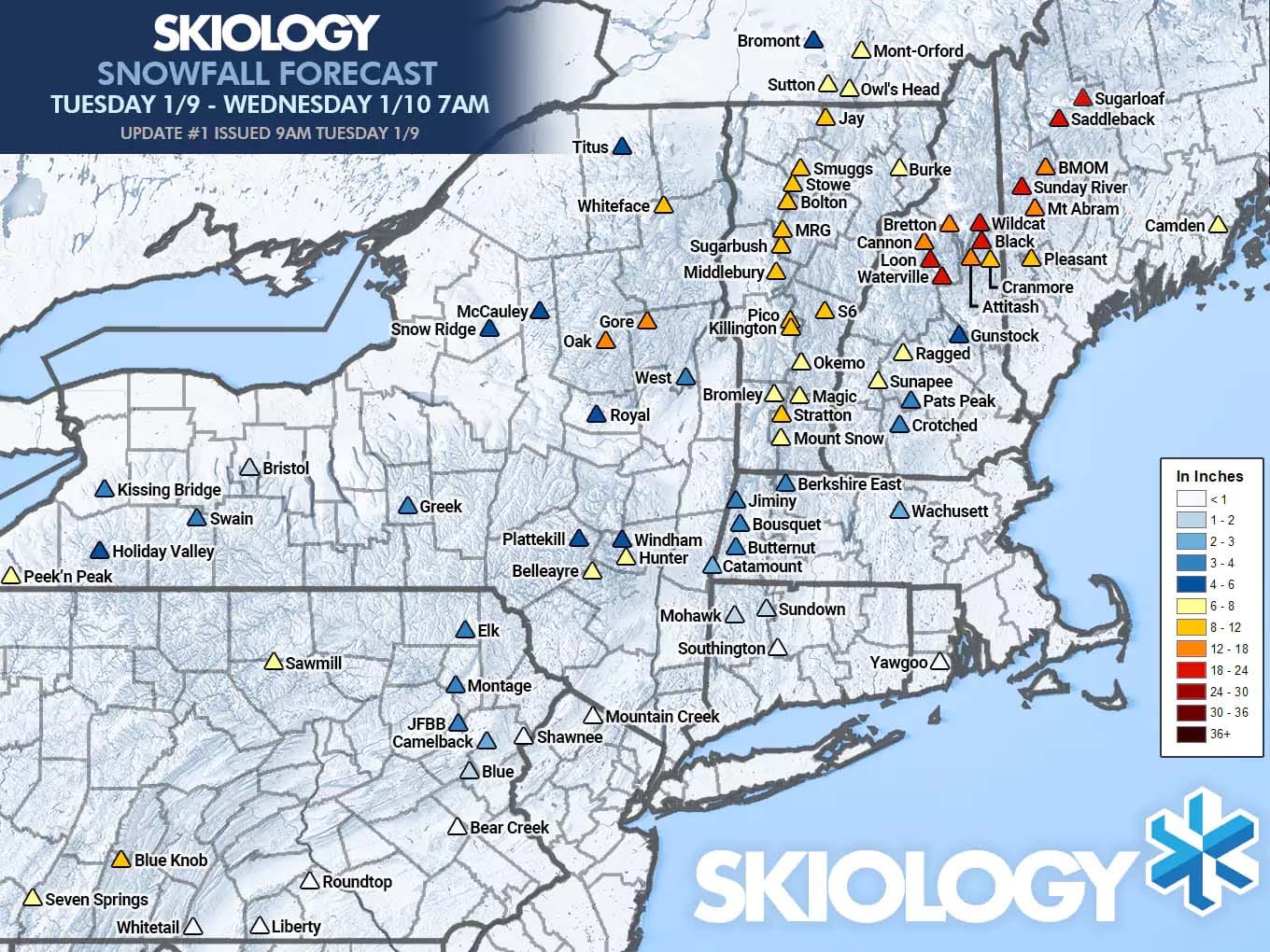
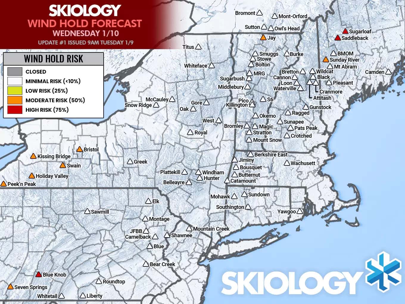
The NWS interpolated snowfall map was before the end of the snow in Northern New Hampshire and Northern Maine, and in many cases showed more than was reported and their interpolation typically comes up short of what ski areas report. For instance, I spotted about 6"-8" at Berkshire East prior to the switch, but NWS interpolation puts them at 3"-4" and there was a similar situation at Belleayre and this is widely what happens in every storm with this interpolation. Radar holes at Jay showed through as expected in the interpolation with a lack of nearby ground observers, though their 13" report is hard to quantify without drifting/snow catches being measured. Here's the final forecast from Snowology as well as my wind hold forecast, though I did indicate that there would be operational delays beyond the wind holds that would make this storm difficult to hunt, and it no doubt was.
Again, the variability in reporting in a snow-to-rain storm are expected, especially in the Northeast where there are zero actual standards for snow reporting. Here's a sampling of some reports this morning where the snowfall was the heaviest. Assumptions were made about whether the totals were before or after changeover/settling, but they are generally easy to make given the variability. Northeast snow reporting is extremely inconsistent overall I'm afraid and shouldn't on its own be used to verify any forecasts overall. Most underreport presently, though some still do overreport regularly.
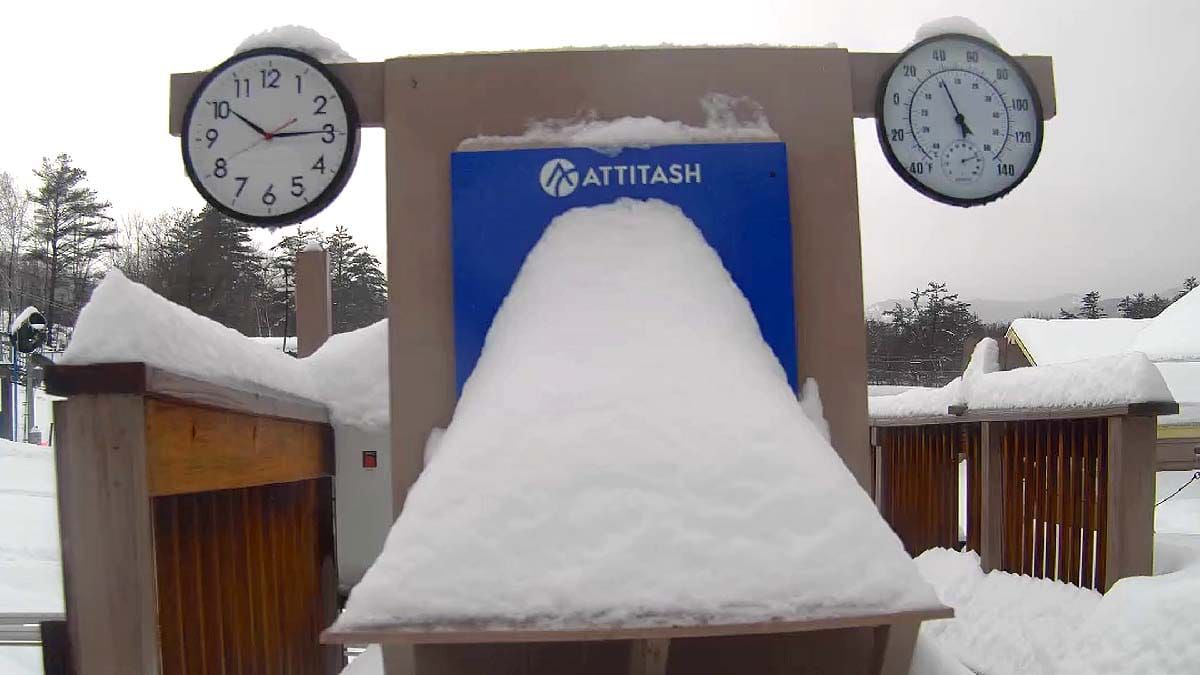
Attitash: 10" (settled measurement, lift holds)
Black Mountain of Maine: 10"
Blue Knob: 12" (CLOSED, before changeover)
Bolton Valley: 10" (before changeover)
Bretton Woods: 12" (before changeover)
Bromley: 8" (before changeover, lift holds)
Burke: 6" (CLOSED, no power)
Cannon: 3" (base settled measurement, lift holds)
Cranmore: 11" (before changeover)
Gore: 6" (base settled measurement, report of 10" settled at summit)
Jay: 10" (before changeover, lift holds)
Killington: 10" (before changeover)
Kissing Bridge: DNR (CLOSED)
Loon: 8" (settled measurement)
Mad River Glen: 12" (before changeover)
Magic: 8" (before changeover)
Middlebury: 6" (CLOSED, settled measurement)
Mount Snow: 6" (before changeover, lift holds)
Okemo: DNR (cam showed 9" wind blown before switch, lift holds)
Pleasant Mountain: DNR (CLOSED)
Saddleback: over 12" (CLOSED)
Smuggs: 6" (settled measurement)
Stowe: 10" (before changeover)
Stratton: 6" (settled measurement, lift holds)
Sugarbush: 9" (base measurement)
Sugarloaf: 14" (lift holds)
Sunday River: 15"
Sutton: DNR (CLOSED)
Titus: DNR (CLOSED, clearing downed trees)
Waterville Valley: 8" (settled measurement)
Whiteface: 4" (mid settled measurement)
Wildcat: 14" (base measurement)
Wind holds were predicted to occur in W-NY after open so those are still pending verification.
Knowledge Is Sometimes Waiting for Another Day!
-- Matt


Comments ()