We've got another cutter coming Saturday just in time for the holiday weekend. It will bring mixed precipitation and wind holds during the ski day on Saturday. There will be a nice back-end to this storm Sunday with wind issues again plus a refreeze. Lake effect snow likely continues on Monday but much lighter and much colder air will descend upon the Northeast. I've often said that Northeast winter weather is the most difficult to forecast in the US, and this storm will not disappoint forecasters, and hopefully it won't disappoint many skiers and riders if they go prepared, and maybe change up their plans and go to the right places to avoid problems due to both this storm and holiday crowds.
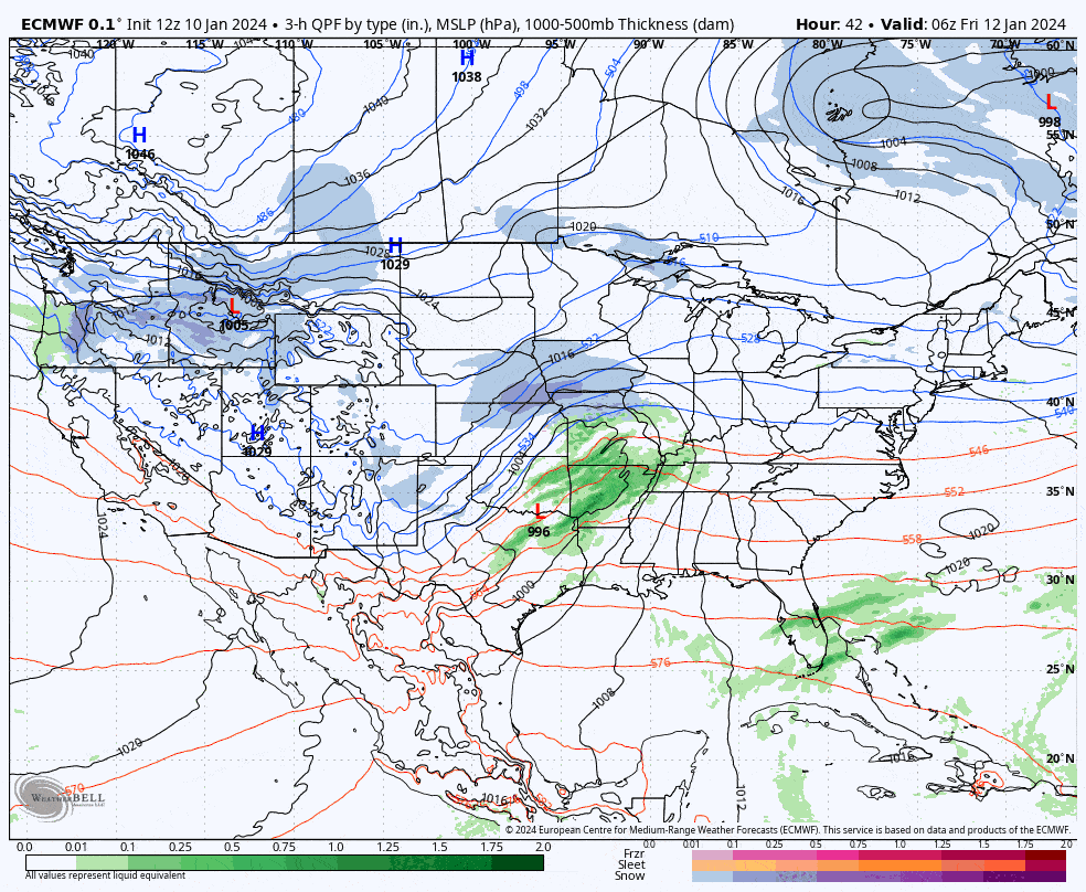
So let's start with the broad view showing Friday through Monday from the ECMWF just to put this all into context.
There's a lot to cover for the entire weekend and I'm going to focus on just Saturday for now with a shorter overview of Sunday. Monday will primarily just be cold, so check those temps. I'm going first cover the variability that still exists in the models and then forecast both snow and wind for Saturday, and give a more general overview of Sunday. There will be daily updates through the weekend with greater detail and accuracy as we dial it in.


