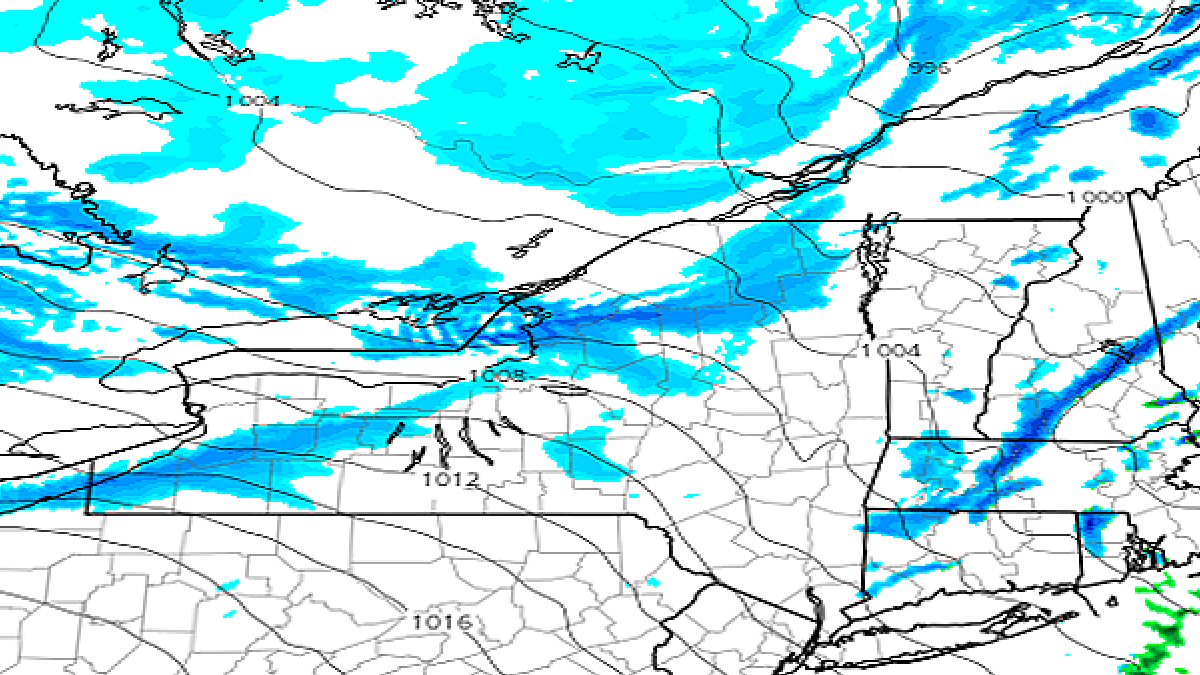
Behind Saturday's storm through the remainder of the holiday weekend on Monday we will have windy conditions, lake effect snow, and wind chills reaching below zero at times in some places. Here's a loop of the 1-hour precipitation intensity from the ECMWF covering 4PM Saturday through 4PM Monday, and then a wind gust map in knots (slightly lower than MPH) for the same time frame to help set this up.
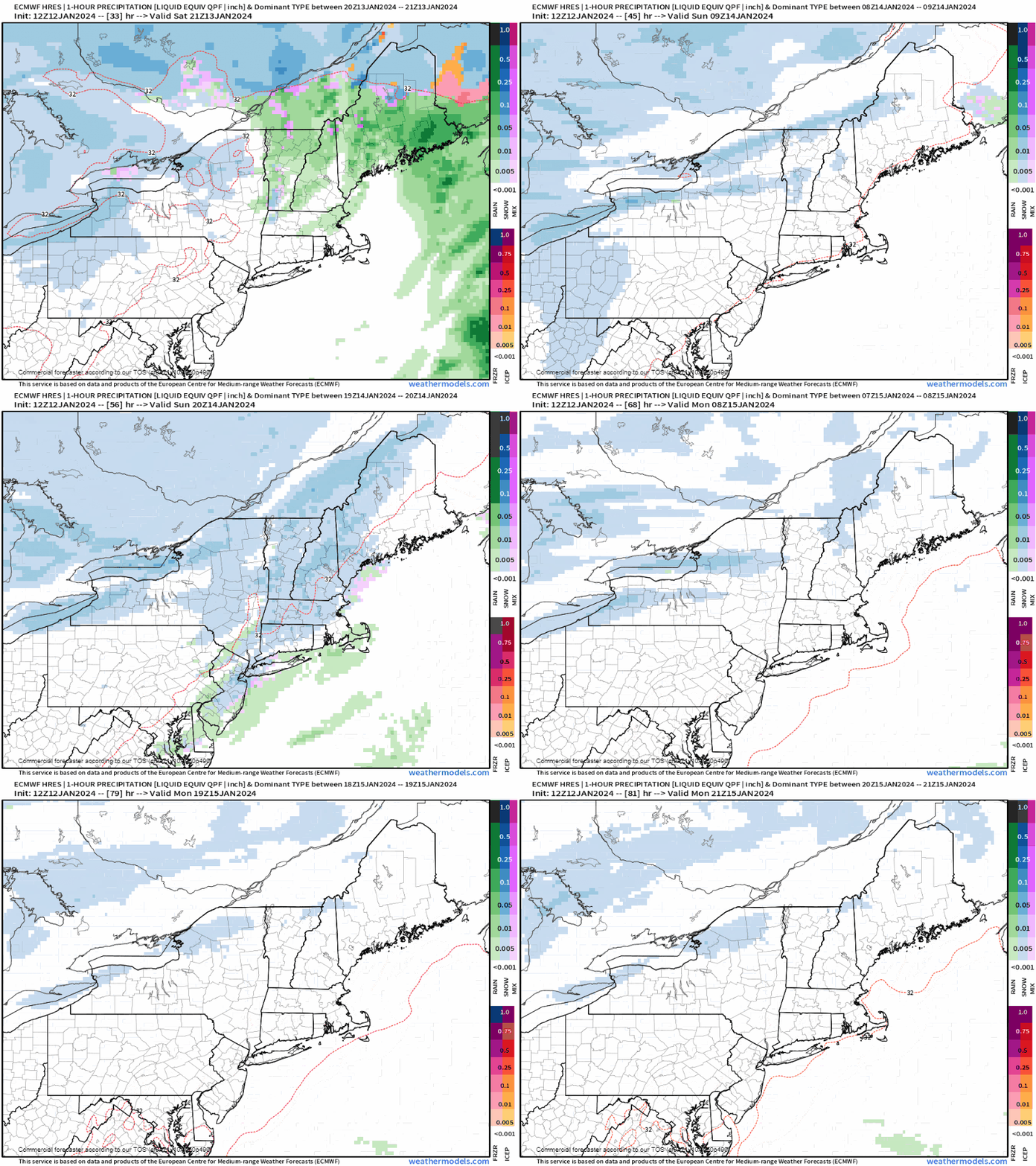
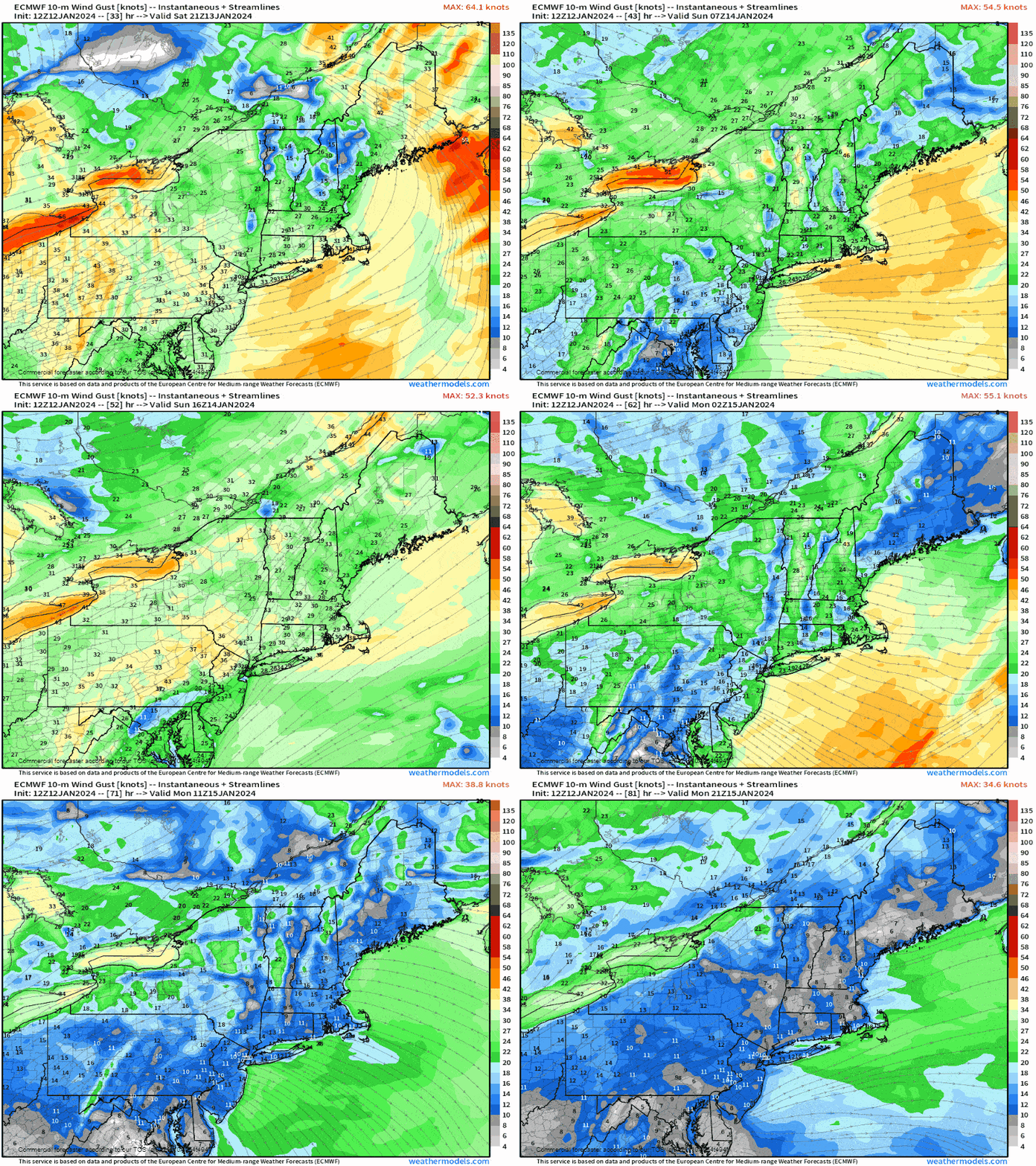
There will be lots of snow off the lakes, however only a handful of ski areas will benefit notably. There will also be some wind holds at ski areas on both Sunday and Monday, though nowhere near the same scope or degree as on Saturday. I'll cover the afternoon modeled temperatures for both days as well.

