We have snow, ice, and rain coming, but more importantly very impactful wind. I've made some bumps in my snowfall forecast since yesterday's Storm Update #2, and the storm is modeled about 1 hour slower and that's going to mean adjustments to the wind holds and timing. Wind will be extremely impactful and morning travel in the ADKs will be difficult, and extremely dangerous in Northern New England snowfall rates in excess of 2" per hour which will create whiteout conditions during the morning ski commute.
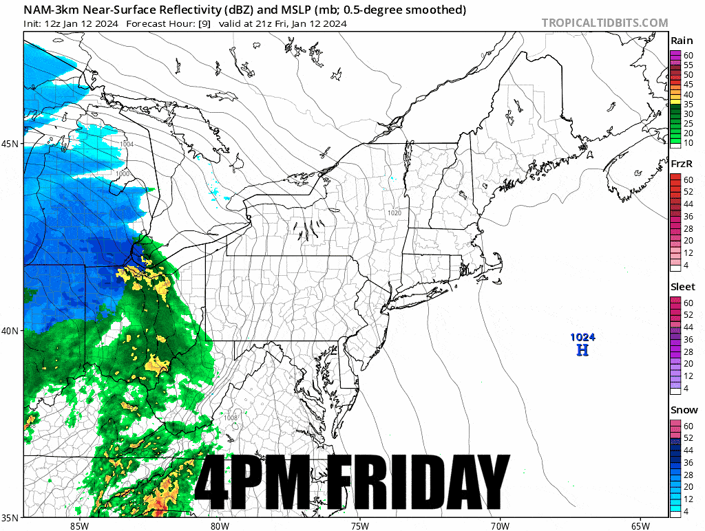
Let's start off on a timestamped simulated radar from the latest NAM3K showing 4PM Friday through 4PM Saturday. The NAM3K is very likely a warm on the changeover line so there will be less rain and ice and more snow than shown.
Wind will be on both the front end when there is heavier precipitation, and on the back end of the storm as the refreeze hits. The timing of the snow will also cause travel issues in the ADKs, VT, NH, and ME. Saturday morning will be a big travel day, but rushing to make first chair in these areas will be a very bad choice. Please don't drive your family through whiteout conditions to get to a ski area with hardly any lifts running. It's not worth it!
There will be a separate update issued later today about the back-end on Sunday and Monday with snow, wind, and chilly temperatures. People have been asking about the Tue-Wed storm also, but I lean heavily to that storm only being a brush, so it's likely only a light event in general, though I'm going to dig back in and make sure my read is correct later on today.
We'll start out with the wind in this update since that is the most important part of this storm for skiing and riding on Saturday.


