I've got some good news to start with. First off, winter is back... again! Things will be seasonal to cold for a bit. No more cutters are in the models that I can see. Secondly, the wind threats on Sunday and Monday looks greatly diminished and transient, though it will remain breezy. Timing is our friend as the wind will primarily pass through outside of daytime lift operations. Today though was a different story and there were few who avoided this, and this happened at Saddleback where the base of the mountain looked like the summit of Mount Washington:
Wind holds have largely confirmed with only a few exceptions and we have some pretty wild video from Alec Salisbury at...
Posted by Snowology Weather & News on Saturday, January 13, 2024
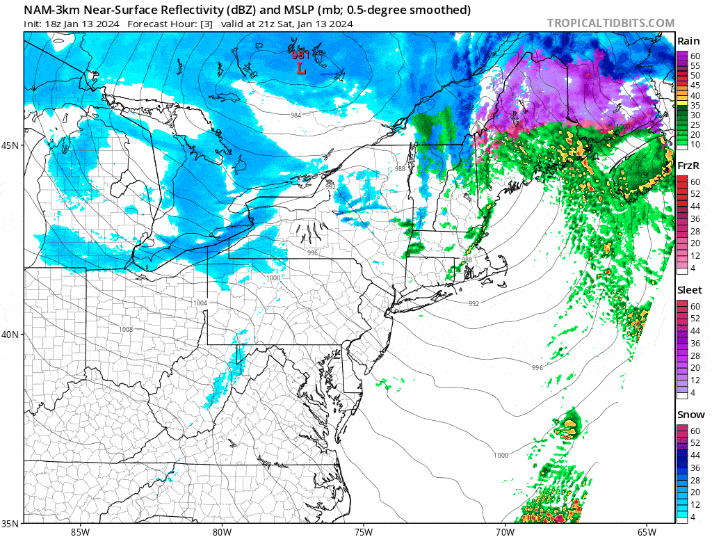
We still have snow coming, and both lake effect bands and squalls associated with a low passing through on Sunday will bring bursts of very heavy snow in some areas. I'm going to update both the snow and the wind forecasts, but first let's take a look at the NAM3K simulated radar covering 4PM Saturday through 4PM on Monday. Note that the NAM3K may not be modeling the weak storm on Sunday very well based on what I'm seeing in other models which show more expansive snow during Sunday from that system. Lake effect pointed towards the northeast off of both lakes is actually expected to continue through Friday morning when a system will likely disrupt the flow.