Lots have been talking about this storm up to a week out but trends were for it to come through flat, i.e. un-amped. We are however going to get a bonus as a second piece of energy will add some umph to it and create some widespread light and fluffy snow for much of the Northeast and up to 6" might fall in some locations.
Let's take a look at the simulated radar showing 4PM Monday through the end of 8AM on Wednesday.
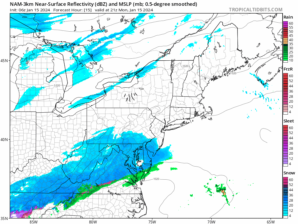
The snow will be running into dry air as it moves northeast today and around 4PM is when the snow should start crossing the southern PA border. By open on Tuesday snow will have reached about the Killington latitude while the enhancement from the second shortwave comes in from the west. That will pop the storm up a notch as it crosses Northern New England. At close on Tuesday the snow will primarily be in Eastern New York and New England and exiting the Northeast a little after midnight.
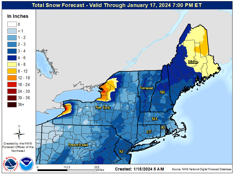
Much of this snow should be quite fluffy, especially more than 100 miles inland from the coast. Wind will be tame so there won't be a lot of upslope enhancement of the snow. This is what the NWS has for snowfall through Wednesday evening and I'm not going to split hairs over 2" here or there that may be spread across two ski days. Note the lake effect is still dumping and will through Sunday in varying directions while a big low in Canada keeps churning.
Generally 0.25"-0.5" of water will fall as snow from this storm. That's enough to freshen true packed powder where the back-end has been delivering, but it won't do a ton for areas that have hardpack conditions outside of when it is falling and unfortunately this last storm did ice things up a bit.
Knowledge Is Powder!
-- Matt


Comments ()