I covered this a light event as more than 6" was only expected at ski areas in the Alleghenies on the front end of this system through opening today, and that's in fact what happened. It was generally a weak system without a lot of moisture, but the snow was very fluffy and stacked up well, plus there was a back-end to this storm that delivered snow off of Lake Erie and Ontario and upsloping into the Alleghenies as well as some in Northern New York and Northern Vermont. That back-end is still ongoing and will until sometime in the AM on Sunday.
I only issued one forecast for this storm as it was a light event and I don't always forecast for light events but I did want to highlight the extra potential off the lakes and in the Alleghenies. My forecast confirmed very well this time, and although not shown I also indicated that more than a foot was expected at places like Wisp, Timberline, Canaan Valley, and Snowshoe and that also delivered with up to 20" reported. I'm also including the NWS forecast that was active at this same time of my forecast but note that their 72 hour forecast includes snow off the lakes through Sunday Morning. I also speculated that NWS Burlington wasn't forecasting the entire back-end through the entire time frame, and in fact they were not. This is not uncommon with light upsloping events in N-VT that primarily impact the mountains. Much of what was forecasted in that area was the result of the lake effect snow band off of Lake Ontario on Thursday evening through early Friday morning.
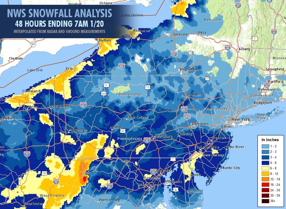
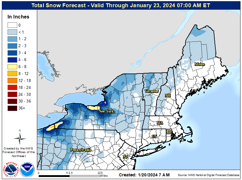
Here's what the NWS Snowfall Analysis has for the 48 hours prior to 7AM this morning which captured the primary event minus some additional back-end snow that was beyond the timeframe of my forecast. Note as always that standard NWS interpolation makes use of ground measurements and radar estimates along with GIS data for terrain to approximate the snowfall, but in most cases more prominent mountains will overperform these results, especially in more rural areas and those in radar holes.
I took some time to gather up all of the snow reports in areas that were expected to receive 2" or more in parts of NY, PA, NJ, MD, and WV. Snowfall of 7" to 20" was reported across the Alleghenies. The list is sorted alphabetically and excludes those who didn't report a total for this entire event on their snow report.
Bear Creek: 4"
Belleayre: 1"
Blue Knob: 7"
Bristol: 6"
Camelback: 4"
Canaan: +20"
Greek Peak: 1"
Holiday Valley: 5"
Hunter: 1"
Kissing Bridge: 6"
Laurel Mountain: 15"
Mount Pleasant: 6"
Mountain Creek: 3"
Peekn' Peak: 6"
Plattekill: 1"
Roundtop: 4"
Sawmill: 1"
Seven Springs: 14"
Snowshoe: 11"
Timberline: +12"
Whitetail: 6"
Wisp: 16"
In the Tug Hill area of NY and also in Northern Vermont it was not possible to gather accurate snowfall for this period due to how snowfall is reported. Some only report the past day while others will include previous day totals in the last 2 day total. Those areas largely confirmed however, though this was a drop in the bucket compared to what had fallen in the previous week. Surprisingly, there are a number of ski areas in Pennsylvania who don't report snowfall on their websites despite snow being the biggest attractant for skiing, though when it snows in PA there is typically no shortage of skiers and riders. Strangely also, only Snowshoe and Timberline shared powder shots on social media.
We still have some back end snow to come, but note that much of what you see in the NAM3K simulated radar loop showing 8AM today through 8AM on Sunday is very light snow, some of which will not hit the ground or at least will not produce accumulations unless it also has some upslope enhancement.
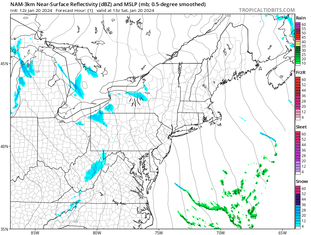
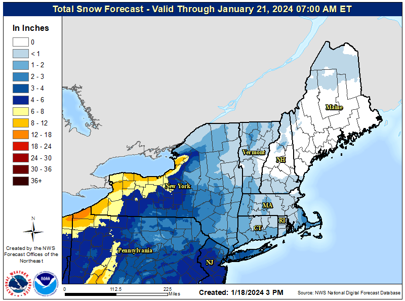
Between this morning and open on Sunday you can expect generally 1"-4" to have fallen in parts of N-VT and N-NY with the heaviest snow mostly pointing southeast off of Lake Erie with some lighter accumulations around Rochester into CNY. That lake effect snow could produce up to 8" more in the 24 hours between 8AM Saturday and 8AM Sunday. Here's what the NWS was forecasting after 7AM through the end of this event.
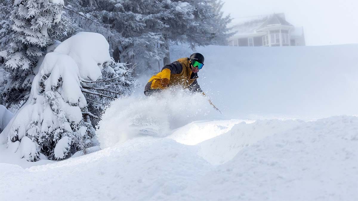
It's no doubt chilly today and will be again tomorrow, but conditions are widely fantastic to full on blower out there. Even those who didn't get a lot of snow recently have been able to crank out the man-made and we're seeing trail counts finally reach very healthy levels on a widespread basis.
Hit It While It's Not Hot!
-- Matt


Comments ()