Alright, I've decided to just extend this to Friday in order to cover the third push of moisture in what is pretty much the same weather maker. Friday may be interesting! Read that as some may in fact stay all snow! Maybe even up to 6"-8" of snow, but the jury is still out. Tomorrow we have the second phase of the first push which will be mostly snow, ice, and rain. Thursday we have the 2nd push which will end in rain except possibly for some ice around Maine as the warmest type of precip. Friday is the third push and a possible bonus.
If you are wondering about the weekend, we've got a re-freeze to navigate, and a high probability of storm that could bring some healthy amounts of snow. I'll be covering the re-freeze situation in a Weekend Outlook, and the Sunday storm will get a brief Storm Watch tonight, but here we are focused on navigating the rest of the week probably with daily updates to help people navigate around what's coming. There will be great skiing every day this week without getting wet, and there will also be not so great skiing if you don't choose well! Let's start off with a loop from the NAM12K covering 4PM Tuesday through 4PM on Friday to set this up.
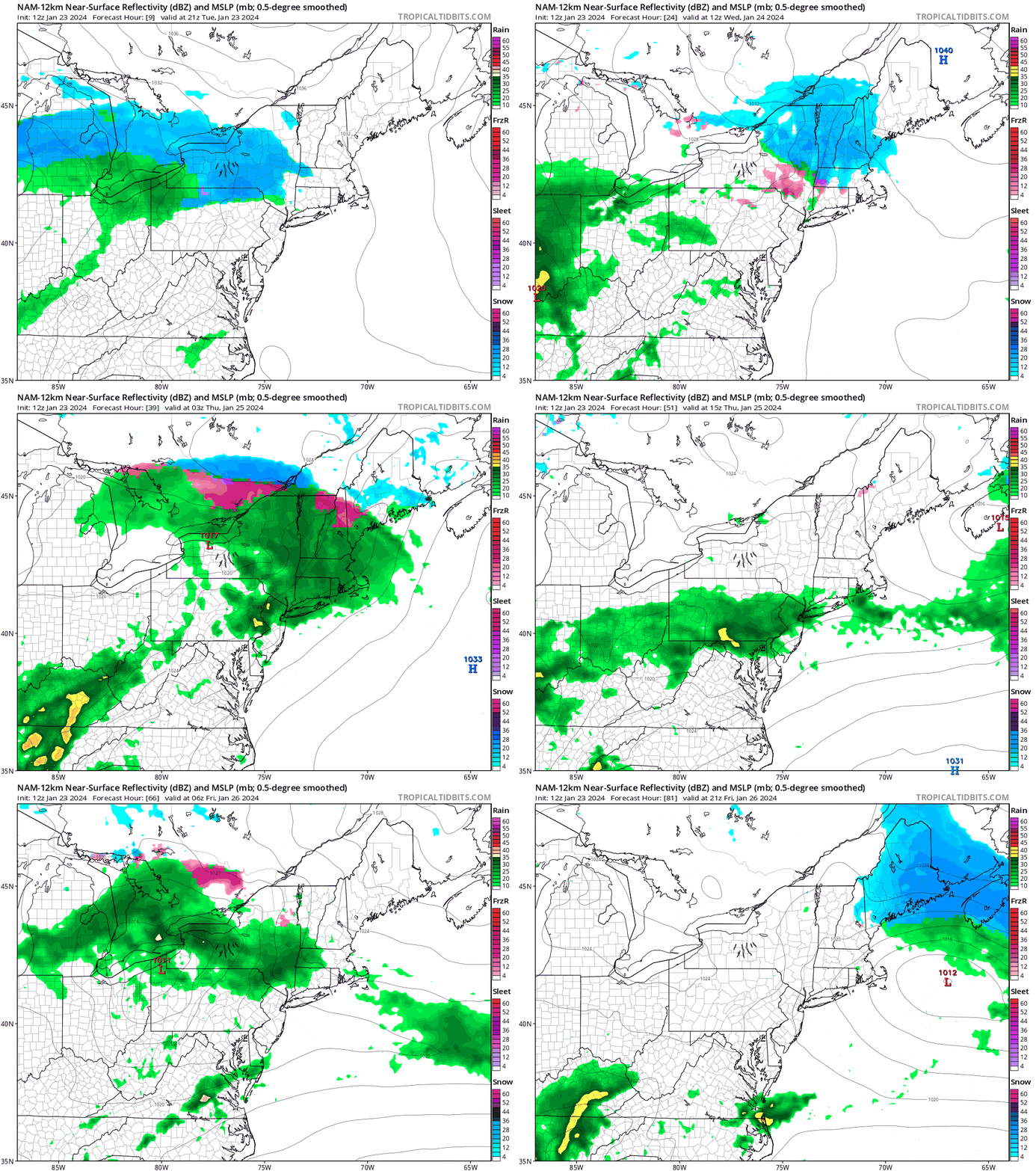
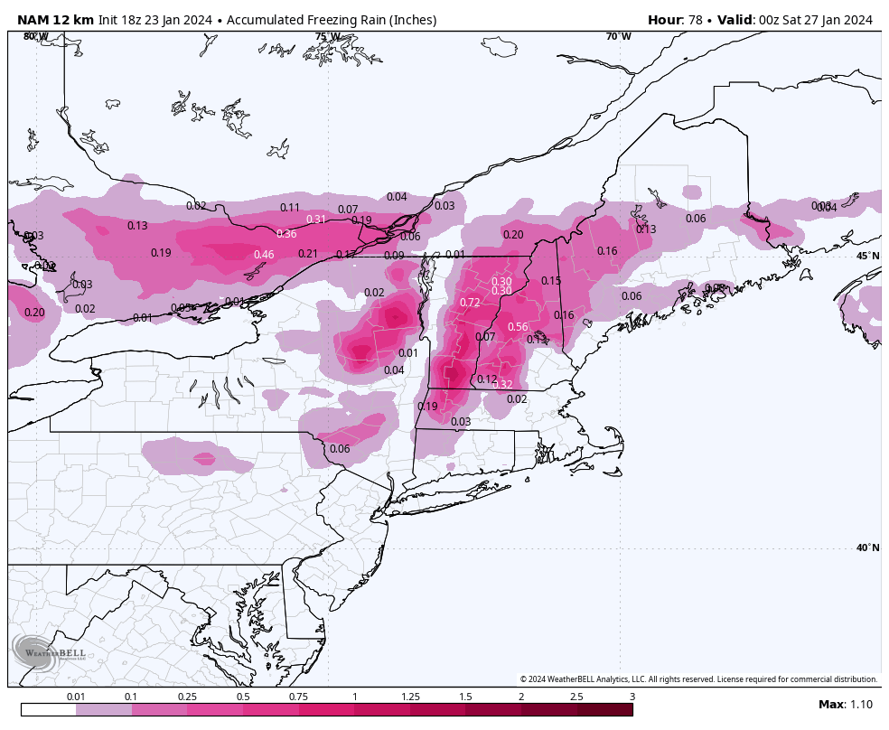
There's a lot of ice in this, mostly Wednesday night into Thursday morning, and then again on Friday. Here's what the NAM12K is seeing for ice accumulations in this system and what you will want to avoid when it is falling, and there may be some notable lift and terrain icing issues especially on Friday morning.
Members will get a break down each day one by one below. Since we're covering 3 different days and different types of weather none of this will be a deep-dive, and all you really need to know are the temperatures and precipitation in order to plan around the weather.

