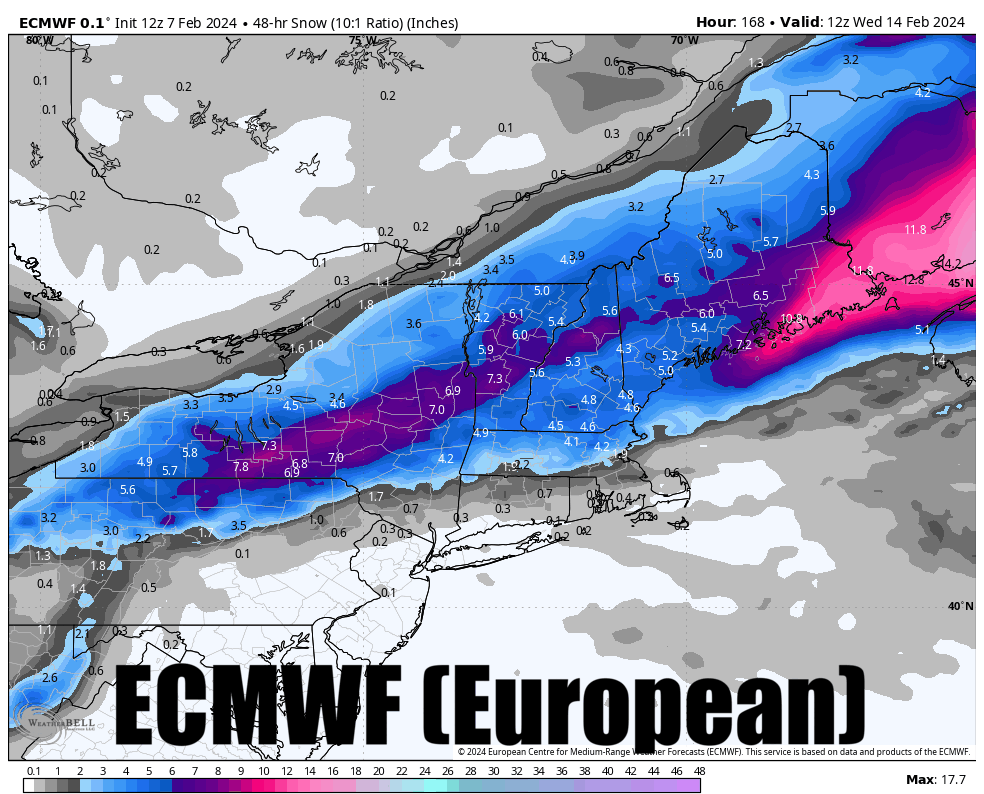
Buckle up folks! Two of the three major medium-range models finally snapped this afternoon to show a full on nor'easter with potential of +2 feet of snow and the other one isn't far off. This isn't out of the blue as it was first covered in our Week Ahead update on Monday as something to watch. Ensembles have long signaled the potential for glory and I've been watching the timing of key elements change. The storm virtually disappeared for a couple of days and then finally came together just right today.
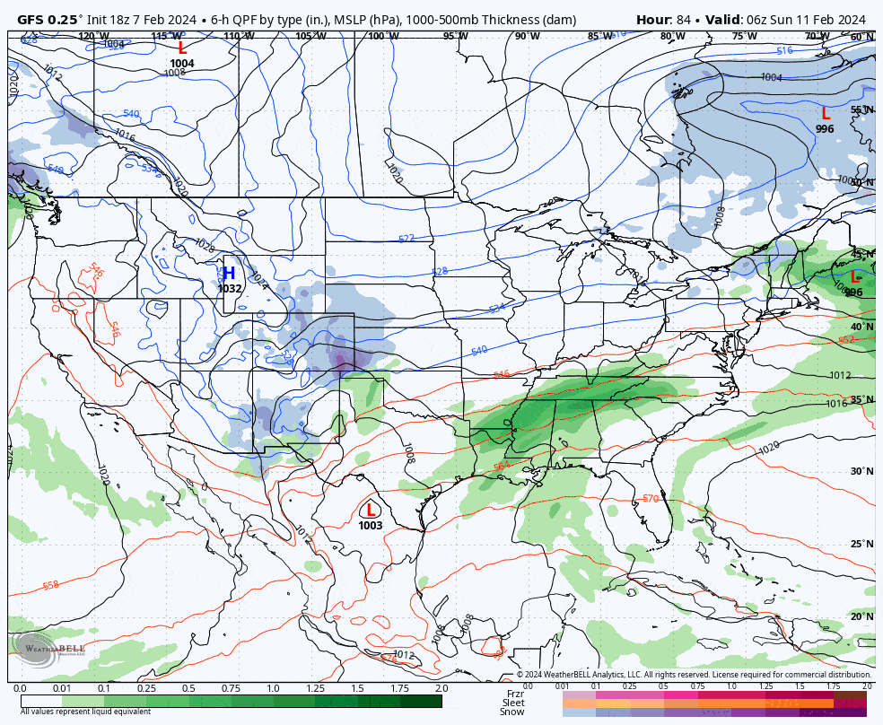
Now however is where I remind everyone that we are 6 days away from the heart of the impacts and SOMETHING WILL CHANGE! The main storm doesn't even spawn in Texas until early Sunday, 4 days away. Some types of setups are more reliably modeled, and this one is all about timing with two elements (plus external influences), and that's a bit more straightforward than many storms thankfully. I would rather though see things come together at 4 days out instead of 6 because the closer you get to the event, the smaller the adjustments will be. With that, let's start off with a broad view loop from today's 12z GFS showing Sunday through Tuesday and watch the magic happen.
When we are 6 days out we don't attempt to pinpoint forecast, rather we dig deeper into the models, study, and try to determine the moving parts, the differences, the trends, and when we might feel comfortable enough to make a hotel reservation so we can blast some pow. That's what I am going to do below the fold for subscribers at this stage, but I would be remiss not to tease our non-subscribers with some snowfall map porn just to show what might be possible!