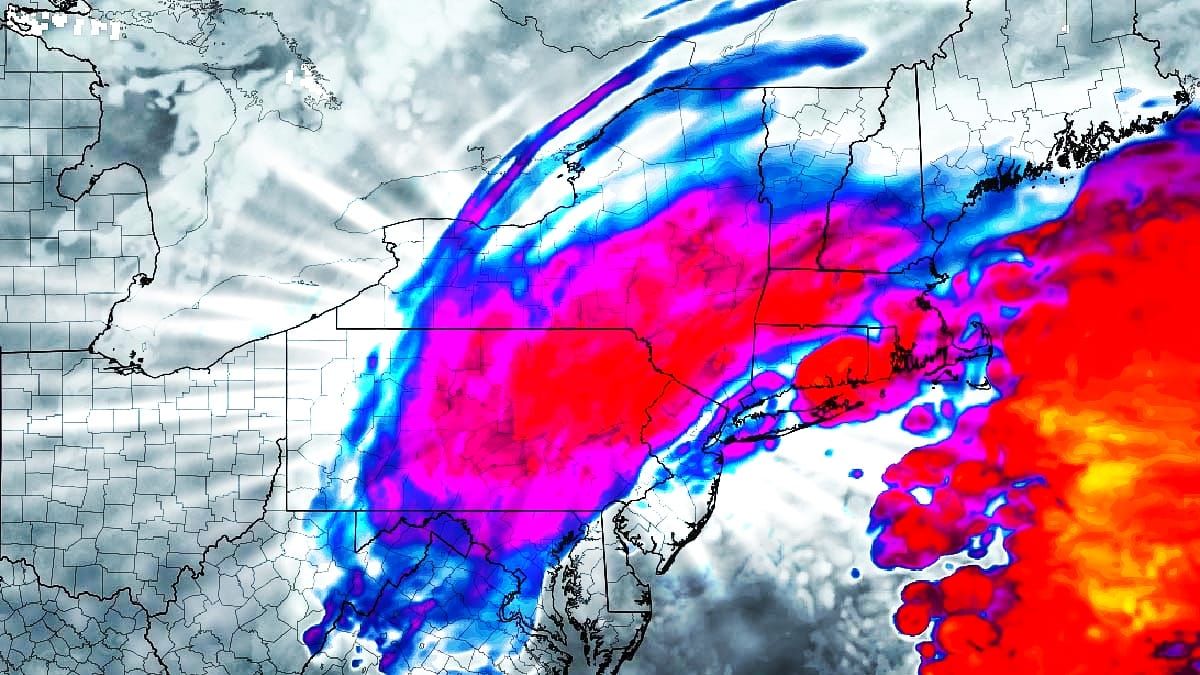
Seems that since my last update everyone has started to realize that the shift south is real. Not only is it real, it's even a bit more south than it was 18 hours ago, which was significantly more south than it was 2 days before.
Why the change? The storm is tracking much further to the east across the South, meaning that it rides up the center of the Appalachians which causes the jump to the coast to happen earlier and it won't be able to push through the suppressive boundary of the south-shifted Hudson Bay Low. A smaller change of about 50 miles in the track as the surface low approaches the Northeast makes all of the difference in the world in where the snow falls, and in this case it has shifted the heaviest snow over 100 miles south from what it looked like 2 days ago. Models do often have issues identifying the exact location of the genesis of lows as the exit the Rockies, and this storm decided to favor a track just behind the sub-tropical jet stream rather than just in front of the upper level low and trough coming out of the Rockies.
Some may feel this is a loss, but the reality is that our friends and followers who ski and ride in Pennsylvania, New Jersey, the Hudson Highlands, and across Southern New England like snow also, and they've been through some pretty tough seasons recently with many ski areas barely operating over Christmas break. These areas where temperatures are more marginal are the most affected by the notable warming we have seen in the last 50 years. Some have even suggested that I ignore Pennsylvania, but my coverage focuses on snow, and they just haven't received a lot since I expanded my coverage south over 2 years ago. I'm happy they're getting some now and so should you! I'm also happy for the kids who are going to get a snow day out of this one. It should be a memorable experience for them, and one that is unfortunately becoming less common in recent times.
I have an update to the Snowfall Forecast and also an update for Timing and Travel Conditions, and if you are going to hunt this storm where the snow is deep, you will experience a lot of issues driving on Tuesday. There are no wind threats on Tuesday with this one, though I would not be surprised to see some operational delays in Pennsylvania due to travel difficulties for staffs who don't often have to battle such intense snow and fewer ski areas have lodging on the mountain to keep them there overnight. There will be widespread wind issues on Wednesday though, and probably a little on Thursday also which I will cover in a separate update. Let's dive into the details!


