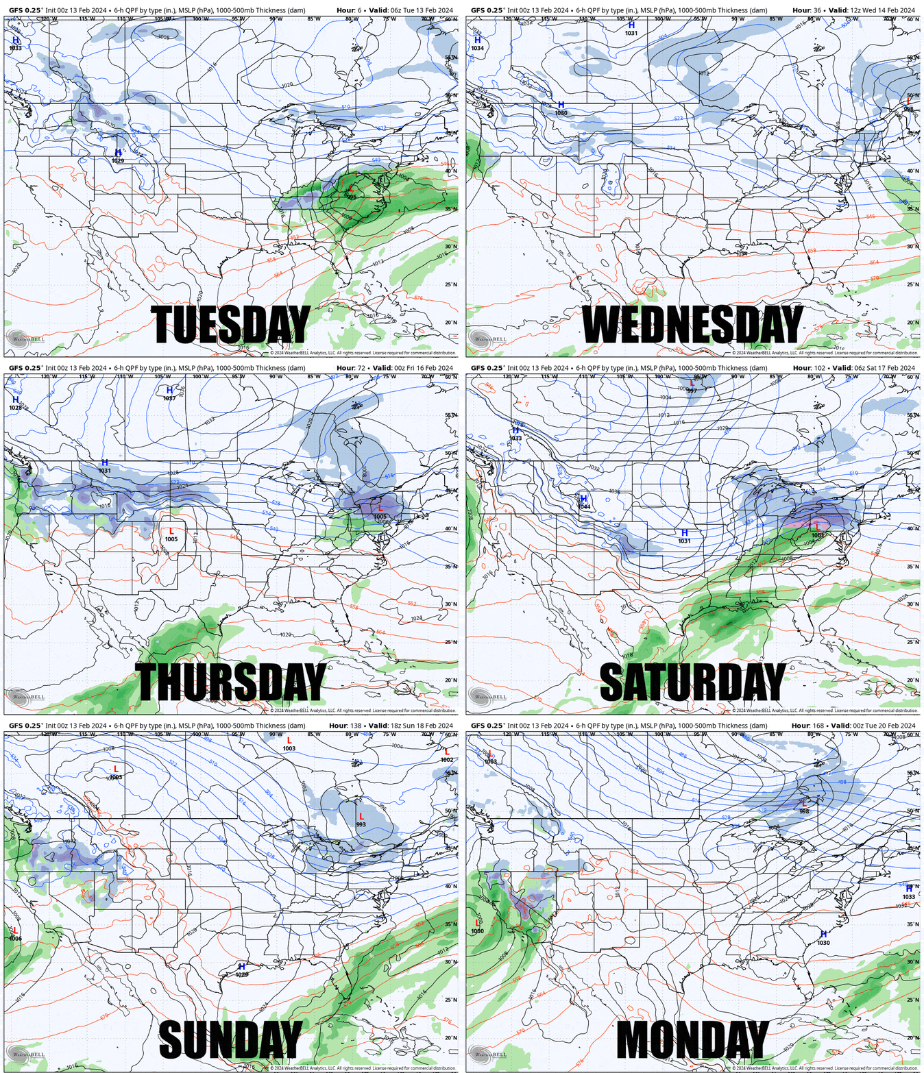
Quit your complaining folks, groundhogs have not yet invented weather modification devices nor do they own crystal balls, winter is far from over, just ask the folks in PA, NJ, CT, RI, and MA. Yeah sure today's storm didn't hit the big mountains up north, but they're literally starving for snow in the more southern areas and this is their time of year to shine. We are in an active weather pattern with northwest flow all week long and we have 5 systems, mostly smaller, coming at us in just 7 days. Let's start off with a loop of the GFS covering Tuesday through Monday.

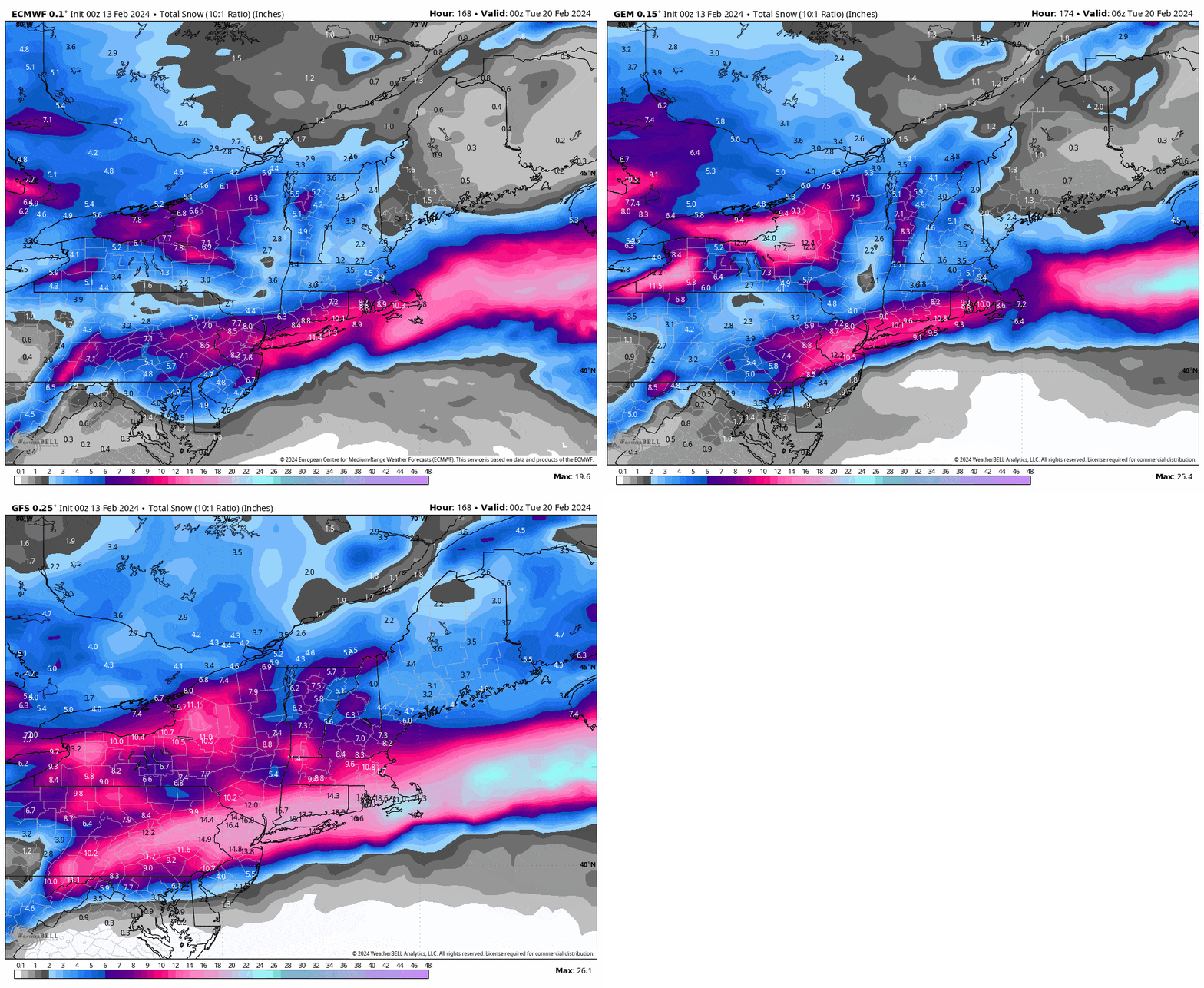
If you are wondering how much snow we might get, here's what the 3 primary medium-range models are showing currently through Monday.

I'll cover the Precipitation Outlook, the Temperature Outlook, the Wind Outlook, and the Long Range Outlook where I'll discuss how it seems that the El Nino pattern may finally be over and what that means! We do have some wind holds coming up on Wednesday that I've already shared a forecast for so that you don't bring your significant other for a big ski outing on Valentines Day only to find the bunny slope operating!


