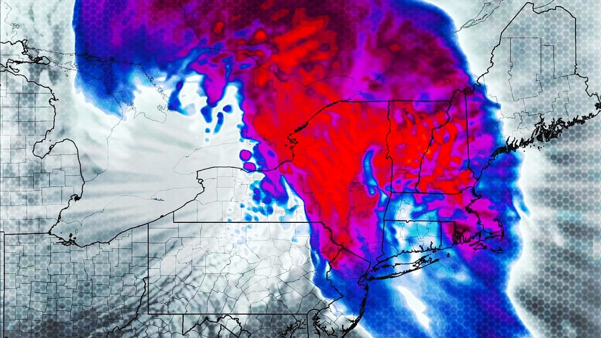
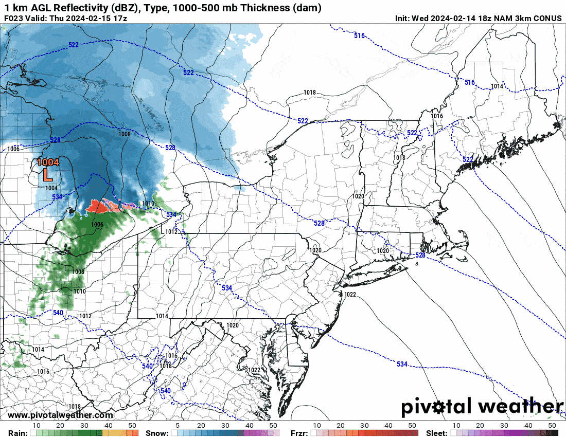
We've got a clipper coming Thursday night into Friday morning and it looks extra juicy and also likely quite fluffy. I expect 11 ski areas across 3 states to pick up over 6" of snow and so I'm covering this with a Storm Update rather than just as a minor system. Here's the NAM3K simulated radar from noon on Thursday through noon on Friday to start things off.
This will be a sleeper pow day for those who understand how this works. Many areas of impact already received 5" or more of snow last night and this will be additive and likely between the two events over a foot will have fallen in just 3 days. We're well on our way to the "well over a foot" prediction from the Week Ahead Update issued yesterday.
For our subscribers I'll cover the Snowfall Forecast, Wind Forecast. and Timing and Travel and this will be generally a short update.


