We make 'Minor Storm' coverage free for everyone except when there are forecast maps involved, but if you would like to subscribe and gain access to to our full weather coverage including storms and also get 50% discounts on lift tickets through the Snowology Club, we have a 10 day free trial available.
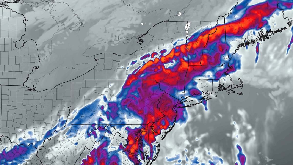
Let's start off with the broad view using the ECMWF covering all of Thursday and Friday to set this up.
We came close to a true nor'easter here, but the upper level low and trough up in Canada was just a bit too slow to reach the coastal low to help it amplify more. As a result we have a marginal air mass and a pretty weak system that will drop possibly up to 6" of snow in isolated areas as well as some freezing rain and rain.
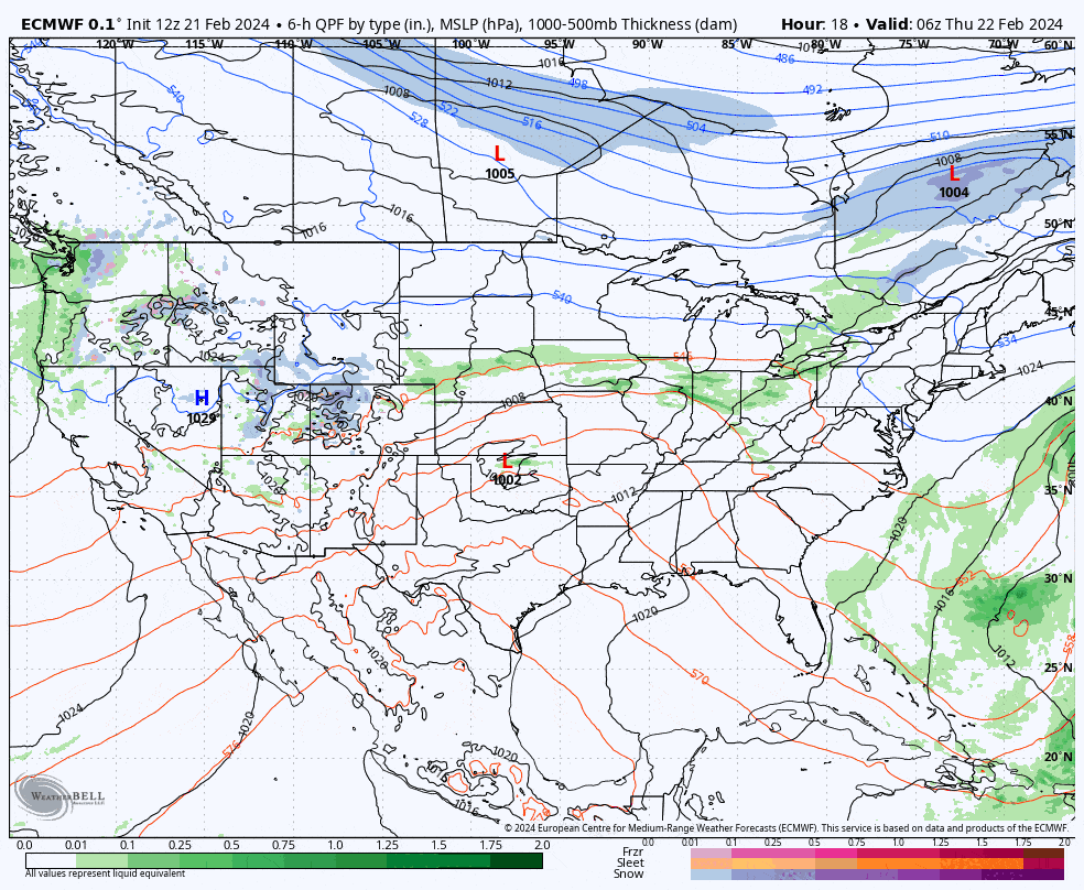
Precipitation Outlook
I don't do manual forecasting for Minor Storms as they generally deliver 6" or less of snow, but I do try to choose the model that best represents what is likely to happen for ski areas. Note, our forecasts make no attempt to extrapolate the accuracy for locations besides ski areas.
Let's take a look at the latest run of the NAM3K covering Midnight Thursday morning through 4PM on Friday.
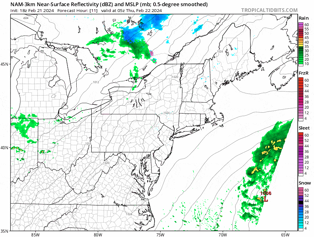
On Thursday we'll see some rain in parts of NY and PA before close with W-NY and W-PA receiving generally 1/2"-1" of rain. Around 4PM there will be a transition from rain to freezing rain and snow in parts of C-NY, S-NY, and W-MA. Northern New England and N-NY will be primarily snow with some freezing rain to start. Snowfall ratios will likely range from 6:1 to 12:1 with the lower ratio snow falling at the southern edge in places like the Hudson Highlands and Southern Berkshires.
Here's what all 4 primary precipitation types look like for this storm. Pay close attention to where the rain becomes sparse on the northern edge as that denotes where it will be all freezing rain and rain.
This version of the NAM3K tends to overdo the freezing rain. Our biggest concerns for ski country will be in parts of PA and the Catskills, and you could throw in the area around Ottawa and Montreal which are outside of our standard coverage. Further north and east the freezing rain is more so transitional and occurs only at the leading edge of precipitation. I do not expect freezing rain to create problems for ski operations except maybe in the Catskills where accumulations could be significant enough to cause icing of sheaves on chair lifts. There is also some risk also around JFBB and Camelback, but typically the southern edge of freezing rain from this particular model and mapping provider ends up a little warmer than shown, especially when temperatures were previously above freezing like they will be in NE-PA. Freezing rain on slopes is of zero concern as long as it has been groomed. It simply turns into granular. Freezing rain is not expected to be significant where natural terrain is in play but a thin crust may form under a topping of snow in some spots.
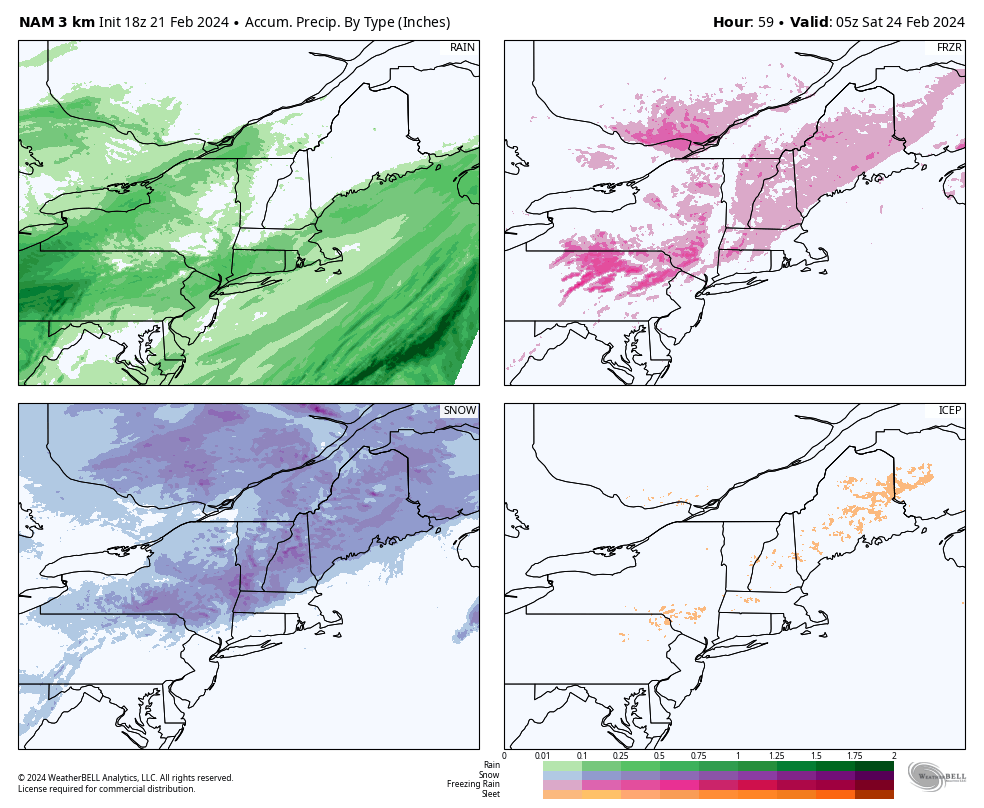
By open on Friday snow will have finished up outside of NH and ME where it should be exiting the state by noon. I'm going to use the ECMWF snowfall map as the best representation of snowfall, but it would be fair to assume that peaks in excess of 3,000' or so will receive 1"-2" more than shown, though the Catskills with more marginal temps and lower ratio snow may end up 1"-2" lower.
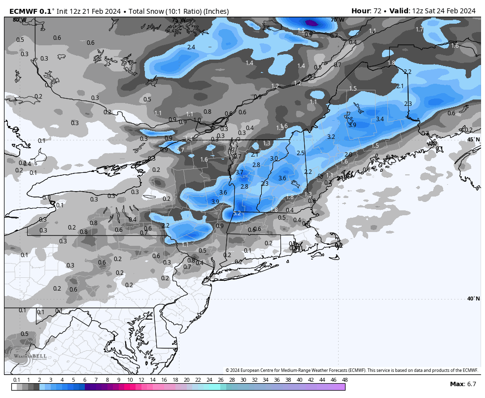
If we see 6" out of this storm anywhere, it would likely be in the vicinity of Southern Vermont and possibly the Whites of New Hampshire and Longfellows of Maine. I expect a widespread 2"-5" across Northern New England, the ADKs, and the Catskills. There's a small chance this storm could amplify a little more than shown and there has been a slight trend towards this, but I wouldn't expect more than 3" extra at any ski area on the upper end were that to happen.
This will generally result in 'fast pow' conditions where some of the snow is groomed in overnight with a topping of several inches may be on top which creates some very nice and smooth conditions to start the day, and things don't tend to get super choppy. This may refresh some glades further north also, but hit the snow early because it won't be deep and won't hold up to traffic scraping it out.
After close on Friday there is a small back end that will mainly impact parts of N-NY, C-NY, and N-VT. I don't expect any more than 2" to fall from the back end as it is brief and not very juicy. Some of the totals in N-NY and N-VT on that map are primarily from the back end after close on Friday.
Wind Outlook
I have no notable wind concerns through Friday, however behind this storm will be a push of Arctic air early on Saturday which will likely create some wind threats for Saturday in the Whites and Longfellows, and possibly some parts of Vermont. This is what the ECMWF sees for gusts on Saturday at Noon in the latest model run and this model runs a little low for gusts on the peaks so I'm expecting gusts to reach up to 50 mph on some ski area peaks on Saturday.
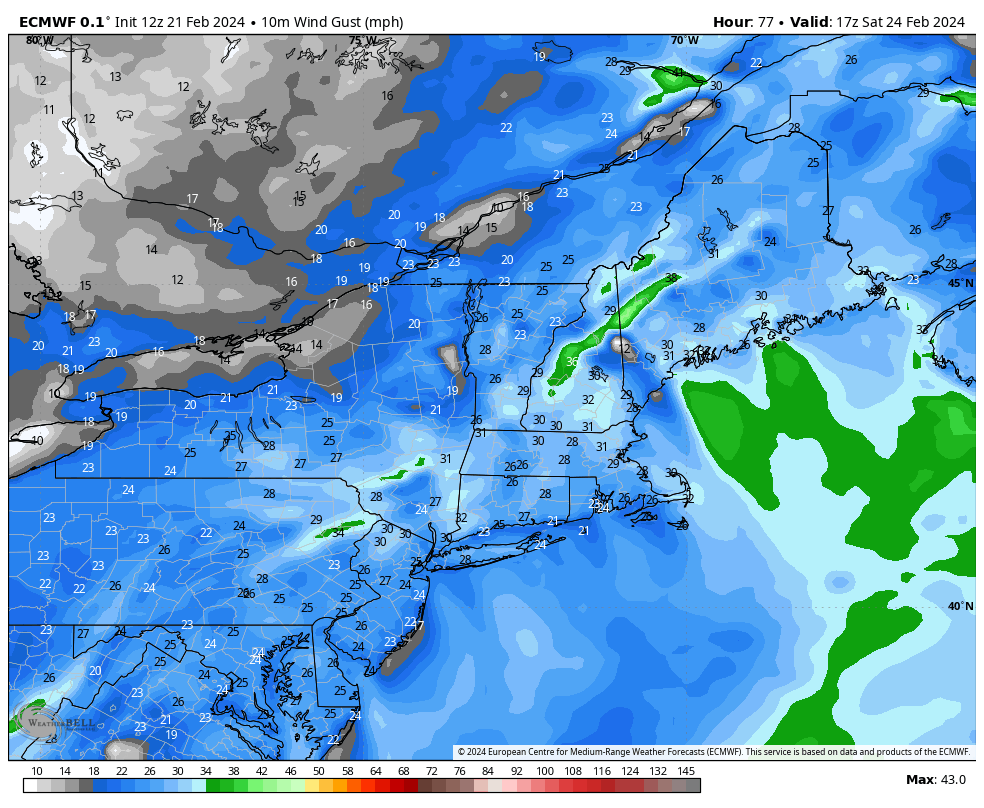
My concerns would primarily be Sugarloaf, Saddleback, Sunday River, Wildcat, Attitash, Cannon, Loon, Waterville Valley, Bromley, Stratton, and Jay Peak. This wind event doesn't look strong enough to cause issues beyond that list, and only some of that list is likely to be impacted. It is still too early to issue a wind hold forecast, but I will likely issue one on Thursday with the Weekend Outlook for our subscribers.
Knowledge Is Powder!
-- Matt


Comments ()