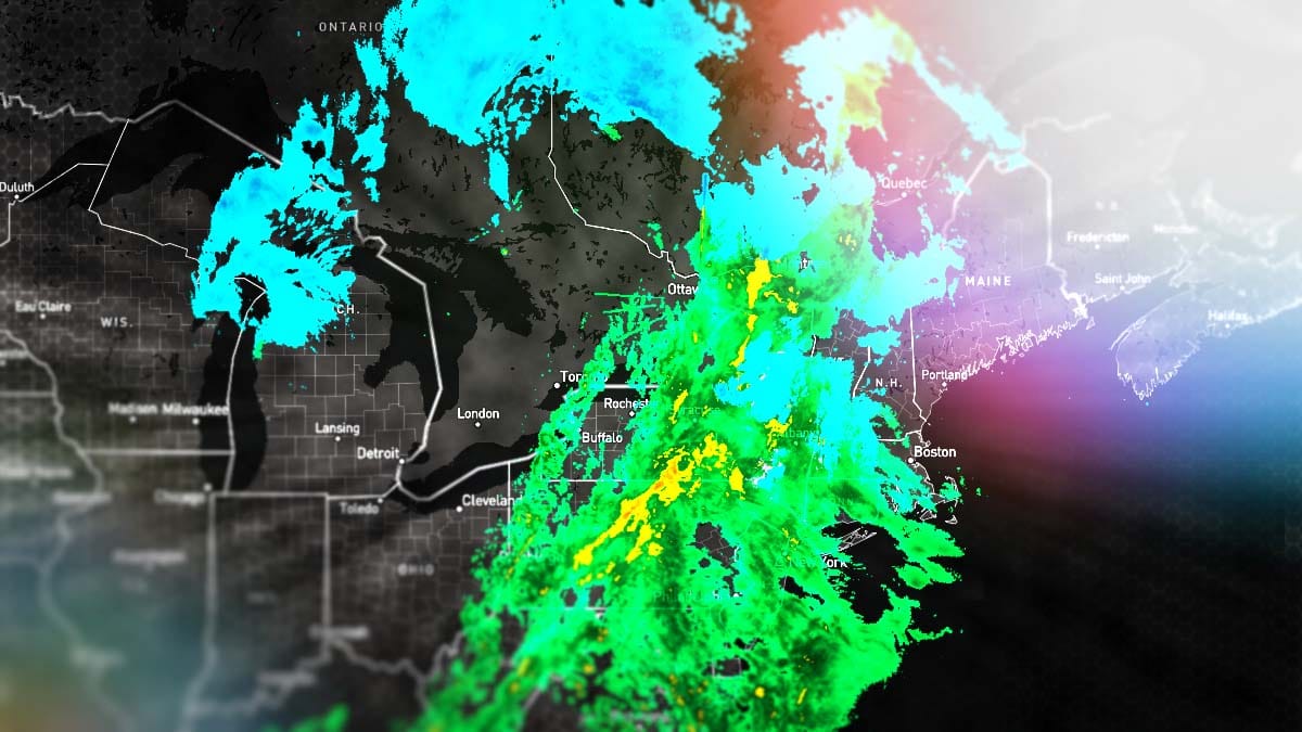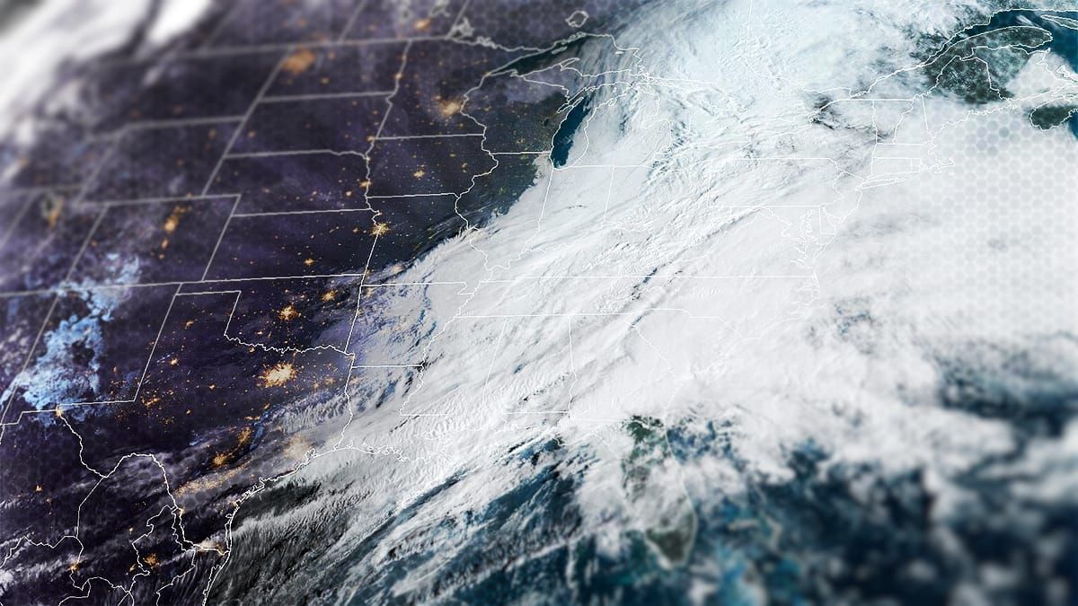
The snow will start in parts of New York before the lifts stop spinning today and it is likely that some ski areas will see snow for over 50 hours straight! We may see some ski areas break 2 feet by Tuesday morning and it's time to get locked and loaded for this storm! This is a big storm with a very juicy back-end, but we also have some very marginal temps on the front-end that may produce some variability depending on whether or not some ski areas mix. Big storms also bring wind and you will need to navigate around that in some cases for the next 3 days. There will be some very notable travel issues on Sunday morning also. I'll start off with the broad view as always showing all of Saturday through Monday.
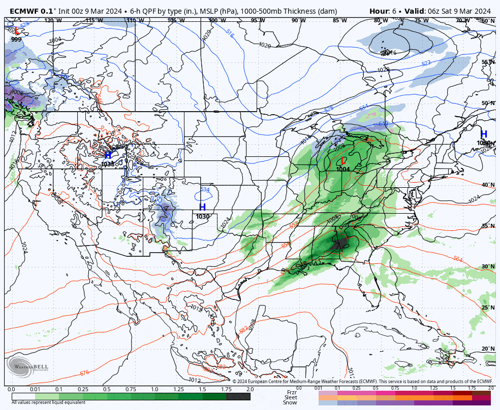
Below I will provide the latest Snowfall Forecast where I will break this down for both Sunday and then the lengthy back-end with a discussion of potential variability, then the Wind Forecast, and finally the Travel Forecast. This triad of forecasts are vital to hunting pow in the Northeast! There will probably be at least one more update on Sunday that covers the following 48 hours of snow and wind. There's a lot here, literally 6 different forecast maps and some other graphics, but it's a 3 day storm with plenty to navigate around and I've made the text as to the point as possible since we are dialed in now and there are specifics to share.
One last thing, don't forget that we spring forward early Sunday morning by an hour as we shift to Daylight Savings Time. You'll lose an hour of sleep!
SUBSCRIBER NOTE: There's an addendum to this update discussing subtle yet impactful shifts seen since this morning's 0z runs that we sent out at 5PM Saturday.