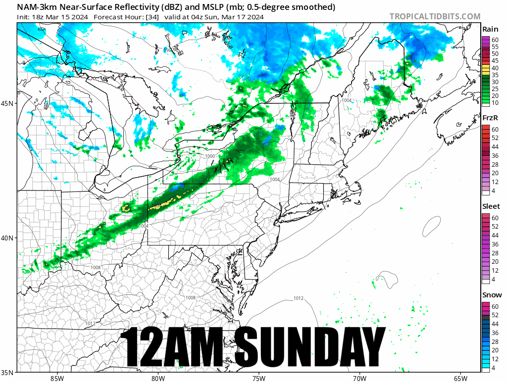
We have a clipper passing through Quebec on Sunday which will bring a cold front through along with some rain and snow and then some additional back-end snow through the end of Monday. This was covered in Thursday's Weekend Update for subscribers but it was too distant to provide more detailed coverage at that time.
I have only limited concerns for rain impacting the Sunday ski day, no concern about wind impacting your enjoyment, and temperatures should allow for some spring-like edge hold everywhere on Sunday outside of maybe some summits. Through the end of Sunday's ski I don't currently expect more than 5" of snow to fall, but this will certainly be a helpful refresh. On Monday and Tuesday however we may see some three day totals approach 8" of sneaky pow in isolated areas and this will be helpful as we are going to enter an extended period of below freezing temperatures on some northern mountains. Here's a timestamped simulated radar covering all of Sunday with the lift hours slowed down.