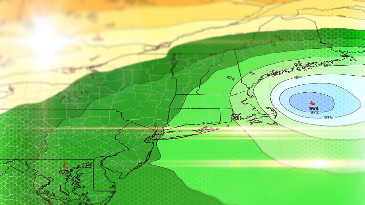
Seems like 'Miracle March' is going to turn into 'Apruary' with what may be the last big storm of the season, and this one looks like a whopper! Not only is a sub-970 mb low off of Cape Cod being modeled, the storm may take 2 full days to traverse the Northeast and then on the third day we may see a pretty decent back-end. We should see widespread snow in NY, VT, NH, ME, and MA. 1-2 feet would be conservative guidance for what is modeled! Trust me, that's not hype, the models have been signaling even over 3 feet at times! This storm has potential of getting its own Wikipedia page!
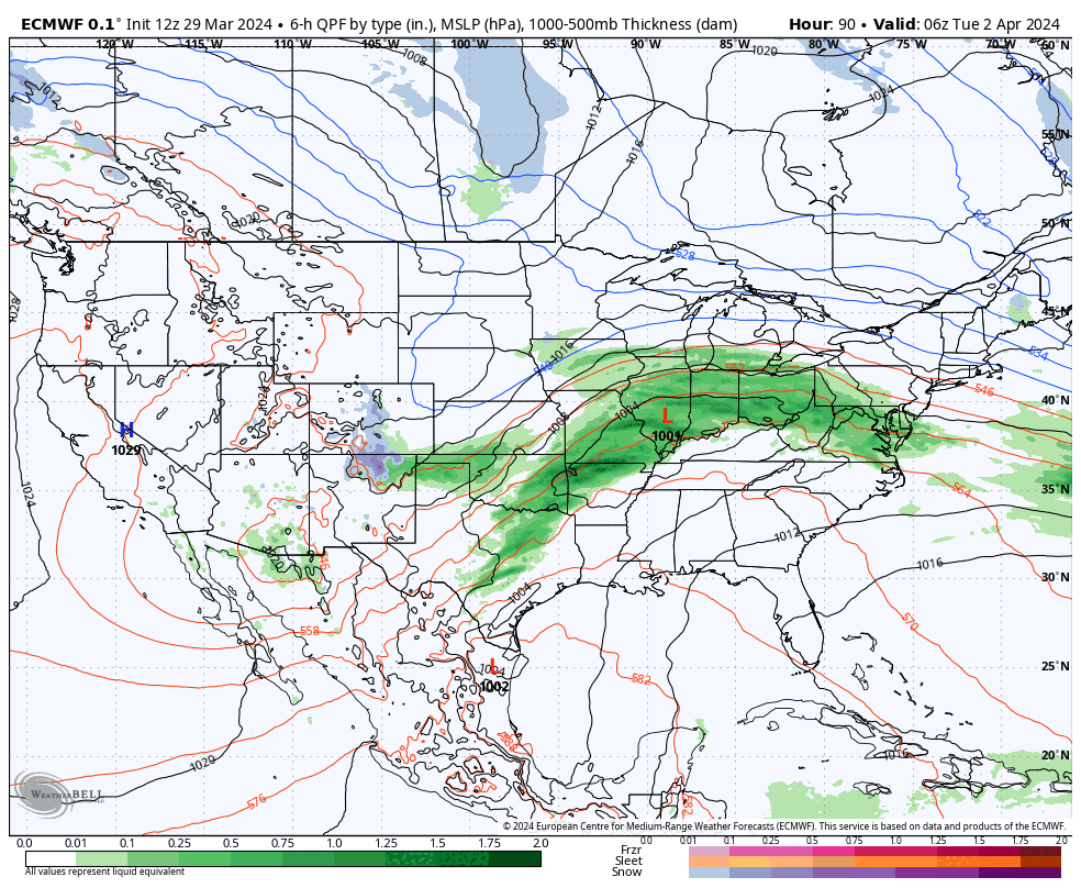
Let's take a look at the broad view from the ECMWF to set this up covering Tuesday through Friday.
This storm looks amazing to say the least!
Snow from this storm is still ~5 days away, though this has been in the models fairly consistently for 4 days already. I'll cover the model spread in Track and Intensity, and then the snow in the Snowfall Outlook. Naturally when you see a 968 mb low being modeled you can expect there to be wind and I'll cover that in the Wind Outlook. Lastly I'll give some guidance on How to Hunt this storm. This won't actually be super long, but it's a great primer to get coverage for this storm moving along so that everyone who wants some can prepare!


