Let's get this out of the way right up top, I'm now comfortable in saying that we should see 1-3 feet of snow widely across the Northeast at open ski areas. This is definitely not an April Fools joke. It does snow in April, and it can snow BIG! By the time this storm finishes up on the back-end either Friday or Saturday many ski areas north of the Albany, NY latitude will have seen 50" to 100" of snow in a 4 week period, and many of those further south who will be open will be getting in on the action this time. This will likely be a top 5 storm since SNOWOLOGY started 6 seasons ago!
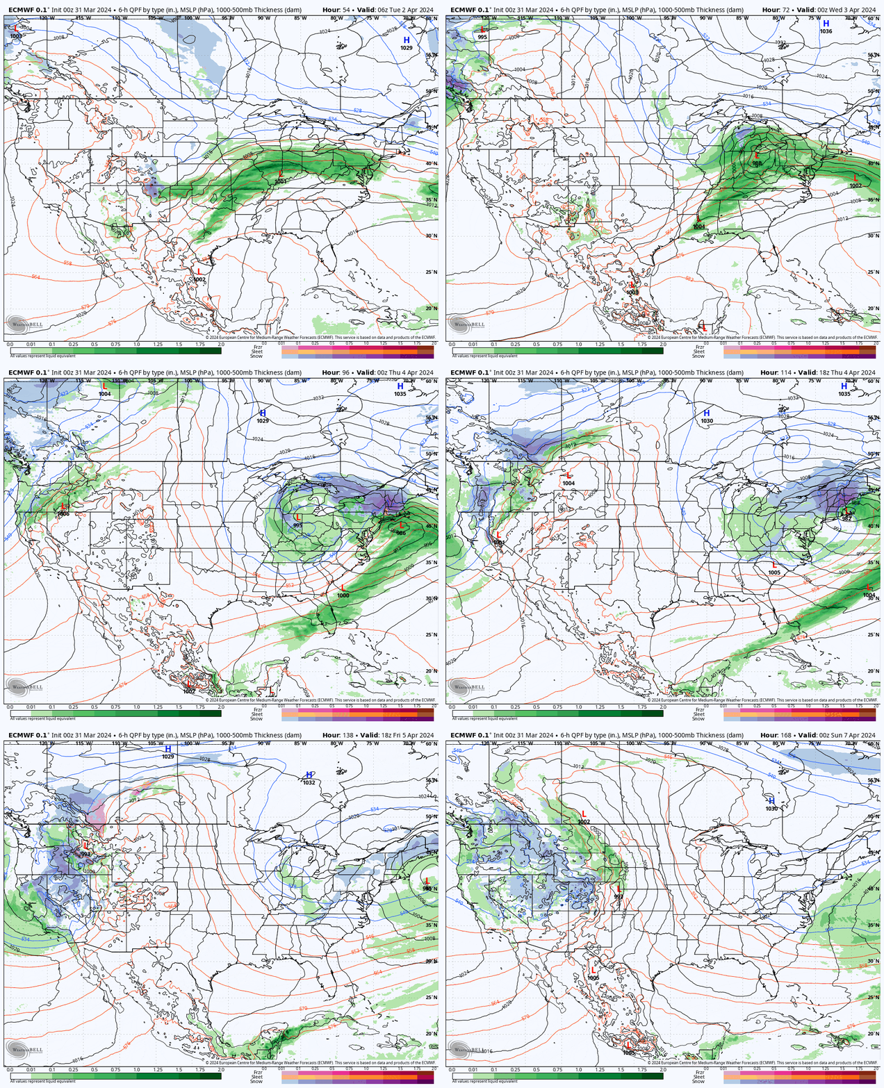
There aren't any significant changes since Friday's update, so here's the latest run of the ECMWF showing the storm from Tuesday through Saturday to get us started.

I'm going to put out a Snow Forecast for the entire event and then break this storm down by day in Daily Overviews. There will be wind issues on Wednesday, Thursday, and Friday and travel Wednesday evening through Thursday will be very difficult in many places. This will be hard to hunt without a plan, but if you nail this it could be the best storm you've ever experienced because it hits during the week, in April, travel will be difficult, and that all means empty slopes on Thursday if you choose your spot well and get there safe! This is how I hunt storms and it works! Friday shouldn't be ridiculous either, but there will be lots more people on the mountains by then.
There's a lot here, but future updates will be even more deterministic with forecast maps and less talk. I've found that confidence in our forecasts are helped by the deeper dive and supporting maps which is why this is as detailed as it is right now as we are in the planning stage for this storm.


