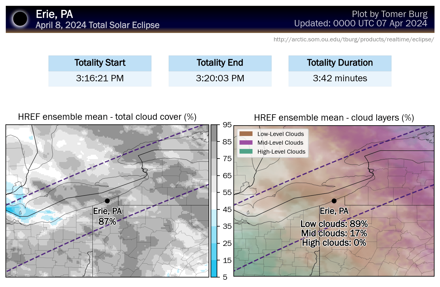
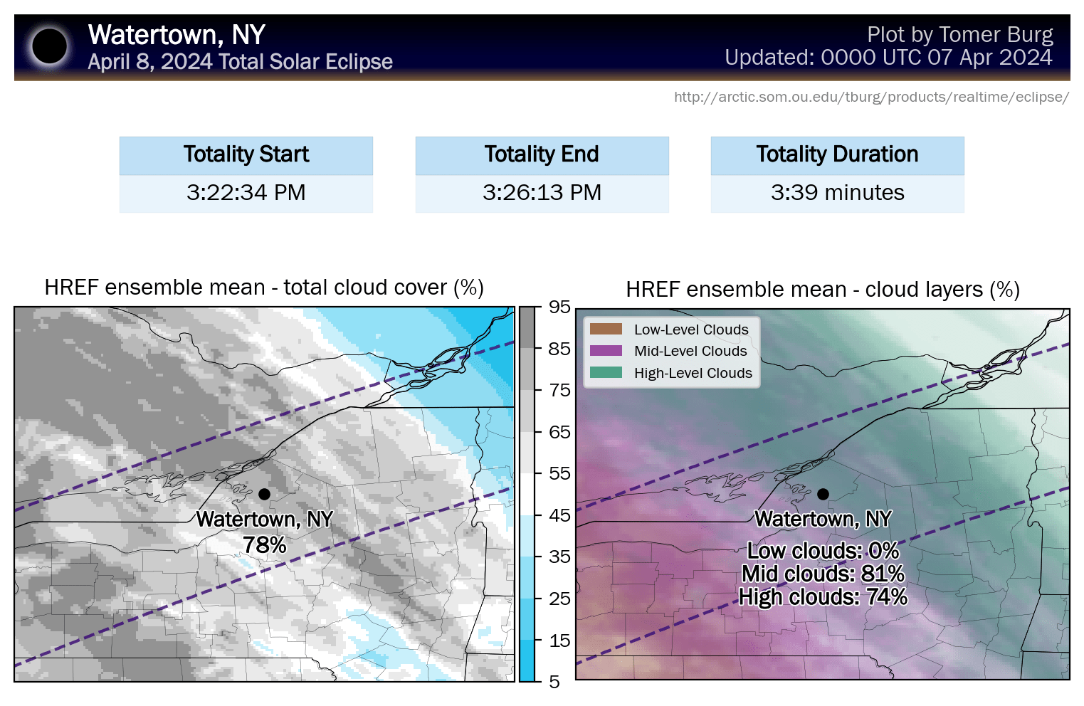
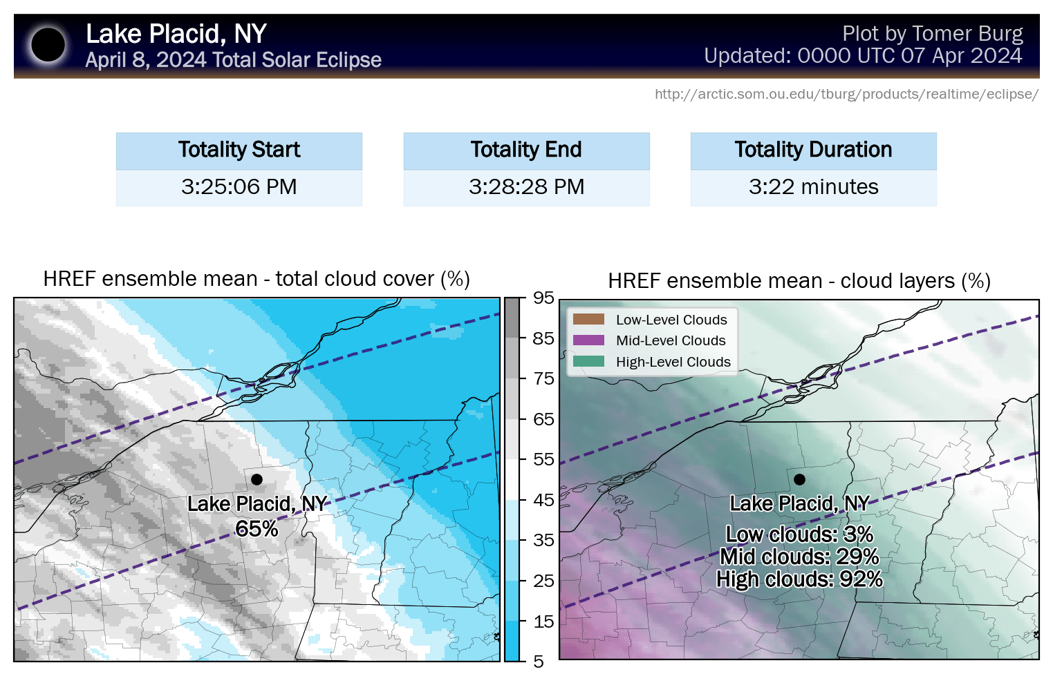
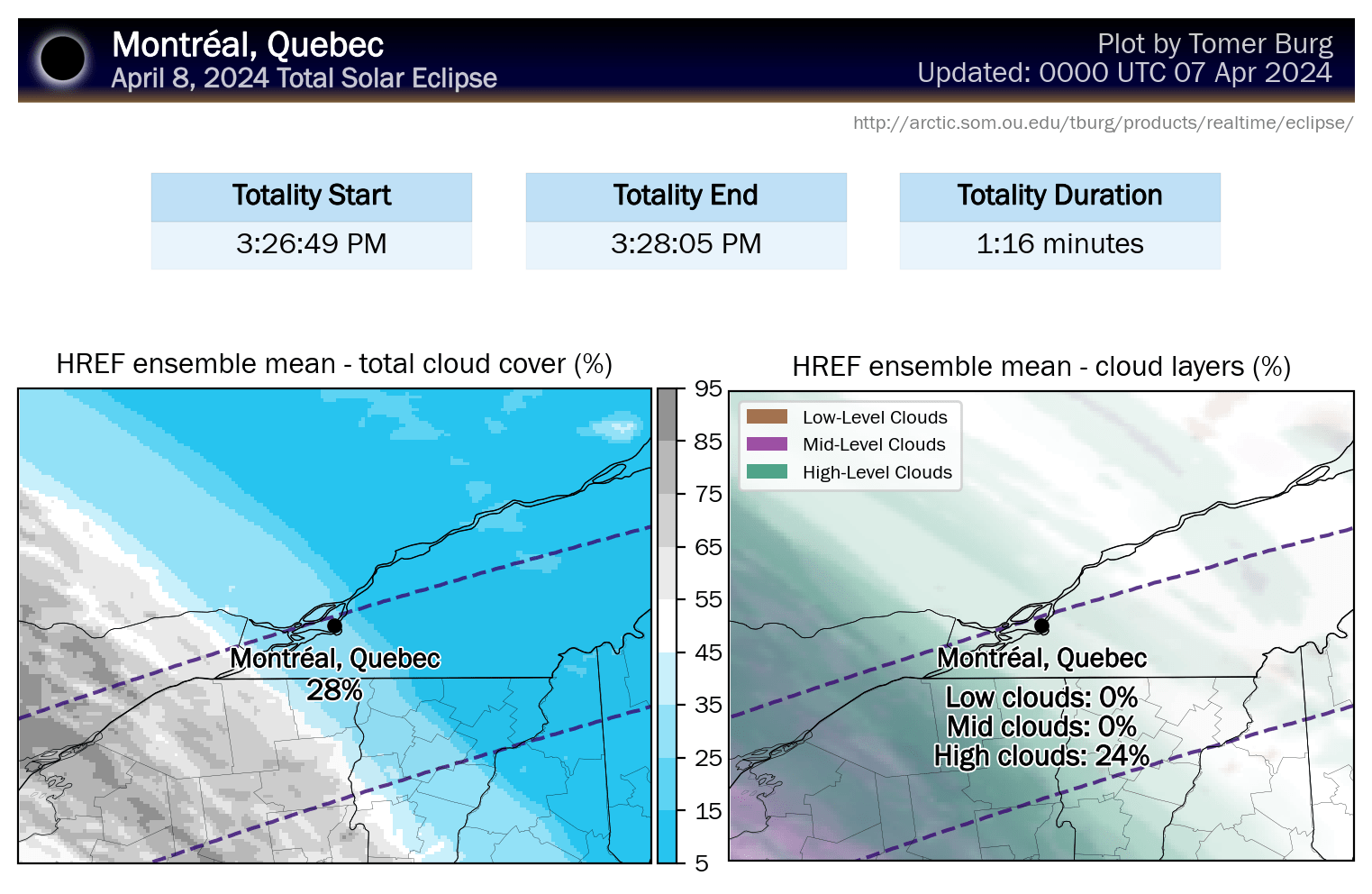
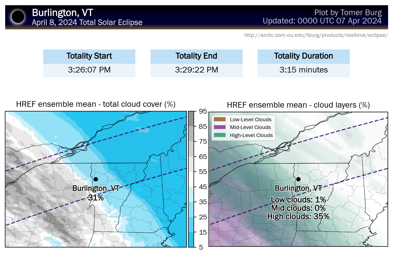
Here's an update on the cloud cover modeling for the eclipse, but first some basics. The eclipse itself will generally begin and end in the partial eclipse stage about 1 hour and 15 minutes from the center of totality and totality itself will last up to about 3 minutes and 40 seconds in the center of the path within the Northeast. On the western edge of the region totality in Erie, PA will start at 3:16PM, and on the eastern edge of the region totality in Houlton, ME it will start at 3:32PM. There are plenty of resources on the internet for exact timing at your location.
Our focus is on cloud cover here, and despite the fact that there will be some obscuring clouds in the Northeast, from a climatological perspective we are getting lucky as April tends to be a very cloudy month for us. There will be great viewing in a fair amount of the area with skies turning bluebird as you head further east.
We'll start off with the latest ensembles from Tomer Burg's research website. You don't need for me to assemble this information for you repeatedly as his website will update every 6 hours with the latest modeling, and it should become quite accurate by this evening, or at least as accurate as these models can be. Some browsers will give a security warning as the site has no SSL on it, but it is a university maintained website and you are not transferring sensitive information to and from this website, so you can bypass the warning safely.
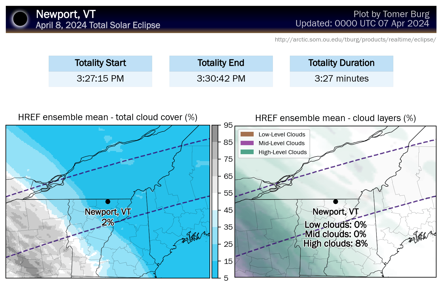
Tomer Burg has updated his maps to use mesoscale models now that they are within range. He has also created new maps from the HREF ensembles that differentiate low, middle, and high clouds as they have varying levels of effect, with high clouds being the least troublesome.
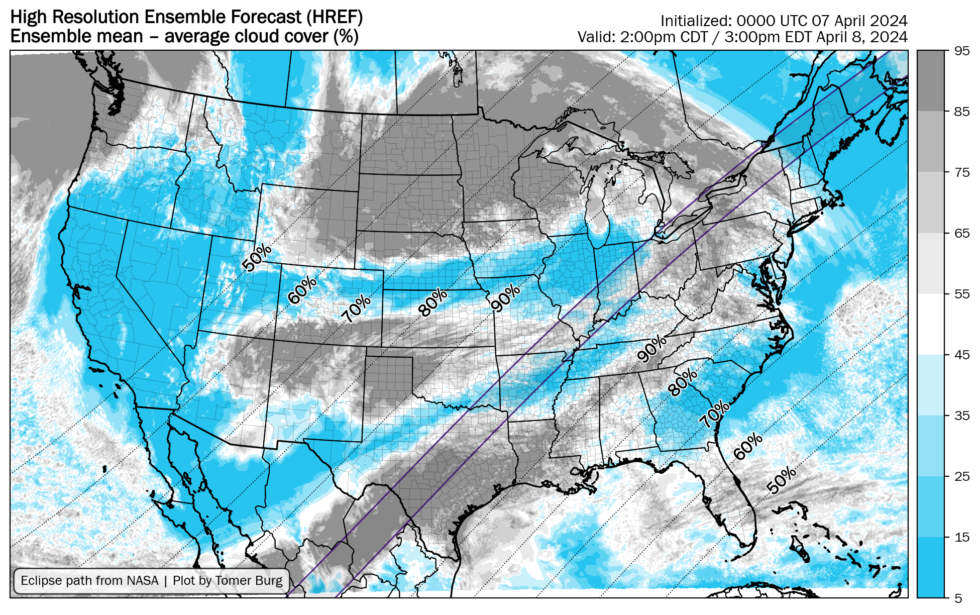
The percentages for this map represent essentially how much light the clouds block or the thickness of the clouds. In his previous updates he rated favorable viewing at 25% or less cloud cover, and somewhat favorable viewing at 25% to 50% cloud cover (up to the white shade). You may still be able to see the eclipse in heaver cloud cover though certainly not at the more cloudy end of the scale. Under partial eclipse conditions there will be more tolerance for cloud cover as there will be more light from the Sun. All of this is rough and I'm not an expert on eclipse viewing through clouds so this is the best I can offer unfortunately.
Over the last three days models have advanced the clouds about 150 miles further northeast and there is likely to be some obstruction now across about half the Northeast, but just because you see clouds modeled doesn't mean it's a bust though there should be some concern once you start reaching the gray shades. Over the prior 12 hours modeling has actually backtracked a little on the advance, so we seem to be starting to dial it in. Mountains also create their own weather as us skiers and riders know so well, and we could see cloudiness that is not in the models, but soundings indicate dry air at the surface ahead of the advancing clouds and winds will not be strong, and that's a really good sign that the risk is minimal.
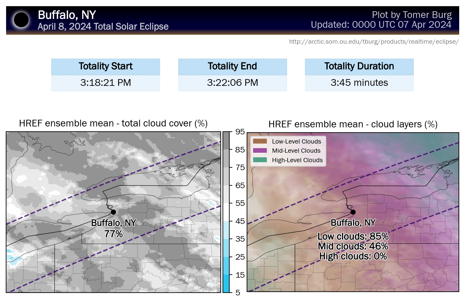
Tomer Burg also has a great "City Dashboard" on his website with a bunch of cities both within and beyond totality that you can click on to view the latest modeling. I'm going to highlight some of these from west to east across the region where clouds are modeled. The version of cloud cover on the left indicates the total cloud cover in terms of thickness and the graphic on the right will break down the different levels of clouds with high clouds in green shades being less troublesome. Beyond Newport, VT there is no sense in including more cities as they have virtually no cloudiness modeled at present.


Comments ()