Let's get this party started! Winter is going to give us another taste of it's white fluffy goodness over the next three days as a weak system taps into some cold air to create snow on the back end of this storm. I don't expect a ton of snow and it won't be something that will cause many to want to hike up a mountain and slide on snow-covered dirt, rocks, and grass, but more than 6" is definitely on the table for a handful of ski areas at elevation and people will ski it and we're going to help those people find the goods!
I'm going to cover this system in an abridged format since there are no operational considerations at this time and it's not an actionable storm for 99.9% of our followers, and unlike during the ski season, Storm Updates for this system will not be paywalled. I should also note that this storm is super-duper tricky to forecast accurately as we're dealing with an elevation storm with a changeover to snow that will have variability, this is all back end snow over 3 days which is beyond what models can reliably see for that type of snow, and the warm ground will melt and compact some of what falls. It's hard enough to forecast a typical Northeast snowstorm, but this makes it extra complex.
Synoptic Overview
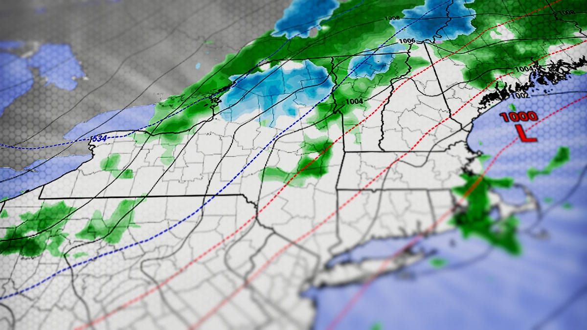
So let's start off with the synoptic setup (broader general weather patterns and elements) using a loop from the GFS covering midday on Sunday through the end of Wednesday.
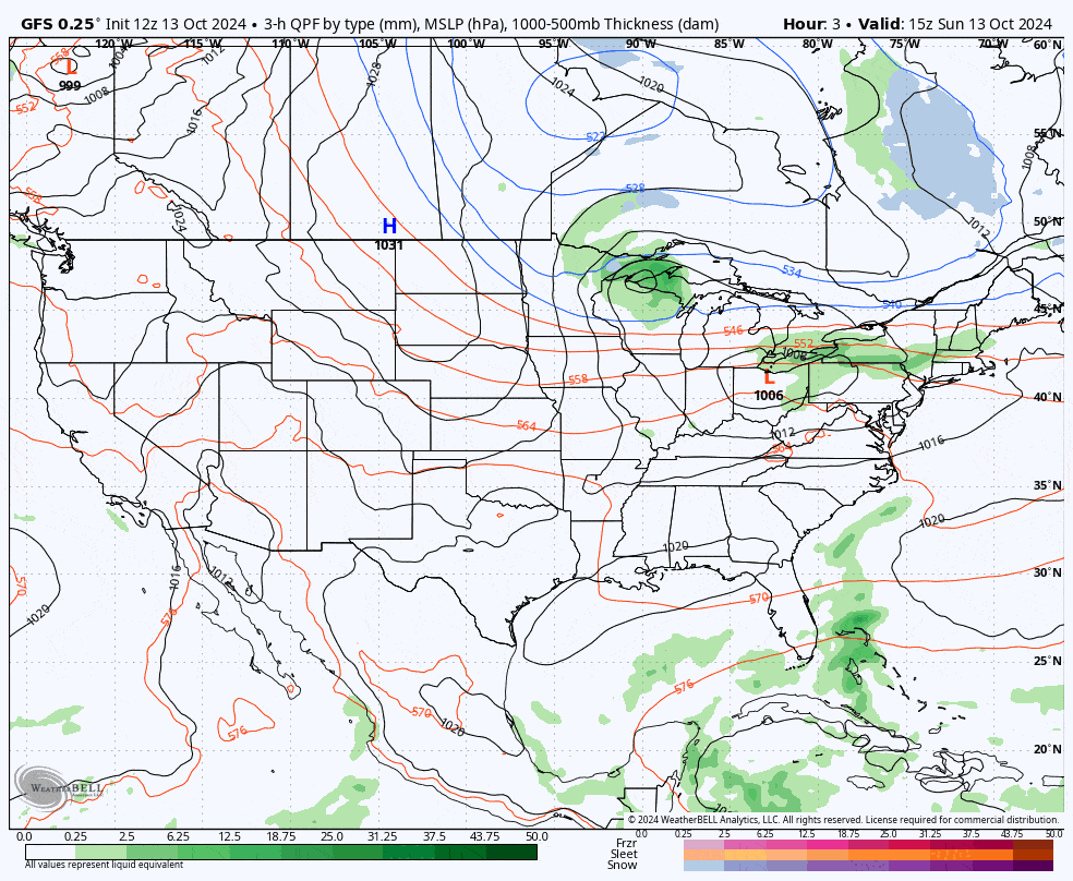
We have a pool of cold air dropping down in a trough with a shortwave traveling along its boundary and rounding up into the Northeast from the Great Lakes. This is a two element storm, the trough and the shortwave and that part is pretty straightforward. The trough though is pretty round and not notably tilted and that means it won't spawn a strong surface low which would pull in more cold and intensify the precipitation, but it will not move out of the region quickly which means we could get up to 72 hours of back end snow out of this on some northern mountains.
Snowfall and TIming Overview
It always helps to visualize the storm and I have the latest NAM3K simulated radar shown here with timestamps covering all of Monday and Tuesday. Snow will continue through some part of Wednesday and that part of the storm may be the most widely prolific for snowfall, especially on the Greens.
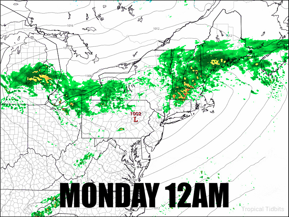
The first wave happens as the low starts to become better organized and pulls cold air in behind the storm early Monday morning. The snow may come down moderately to heavily for a time in parts of the Adirondacks and it should flip to snow above 4,000' starting around 3AM on Tuesday morning and pound at times through around 3PM. In the Northern Greens that changeover is expected to happen closer to 8AM on Monday and accumulate through until about 8PM. Snow will be less notable in the Whites and Longfellows and primarily will happen during Monday evening, though the Whites has a chance of further accumulations on Wednesday.
The second wave of snow comes in from the northwest around 8PM on Tuesday. This part of the storm has lower confidence due to it being back end snow and being more than 48 hours away. Small shifts in how much moisture is available will determine how productive this part of the storm is. Right now the back end does look juicy and modeling generally shows it lasting until sometime between 8AM on Wednesday to the end of the day in some spots. My forecast assumes accumulating snow lasting through 4PM on Wednesday.
Here's my snowfall forecast for the full event, and the first Snowology snowfall map of the season!
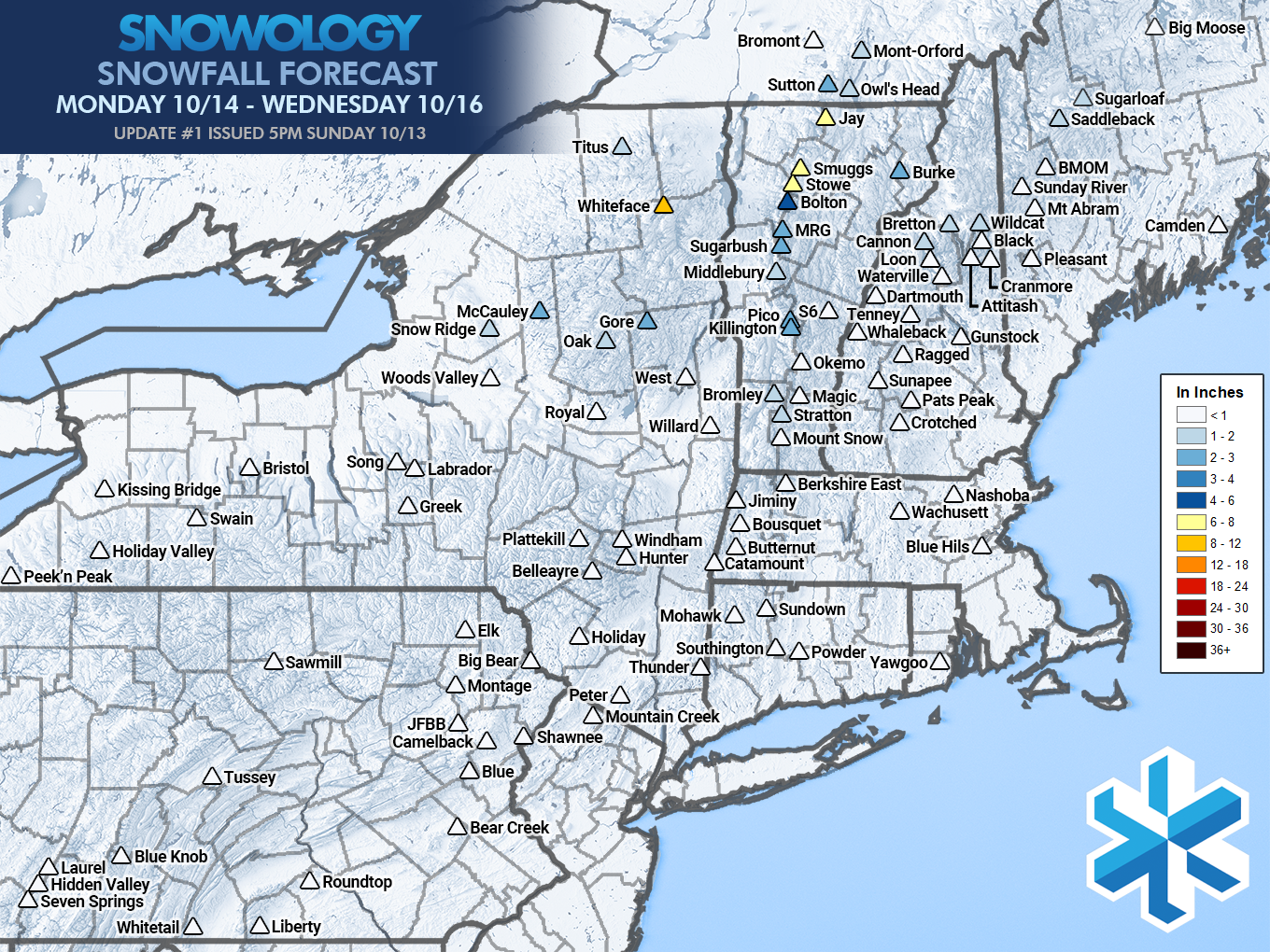
This snowfall forecast is for snow on the ground and not on raised surfaces like picnic tables and decks where those surfaces probably accumulate 1"-2" more. This forecast is also for near the peaks and not the bases of ski areas, in fact we should see very little accumulation at bases.
As I indicated earlier forecasting snow in these super marginal conditions for almost every aspect makes this forecast difficult. Temperatures in the Northern Greens will hover above and below freezing for this entire event, though the Adirondacks will be a bit cooler with less melting at elevation. Snow will melt and compact in contact with the ground, and forecasts are made for what accumulates on the ground and not just what falls (models don't understand accumulation well in marginal temps so you have to adjust manually).
One tool like I like to use in this exact situation is a special version of the snowfall map for the NAM3K from Tropical Tidbits that has a correction for "Ferrier Rime". This basically reduces the amount of snow it sees, and the model has notable issues with snowfall on mountains above 15F due to how it handles the riming of snowflakes. This map typically overcorrects on the downside, but it gives us a good estimate when we expect some melting and compaction. The following snowfall map however only goes through 2AM on Wednesday so our forecast is a bit more aggressive than what is shown here based on the expectation of up to another 14 hours of upsloping snow.
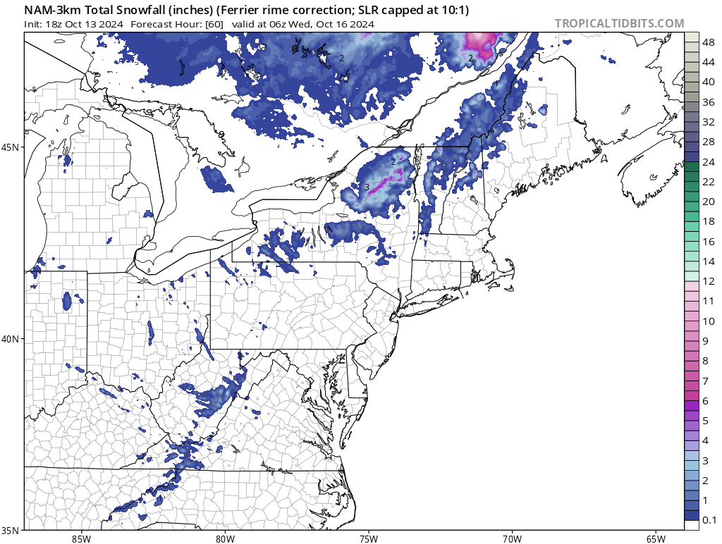
Whiteface's Auto Road should be skiable without creating sparks as of early Monday evening, and I expect about 6" of snow to fall near the peak there by the end of the day with accumulating snow potentially below the 2,000' level. It may be dumping pretty hard until some point in the afternoon. We expect no more than 3" at any other ski area during Monday with Northern Vermont, Northern New Hampshire, and Northern Maine getting some snow through the end of the day.
After a lull with on and off light snow and maybe some sprinkles of the uncrystallized stuff, the upsloping component on the back end should start Tuesday evening, probably around 8PM. I expect that we'll see some healthy accumulations in the Northern Greens and Adirondacks. The snow should be widespread enough to add some more broadly to the mountains of Southern Vermont and other areas of New York, though lower elevations will likely melt and compact more. Right now we're expecting 4"-6" of additional accumulation on the Northern Greens during this time frame with another 2"-3" on Whiteface. So if you are looking for some fast grass in Northern Vermont, Wednesday afternoon may be the time, though we'll likely update our forecast as we get closer to Wednesday.
If you are one of the diehards who is going to hunt this, please remember to share your photos and videos with us on our Facebook Page, and we would love to share some of the more timely and notable things in our feeds with your permission!
-- Matthew Scott


Comments ()