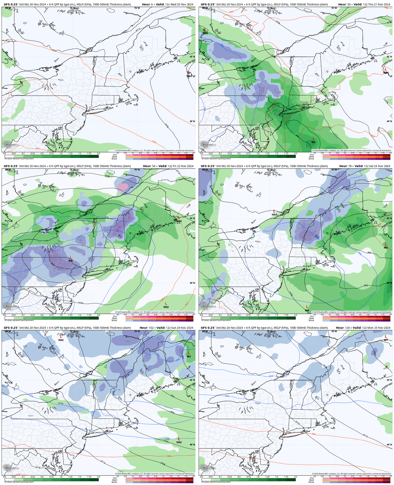
This will be the first widespread snowstorm of the season and we're just 24 hours away from the start of snow in the Northeast and a whopping 90 hours before it ends early Monday morning.
This is a very long-lived storm that is going to mosey around in New York through the end of Friday before transfering energy to another low in the Atlantic only for it to swing back into the Gulf of Maine and likely bring more rain and snow to Northern New England on Saturday and Sunday. This is a very uncommon way for a storm to progress, and it's definitely the most difficult one I've forecasted in what now is my 7th season of helping to guide my fellow Northeast snow lovers through the fog and to the pow. Let's lean into this with a loop from the GFS showing the 6-hour precipitation intensity covering Wednesday morning through the end of Sunday.

With likely only 5 ski areas operating this weekend within the Northeast, all of which feature very limited terrain along with low probabilities of opening significant terrain due to this storm, there are not going to be many if any great opportunities to ski what falls. This of course happens almost every fall as winter weather starts to set in, but make no doubt about it, the snow that falls will be useful to most who try to open for the Thanksgiving weekend by helping to build a base. This storm will bring a widespread 1"-3" of water that falls both in crystallized and uncrystallized forms and we could use some moisture in any form given the widespread drought.
I'll jump straight into the Snowfall Outlook this time, then have a quick discussion of the Wind Hold Outlook, and then I'll revisit once again How to Hunt this Storm.


