You may have heard that there's a Thanksgiving storm that could mess up holiday travel and also bring smiles to Northeast skiers and riders. Some hopped on this when by a fluke both major models signaled a coastal storm 9 days ahead of impacts, and some are continuing their hype.
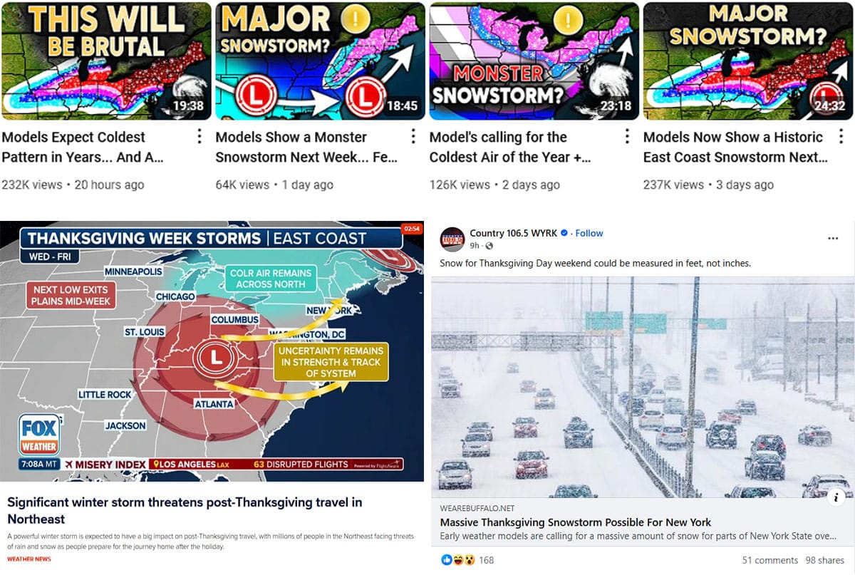
Here's a rule of thumb that I generally use for forecasting winter storms; if something looks perfect for a monster storm 9 days out, it probably isn't going to happen like it is shown because things are going to shift in a big ways the majority of the time over that period. Think about it this way, if a model is off 1 mph on the forward progression of one element that forms the storm 7 days out, that's 168 miles, and that's just one of the moving pieces. 168 miles is enough for two elements to miss coming together optimally at the right time for cyclogenesis in the East. Now that doesn't mean storms don't happen most of the time when you see them 9 days out in the models, rather it means that elements of a storm may be present, but how it forms, how it tracks, and how strong it is are definitely open questions.
Unfortunately hype works really really well on the internets so you simply need to find trustworthy sources, and I assure you that none of them are the ones sharing snowfall maps 9 days out and using apocalyptic language outside of major weather disasters like hurricanes.
So Are We Getting a Storm on Thanksgiving?
I'm issuing a Storm Watch because of high interest and how close we are to possible impacts, but I'm not confident of this being a big storm, or even a storm at all. I currently believe our chances of a big storm, one that might bring a foot or more over a large area, is probably 40% right now. I'm going to walk you through the presently modeled solutions using something called "ensembles" to help understand the probabilities of a big storm.
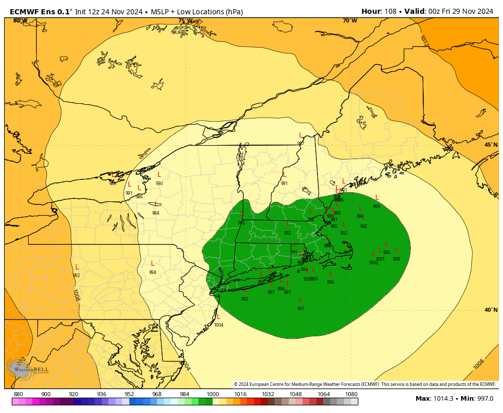
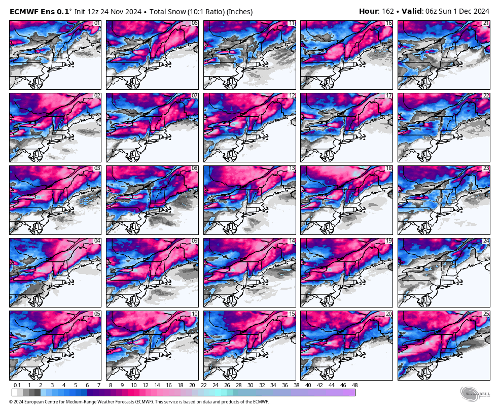
Here's what the ECMWF ensemble members show as of this afternoon for low locations of each ensemble member on Thursday evening as well as what 25 of the 50 ensemble members snow totals through Saturday. This would certainly be classified as very strong confidence, especially for this range, with about 2/3 of the ensemble members seeing a big storm.
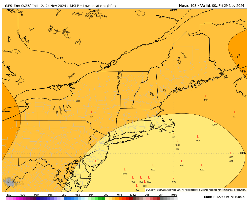
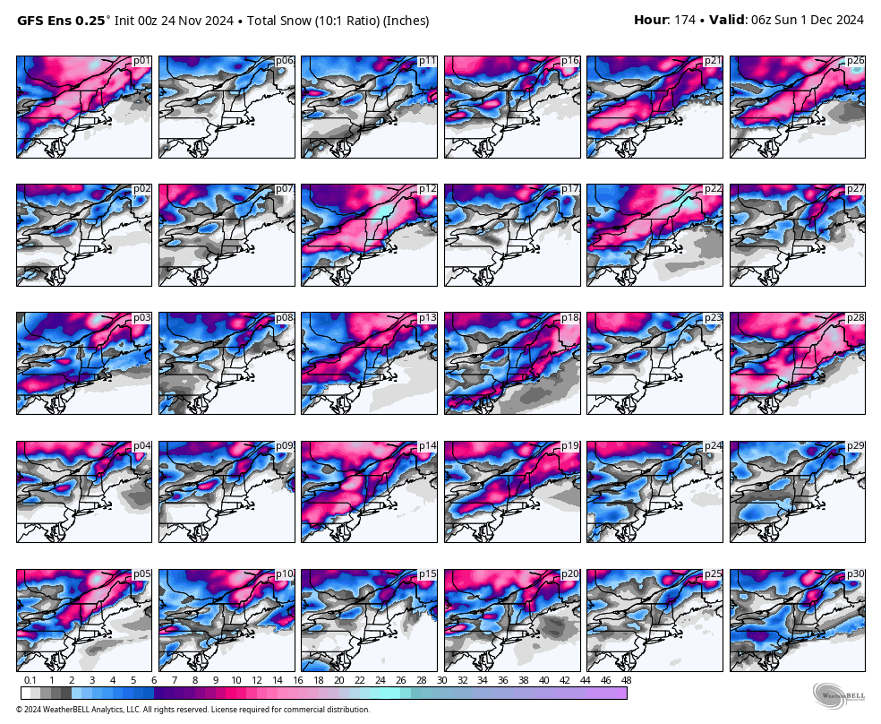
And then there are the GFS ensembles. Here's what all 30 ensemble members show as of this afternoon for low locations of each ensemble member on Thursday evening as well as snow totals through Saturday as well. I would also classify this as strong confidence of there not being a big coastal storm with only about 20% of ensemble members seeing a larger coastal storm. A big storm is certainly not off the table though.
Simply sharing snowfall and other maps generated from models is not forecasting. You really have to look at the various major elements and how they might come together in order to gauge how tentative the solution for a system might be. You also have to weigh the known biases in models for various regions and scenarios, and I'm afraid that many don't know these well.
The ECMWF has a notable and repeatable bias where it over-amps Northeast coastal storms generally from 3+ days out. Not all storms, but in this setup, yeah, that bias likely at work here. So when we have disagreement like this with virtually no support in the GFS, my confidence is lowered greatly and that's why I'm giving a big coastal storm a 40% chance right now, however there is also the potential of more isolated moderate snow and also the possibility of some notable lake effect and upsloping snow behind this system even if it isn't a "bomb cyclone". There could also be a storm that comes a day or two later from a different combination of elements.
Breaking Down the Potential Storm
I'm going to quickly walk you through the basic setup of this storm and explain what is different between the two models in less technical terms. I'm going to start with the ECMWF that currently sees a big storm before showing why the GFS doesn't and what may otherwise happen.
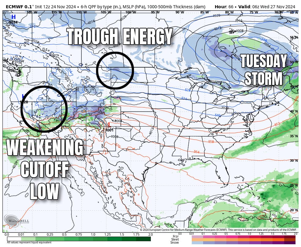
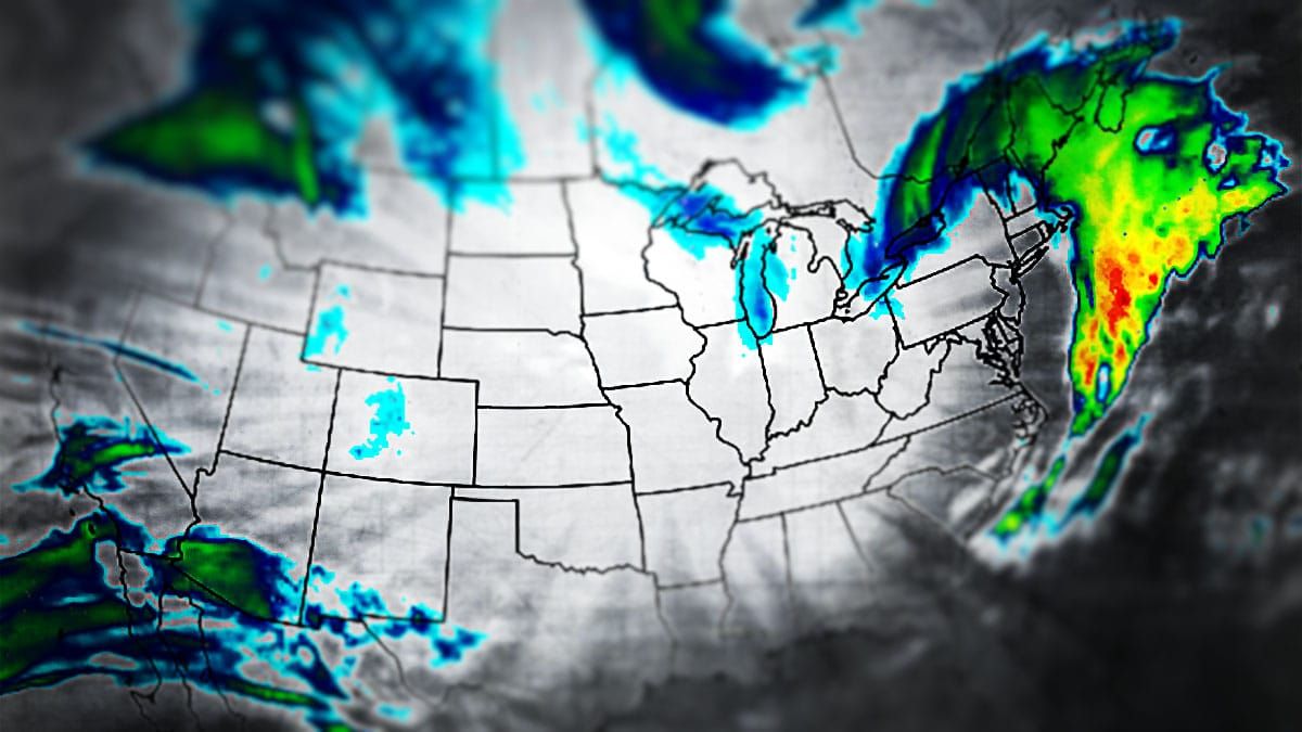
Here's a precipitation intensity map from Wednesday morning with the two major elements of this potential storm circled. This is what is left over from a storm that is coming onshore in the West right now after a cutoff low forms.
Now we're going to look at the same weather but using something called "vorticity" in the mid-levels of the atmosphere. It's easiest to just think of vorticity as energy in the atmosphere.
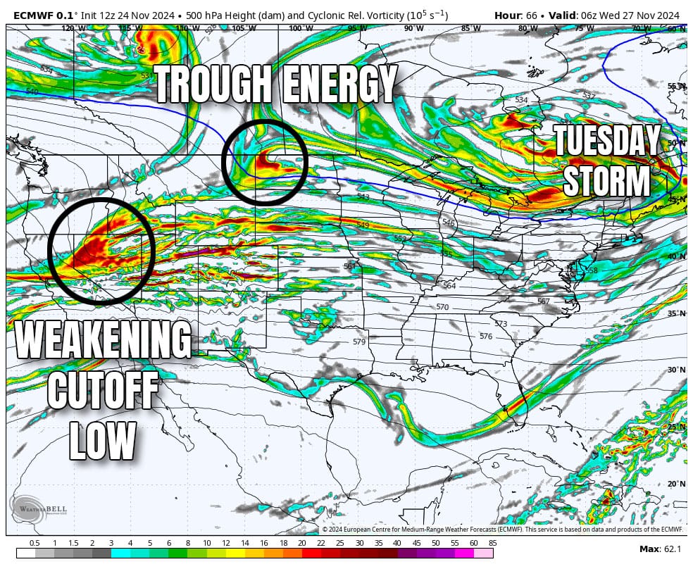
On Tuesday morning the ECMWF sees these two pieces of energy "phasing" together and that creates a surface storm in the Midwest that would then track near the Northeast coast and create at least a moderate intensity coastal storm, but likely not huge. In this scenario snow is not very likely along the heavily populated corridor from Boston to DC, though wind and rain can be issues for travel of course.
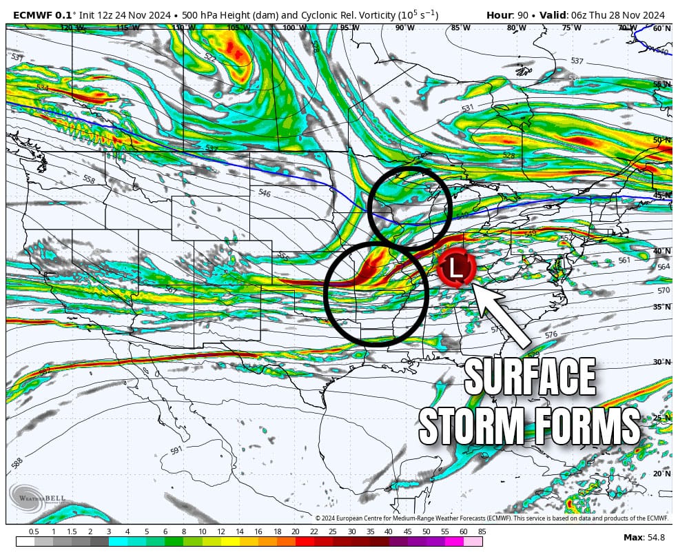
On the flipside here's what the GFS sees at this same time on Wednesday morning. This is what I call a "missed connection" The northern trough energy simply moves faster than the weakening cutoff low energy and they fail to phase with each other. You need both otherwise this is just a weak shortwave with light impacts.
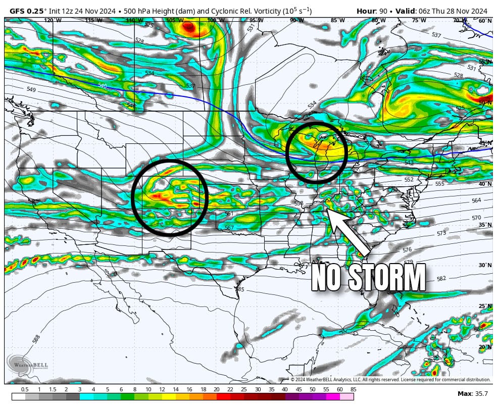
This setup for a storm is actually pretty basic and it's really only a question of timing of these two elements and also how strong the attraction is between the trough and the energy left over from the weakening cutoff low. If they get too close together they are drawn to each other almost like magnets, so there is a notable inflection point where models will see a storm and where they won't. Unfortunately the ECMWF seems to overplay this attraction at times as well as the explosiveness when they phase with each other, but it is not always wrong!
If this connection does miss, it is not uncommon to see a different bulge in that trough pick up the more southern energy and bring it to the Northeast 1-2 days later. There's little support for that now, but if the storm fizzles, it might come back as a different storm next weekend.
I'll cover this as it evolves.
Knowledge Is Powder! It's also knowing who to trust before you drop $500 on a hotel room trying to hunt an imaginary storm.
-- Matthew Scott



Comments ()