I just wanted to share a quick post storm wrap up and holiday weekend update that includes some short updates shared on our social media feeds today as well as subscriber tips on navigating the holiday crowds. I'll cover the Open Ski Areas, a quick Storm Postmortem, and then Where to Hunt and What to Expect for just subscribers.
First though, if you are going to Killington this weekend either for the World Cup or to ski/ride, be aware that they have notable changes to where you can park and also other requirements for the event itself such as a request not to bring bags. The event will be busy and you should arrive early.
Open Ski Areas
Here's your updated Operating Status Tracker for this weekend with 14 ski areas that should be operating by Sunday in the Northeast. Everyone in blue is open as of today and everyone in green has announced opening Saturday or Sunday. We are not aware of anyone else who is targeting an open at least by Sunday. Detail for openings to come is below the graphic.
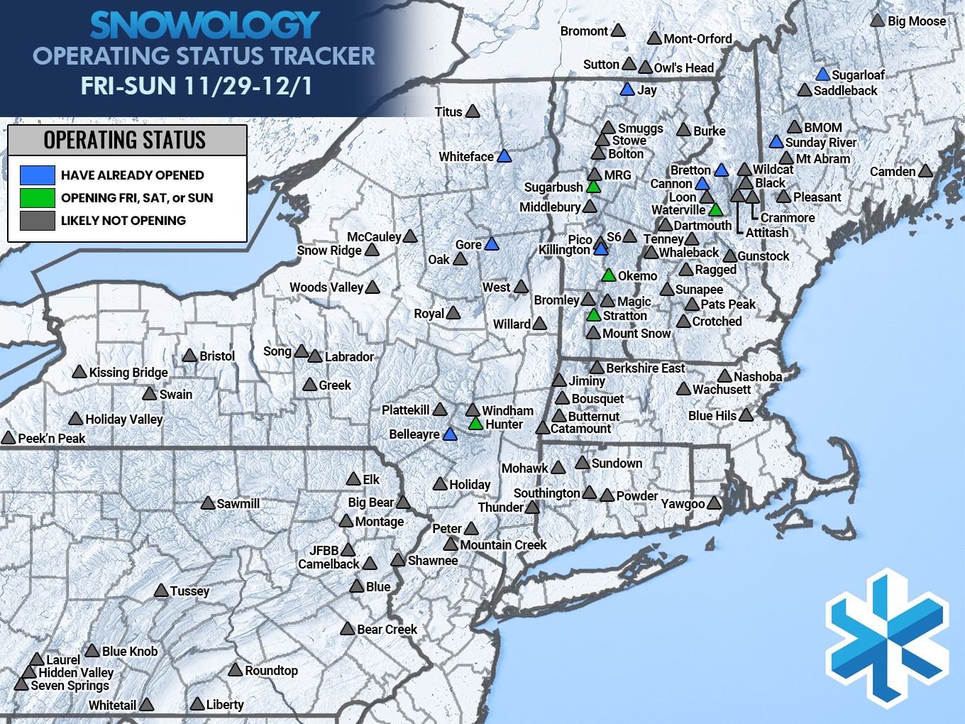
- Hunter: Opens Sunday
- Stratton: Opens Sunday
- Okemo: Opens Sunday
- Sugarbush: Opens Sunday
- Waterville Valley: Opens Saturday
Some additional ski areas will open midweek and many dozens are targeting opening by the following weekend with the excellent snowmaking weather we have in front of us for possibly 2 weeks or more.
Storm Postmortem
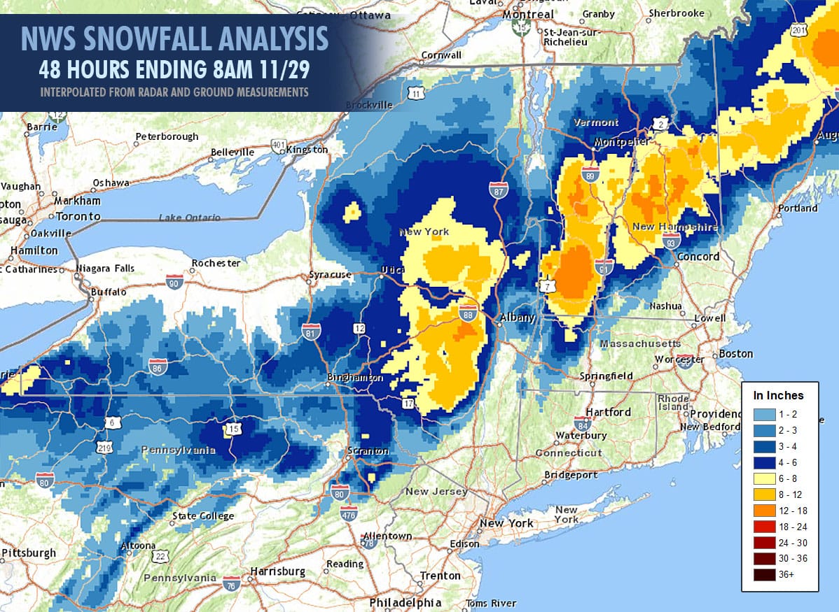
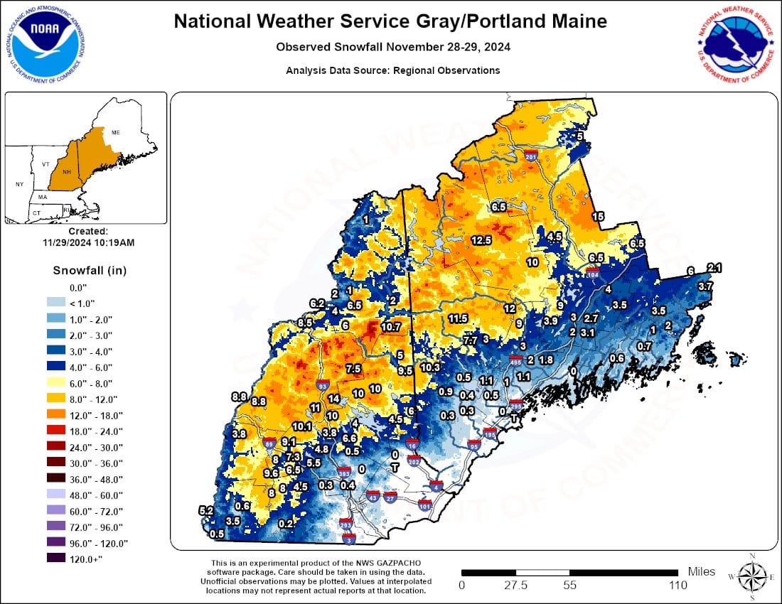
Here's the NWS Snowfall Analysis for the front end of this storm. Remember that this particular map commonly underestimates snowfall on higher mountains, especially more remote ones. This interpolation is generally more consistent with the base of mountains. At the same time snow reporting from ski areas varies a great deal in technique.
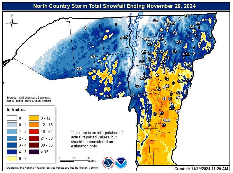
This interpolations below from the NWS Burlington and NWS Portland/Gray offices cover just a section of the region but they uses more sample points and it is tuned to be more accurate for the mountains. NWS Portland/Gray seems to have over enhanced the high terrain a bit too much however. These maps will give you a decent idea how the more generic treatment above differs from the versions the individual offices generate. You can even zoom in and see the higher amounts on the peaks. Whiteface for instance was estimated as having about 10" near the summit though they reported a range of 2"-4" (which they probably exceeded up high). Interpolation isn't always right of course. If you zoom way in you can see that they estimated 18" on the summit of Killington but it is literally only 1 pixel.
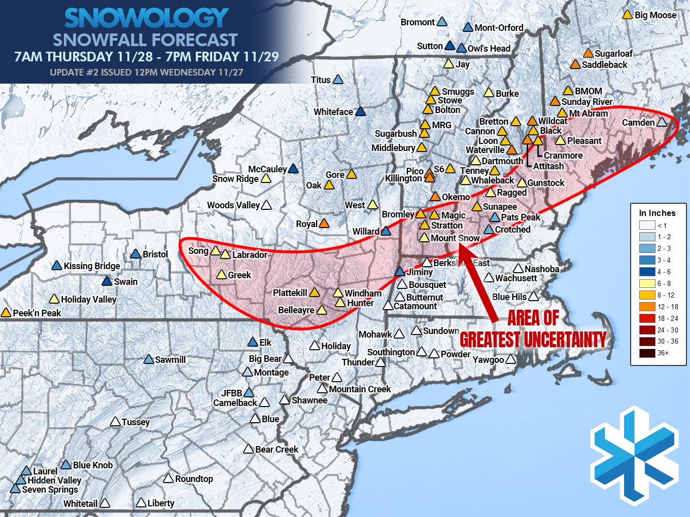
This is what the final Snowology Snowfall forecast was as of Noon on Wednesday:
The following list includes what ski areas have reported from this storm.
- Killington: 21" (possibly too high)
- Bromley: 16" (base measurement)
- Sugarloaf: 14"
- Mount Snow: 14"
- Okemo: 14" (webcam estimate)
- Magic: 12" (base measurement)
- MRG: 12"
- Royal: 12"
- Bretton Woods: 10"
- Belleayre: 10"
- Sunapee: 9" (webcam estimate)
- Sunday River: 10"
- Gore: 7"
- Cannon: 6" (possibly base measurement)
- Windham: 6"
- Jay Peak: 6"
- Stowe: 5"
- Whiteface: 4"
- Hunter: 3" (possibly base measurement)
Snowology forecasts snow as the average accumulation found 2/3 up the vertical rise of the ski area. We mainly seem to have missed just around Bromley, Magic, Stratton, Mount Snow, and Berkshire East as this area did not mix as much as we expected, though in NY, NH, and ME we seem to have accurately predicted the changeover line and snowfall amounts in most cases. Note that forecast included some lake effect through 7PM that hasn't yet fallen in the regions just off the lakes.
This was one of my better forecasts overall with most ski areas matching our forecast with the exception of that overperformance in Southern Vermont and the Berkshires which I listed as having uncertainty.

