We're issuing a storm watch for sometime next week, however those who jumped on early model runs in the last two days were likely chasing a fantasy storm. When things look great for a storm 7 days out that violates one of our core rules of forecasting which is that most likely things will change from that distance, and they did. Models ensembles also have very wide spreads with no strong preference for one solution over another.
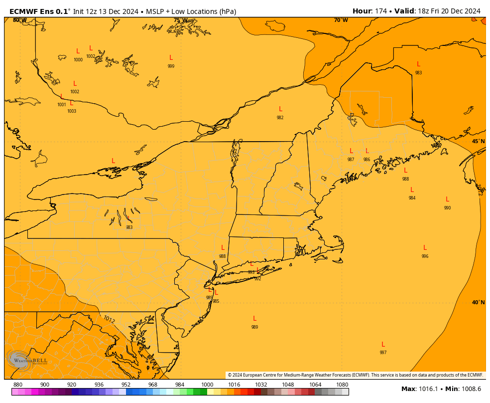
What is likely however is that there will be a strong trough in the upper levels dipping down far enough south that it could spin up a surface low. Near this trough also would be a cold front so there would be plenty of cold air around as well as warm moist air to make a nice storm. How exactly that happens, when it happens, and where it tracks are open questions at this point, but right now there is certainly zero consensus for a big storm at any given time next week.
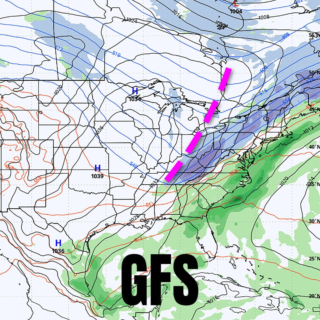
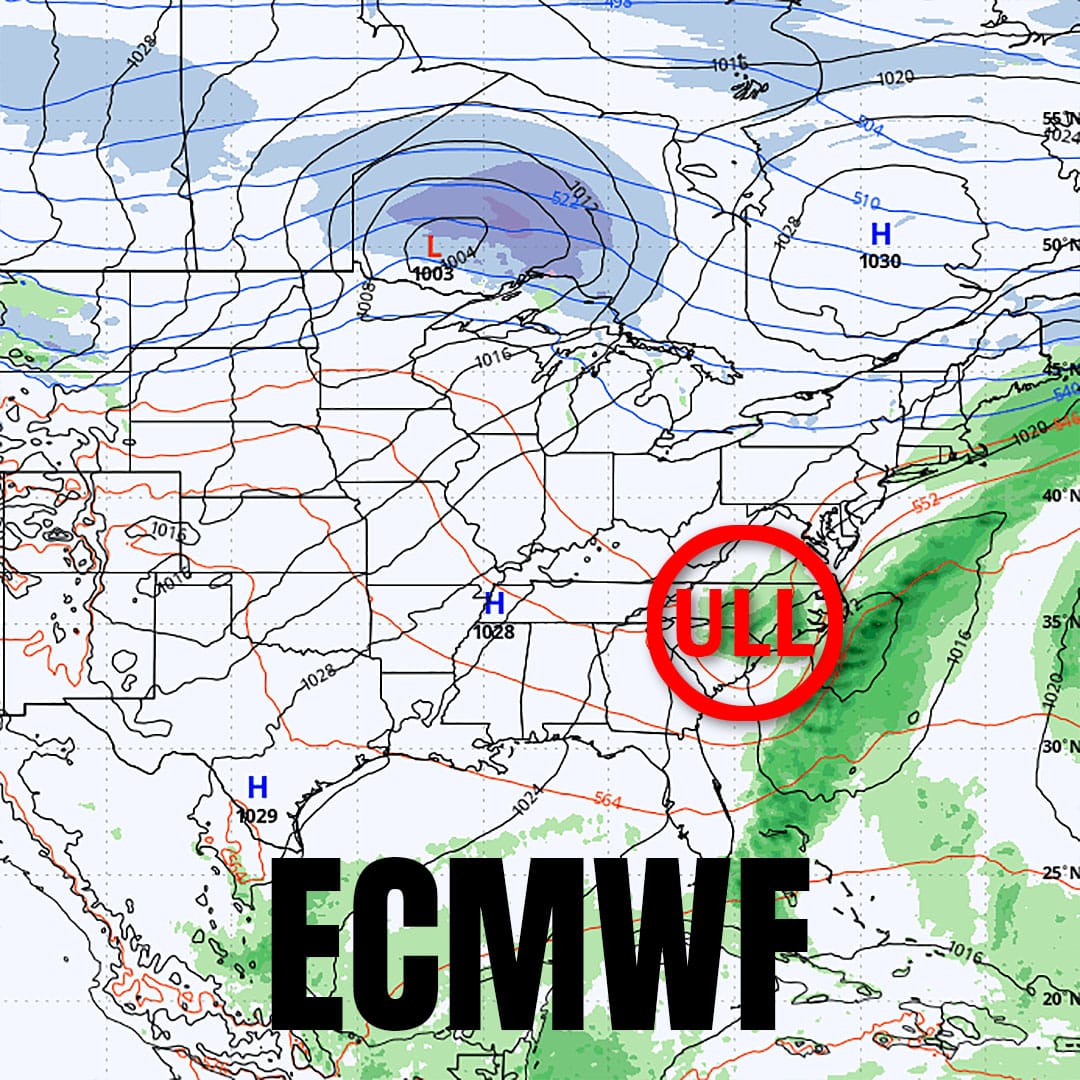
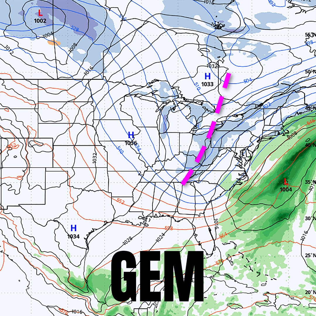
Shown above are the latest runs of the GFS (American), ECMWF (European), and GEM (Canadian) models showing 1PM on Thursday. The GFS and GEM both see a trough similarly and are roughly in agreement but the GFS sees light to moderate snow on Thursday and then a different piece of energy phases with the trough energy on Saturday and spins up near New England. This will likely change. The ECMWF is now seeing the trough pinch off an upper level low which changes the dynamic entirely and basically sends the storm out to sea with some back end snow. Behind that trough will be cold air and wind and an extended lake effect and upsloping snow event could come, and clippers do like to follow these systems as we recently saw with flow from the northwest.
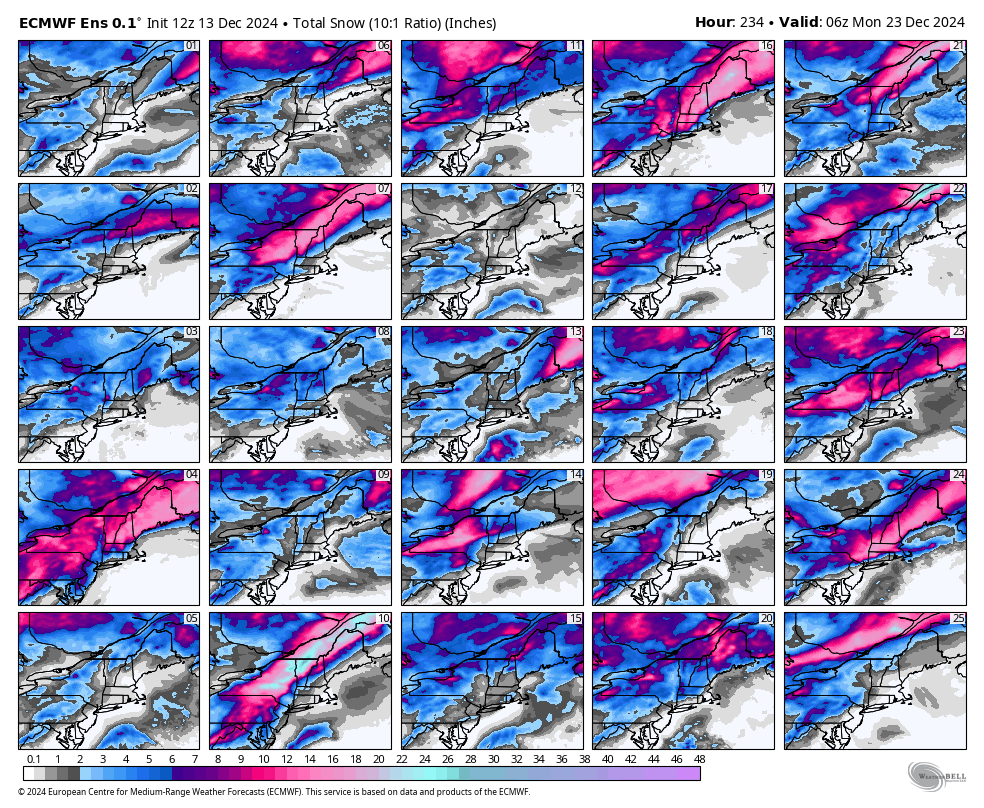
We'll cover what might potentially come from this system as consensus builds, but we feel it's likely that some sort of snow will happen later next week so make sure to follow Snowology to the pow!
-- Matthew Scott




Comments ()