It was pretty damn chilly overnight, but today will be widely the best day of the Christmas break from this point forward. Unfortunately we have two waves of precipitation coming starting Saturday that will cause just isolated issues in the region, but Sunday and Monday I'm afraid that we will see some widespread r@!n as temperatures moderate.
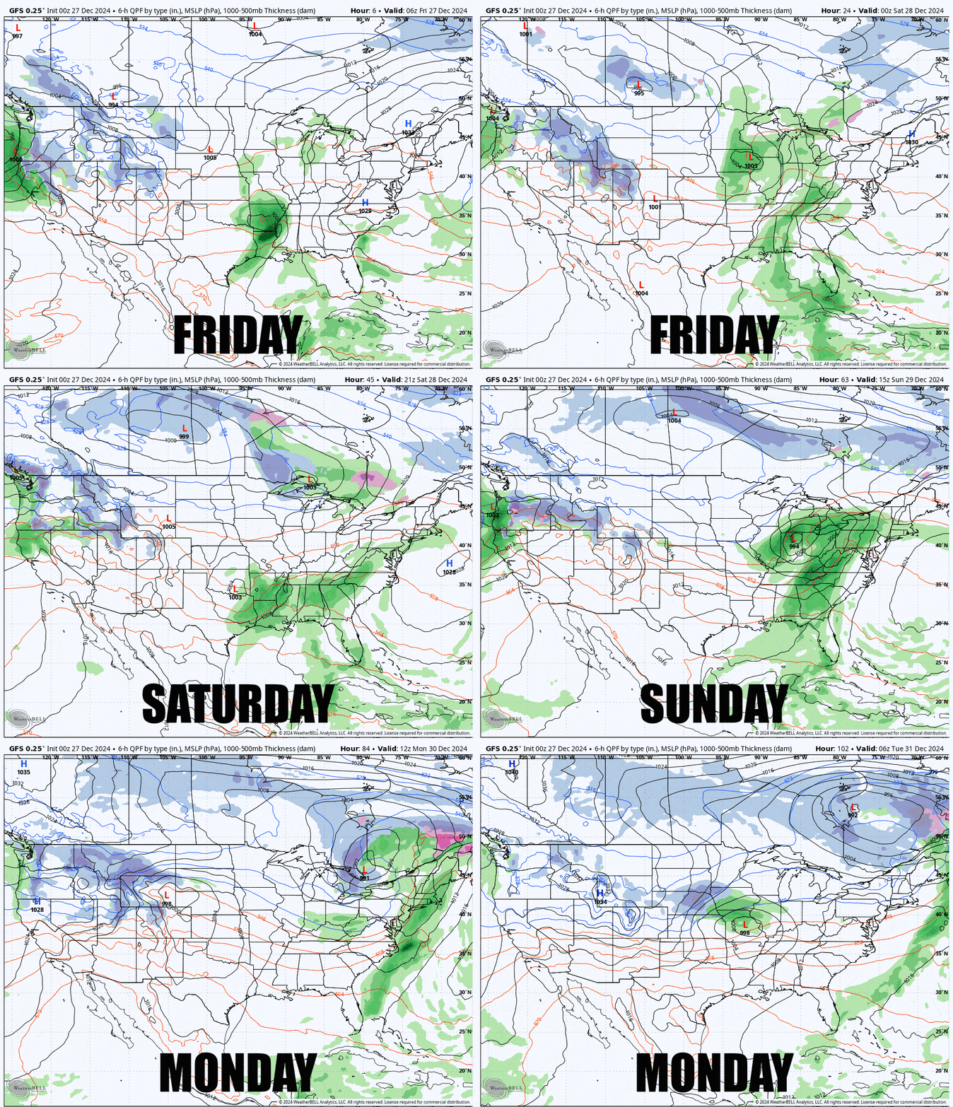
Let's take a look at Friday through Monday at the synoptic scale using the GFS showing 6-hour precipitation intensity.

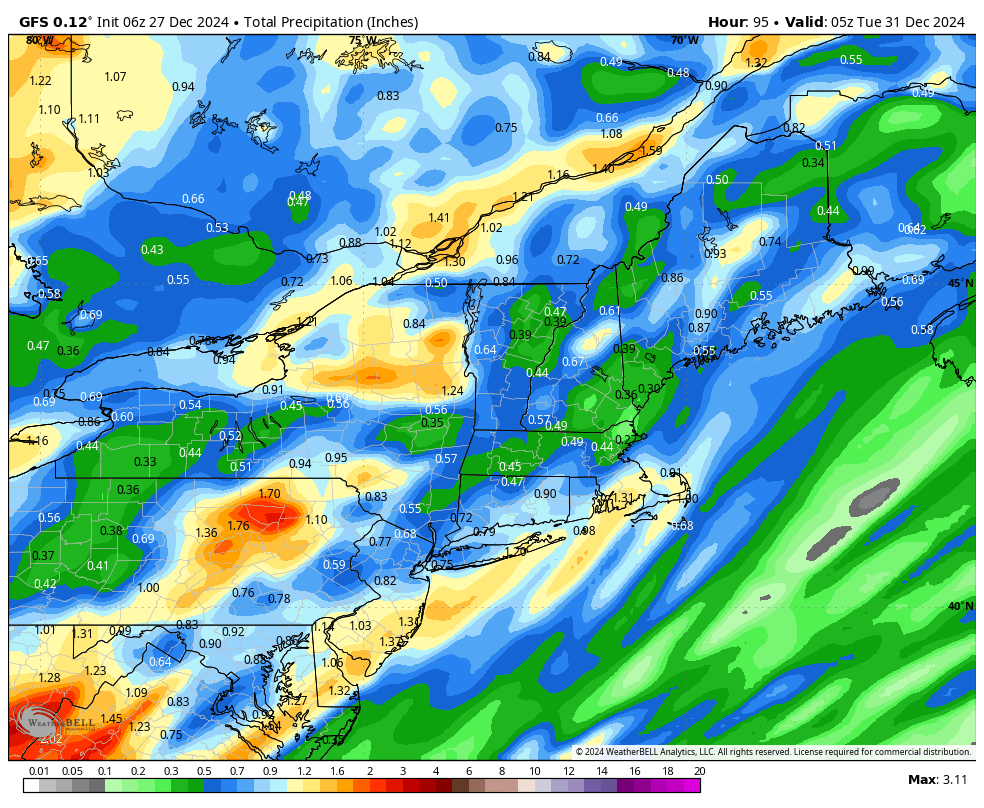
Keep in mind that 6-hour precipitation maps will show precipitation happening more broadly than what radar might look like showing instantaneous precipitation. Here's what the same model shows for precipitation through the end of Monday.

This isn't that bad as far as r@!n events go, but it will certainly dampen spirits on Sunday and Monday for many who can't dodge this.
Saturday is close enough that I can provide good detail on where and when impacts are expected, but high resolution accurate modeling really only exists within 48 hours and that means by Sunday precision is reduced as we switch to lower resolution models, and by Monday things are fuzzy enough that it doesn't make sense to try to pinpoint the timing and location of precipitation, though weather apps will attempt to do that. That's just how weather forecasting works.
Generally the driest areas will be in W-NY and W-PA, and then the Northern parts of NY, VT, NH, and ME, but everyone is likely to see some rain by the end of Monday.
I'll step through the basics for each day below for our subscribers.


