Here's the Snowology primer for The Week Ahead where we cover in brief the weather across Northeast ski areas through the next weekend in order to help prepare you for what is to come. We also provide a Weekend Update on Thursdays and of course Storm Updates and other updates with finer detail when appropriate.
Synoptic Overview
There are three primary stories this week starting with a moderate wind and r@!n event on Monday that has already been covered, then a disorganized coastal storm on Wednesday that will be followed by what looks to be an epic cycle of back end snow that may last through Saturday or even Sunday as Arctic air will light up the lakes along with remnant moisture upsloping into the ADKs, Greens, and Whites. To be clear, this event looks prolific and we should easily see some totals in excess of 2 feet by the time the weekend is over. Let's look at the ECMWF (European) model covering Monday through Sunday.
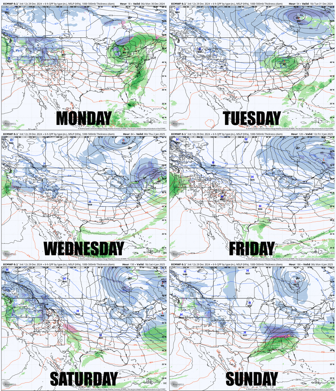
Modeling at the synoptic level looks pretty solid through the weekend so I don't expect any surprises for the region from systems or unexpected variability in the general temperatures, though we can't pinpoint individual ski areas reliably from up to 7 days out of course.
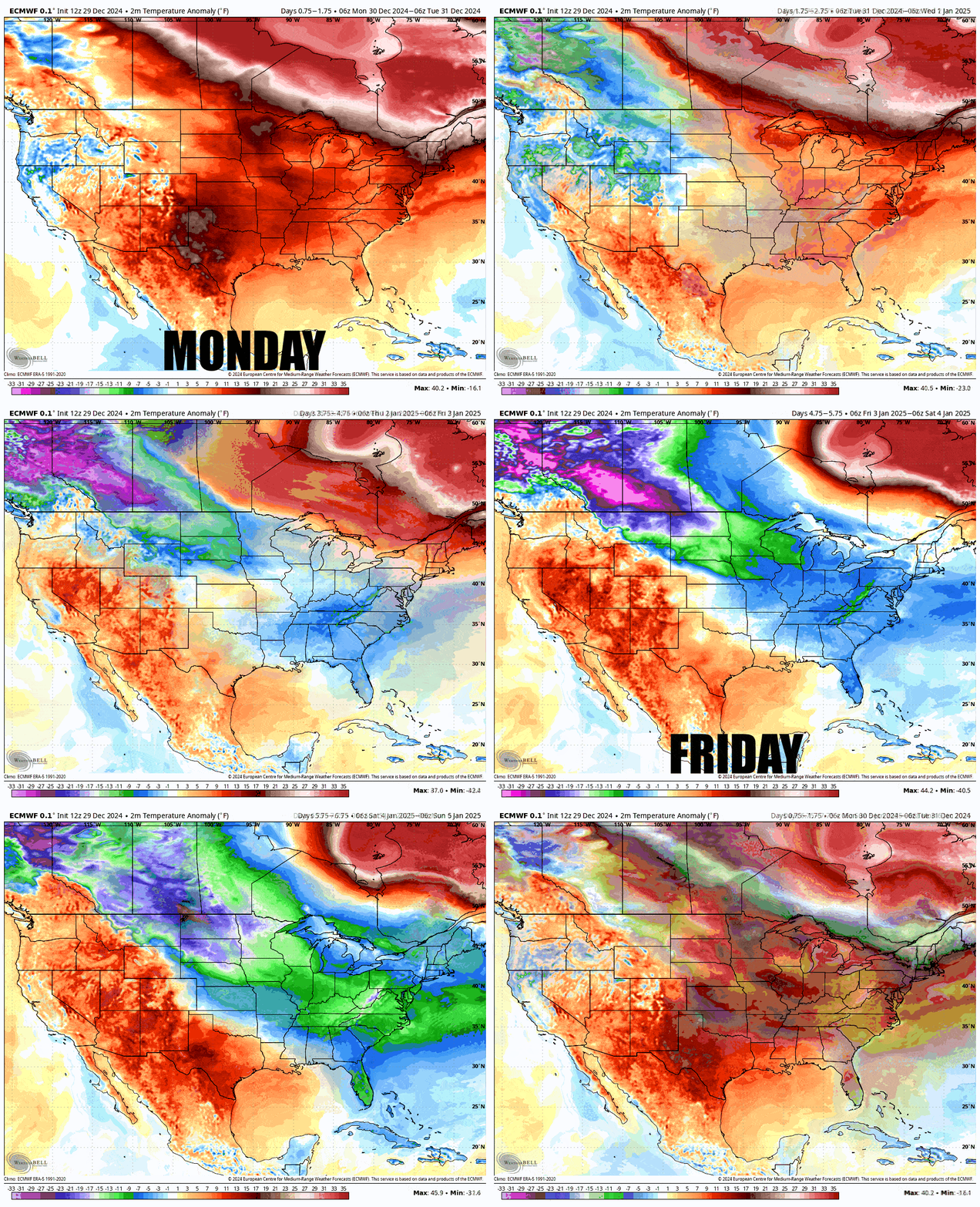
Temperatures of course are quite warm now, especially for this time of the year, but we'll transition to below average temperatures by the weekend in the Northeast, and the Mid Atlantic will likely even get a pretty nice snowstorm around the following Monday, though that will wreak havoc in the cities there. Here are the daily temperature anomalies through Sunday from the ECMWF.
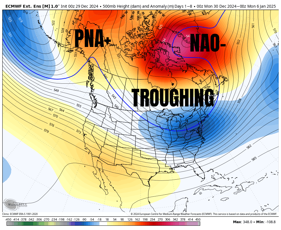
The general pattern that we will start to transition into on Wednesday with the next storm is just about as good as it gets. We have a PNA+ pattern in the West, signaled by the ridge in Alaska and British Columbia, and that is a major trigger for another ridge near Greenland that indicates NAO-, and in between the steering currents of the atmosphere squeeze down persistent troughing which brings both cold weather and a higher chance of coastal storm tracks. This pattern looks to stay dominant until at least mid-January! This is a 10/10 extended-range outlook for Northeast snow lovers, though Quebec tends to be more dry in this situation.
I'll walk through the general forecast day by day below for subscribers, pointing out the most notable events of each day across the region.

