Ok snow lovers, we're getting a storm on Wednesday and it's kind of going to be a bit messy to start, but then the cold air comes along with wind and lots of ambient moisture on the back end we are likely to see some prolific snow through Sunday morning. This will be another sleeper of sorts because it happens over days and only off the lakes and in the mountains. Just a warning, with 4 days to cover and a lot of things to consider, this is a little long. Future updates will be more brief after this introduction to the storm.
Let's take a look at the wide view of this system as modeled by the ECMWF from Tuesday through Saturday. Note, this map shows instantaneous precipitation similar to radar.
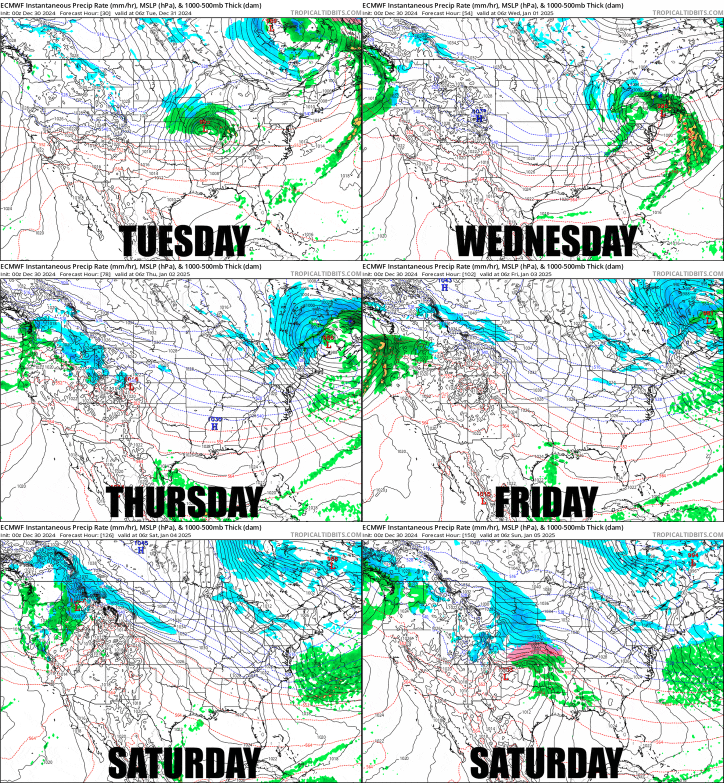
The storm tracks up through the Midwest until somewhere near Lake Erie when it jumps to the coast near NYC and then tracks up near the coast through Maine and then curves north into Quebec after hitting resistance from the Greenland Block (ridge of high pressure). This also slows the storm down in Maine and gives the immediate back end of the storm some extra time to dump through Thursday before we transition to lake effect and upsloping snow through what looks like early Sunday. Just to be clear, not everyone is getting snow from this, it will ice things up again in more southern areas and near the coast as the cold air behind this storm sets in, but there will be time to recover by the weekend for the less fortunate.
I'll walk through the Front End Snowfall Forecast, which will be complex, then the Back End Snowfall Forecast, and then give a preview of the Wind Hold Forecast with the potential of widespread issues on Thursday with all of the other days presenting some degree of risk in a more isolated manner.

