The front end on Wednesday is going to be pretty disappointing almost everywhere, but as soon as the wind wraps around and blows from the northwest, the snow is going to start stacking up deep and in some spots it will continue through the end of Sunday. This is primarily a back end storm with lake effect and upsloping snow that will heavily impact areas off of both lakes, and on the upslope in the Alleghenies, ADKs, Greens, and Whites. That's up to 5 days of snow in some places, and it will be prolific where that happens. Currently I am forecasting as much as 30" of snow, but we have widespread notable wind threats to lifts on Thursday, and limited and more isolated threats of wind holds on all 4 other days, so plan wisely, and consider subscribing if you haven't already.
If you haven't subscribed yet, here's a special offer! You can get a full 1 year subscription for just $19.99.
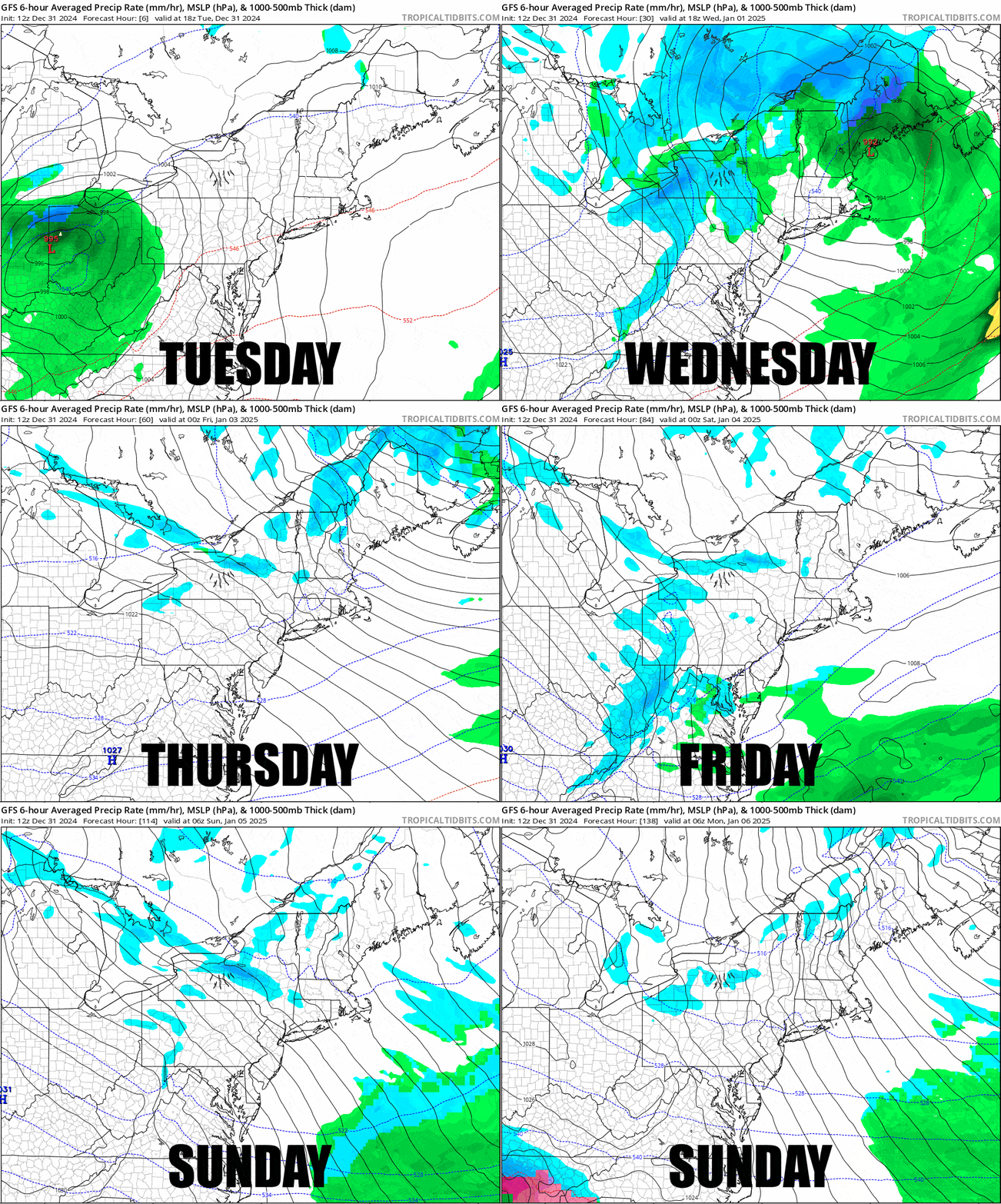
Let's jump into the forecast staring with the the wide view and a loop covering all Tuesday PM through all of Sunday from the GFS, but note, the GFS lacks the resolution necessary to detect some elevation dependent snow and it tends to run a little warm on precipitation types.

I'll go through the Snowfall Forecast breaking the storm down into just Wednesday and Thursday, and then as a whole through Sunday. I will also cover all 5 days with the Wind Hold Forecast with extra detail for Wednesday and Thursday. I will cover Where to Hunt Thursday as that will be tricky.


