Sorry for the delay on this update, these multi day systems with wind to boot take many hours to prepare. My forecasting isn't automated and this is a bit complex. This one is a bit long also to help the powder hunters navigate the snow and the wind through Friday as well as the weekenders after that.
Every time we get a storm that is sort of crap on the front end but delivers primarily on the back end, we see doubters on the internets. They should probably sign up for a 10-day free trial. What some people don't know, especially people who don't ski and also people who don't know how to powder hunt anything but nor'easters is that back end snow is the majority of snow that we see near the Great Lakes and also on the northern side of the ADKs, the Northern Greens, and the NW side of the White Mountains, and these are among the snowiest places in the Northeast. Simply put back end snow is a BFD for Northeast skiing and riding, and I'm afraid there are a lot of people who don't actually know this because back end snow does not get wide coverage outside of some lake effect events.
By Sunday parts of PA, NY, VT, and the Eastern Townships will be quite deep to very, very deep. This is a 5 day system and we're only 1 day through it. The front end was not the big deal in this storm, it was always the back end.
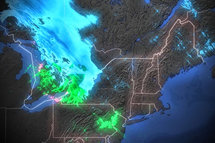
Here's the Northeast view from the NAM12K through the end of Saturday to set this up. This is similar to simulated radar but at just medium-resolution. The take away from this is that there's days of lake effect and upsloping left to go (note, Sunday is not shown but it will continue on Sunday).
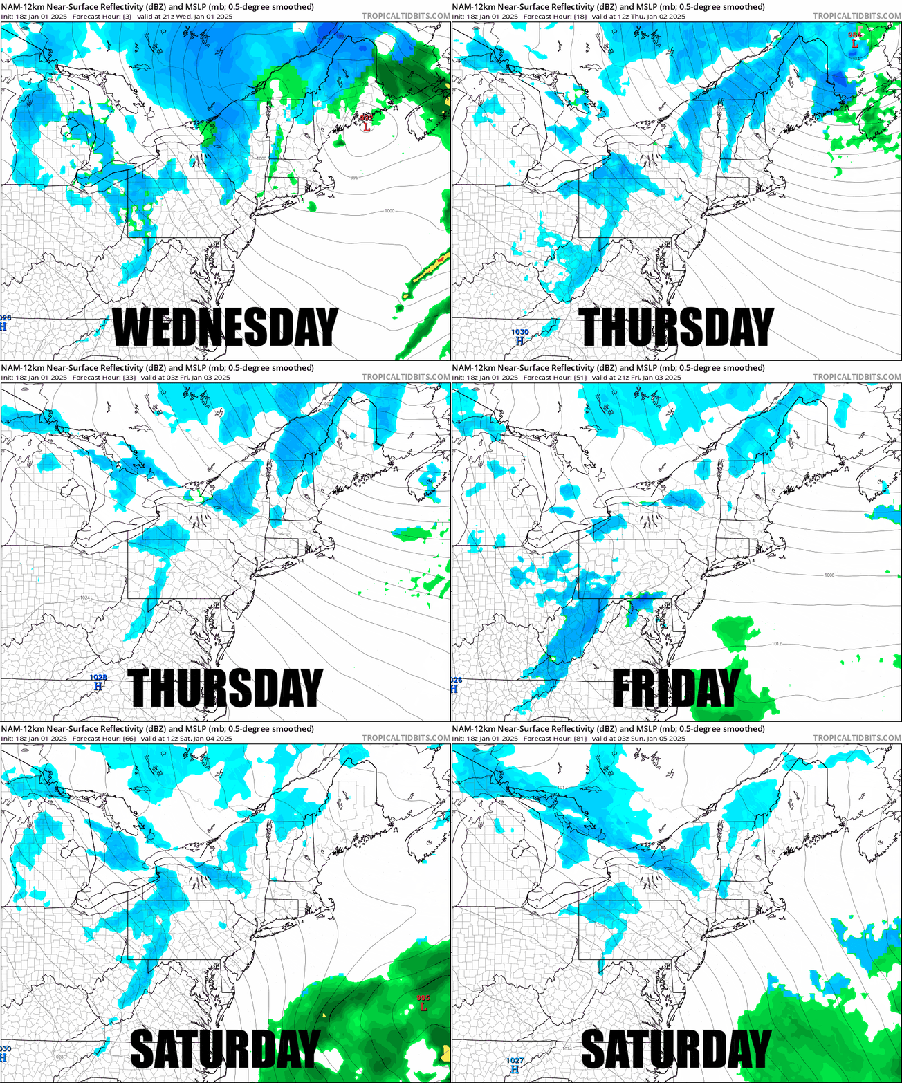
I'm going to update the Snowfall Forecast through both 4PM on Thursday and then also through 8AM on Sunday morning. I will also step through the Wind Hold Forecast through Sunday with a detailed forecast covering each day. Note, Thursday still looks really bad in parts of NY and New England and hunting opportunities will be limited until the wind subsides or you break out your skins. I'm going to start though by going over Phases of Recovery After a Melt since the majority of ski areas will not turn into packed powder by the weekend.
Phases of Recovery After a Melt
The dose of reality with this storm is that it follows a nasty melt and that's going to turn out a lot more differently across the full region as cold air comes back and sets in for the long haul.
There are 3 primary phases to recovery, the first being the refreeze so that they can start grooming a surface on the hardpack. Without new snow this first phase is just hard and fast and things get skied out quickly on steeps with just moderate traffic. The second phase comes over the next 3 frozen days as groomers and edges build a deeper and more tolerant skiable surface along with some resurfacing and also terrain expansions start from snowmaking, and a little snow also helps with this. The third phase of recovery happens, when natural snow starts to build on top of that hardpack and natural terrain starts to be opened up and real packed powder conditions return, just not generally widely at once without a true nor'easter.
This coming weekend we'll see some full recoveries to phase 3 where the back end snow generally performs the best as back end snow is expected to last through Sunday, though not everywhere of course. The others will be around Phase 2 where people and their groomers and snow guns create the magic. It will be a tale of two worlds, but remember, you can go to where the snow is (barring personal considerations) and there will be plenty of it.
Snowfall Forecast
The forecast below is just for 4PM Wednesday through 4PM Thursday. The previous map also included the snow through 4PM today. There is a little trim across VT, and a slightly larger trim in NH where less moisture on the back end will not produce as much snow there. Parts of NY, S-VT, NH, and ME already saw accumulations through 4PM today that are not shown here.

