We still have 3 more days of accumulating snowfall across mainly parts of NY, VT, W-MA, and W-PA. The heaviest part of the upsloping snow has already occurred but we will continue to see upsloping snow through Sunday morning in parts of NY and VT with variable intensity, and the lake effect will continue in earnest through Sunday evening, especially off of Lake Ontario pointing towards the ESE.
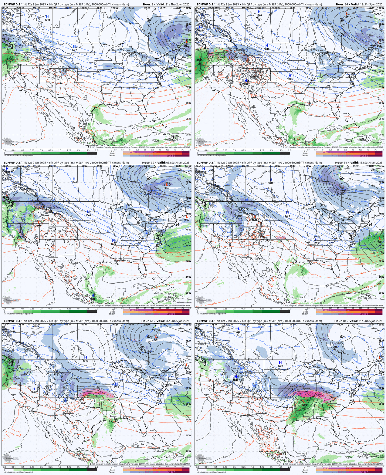
Let's start off with the wide view showing the 6-hour precipitation intensity from the ECMWF from 4PM Thursday through 4PM on Sunday which covers the end of this storm and sets up the weekend. You may note the storm up in Quebec is moving west instead of east and that's due to a Greenland Block or NAO- pattern where blocking high pressure south of Greenland causes storms to slow down over the Northeast and even loop north and then west into Canada. That is bringing moisture and wind over a 5 day period to the Northeast and that's why the back end of this storm is prolific.

I think after 3 previous updates we know what's happening so I'm going to rip through both the Snowfall Forecast and the Wind Hold Forecast with detail on each of the three days in order to help you score some pow, but in a much more deterministic manner.
With the wind dying down now where the snow is stacking up, Friday is the day to start hunting this storm, but you still need to choose wisely!


