Here's the Snowology primer for The Week Ahead where we cover in brief the weather across Northeast ski areas through the next weekend in order to help prepare you for what is to come. We also provide a Weekend Update on Thursdays and of course Storm Updates and other updates with finer detail when appropriate.
Synoptic Overview
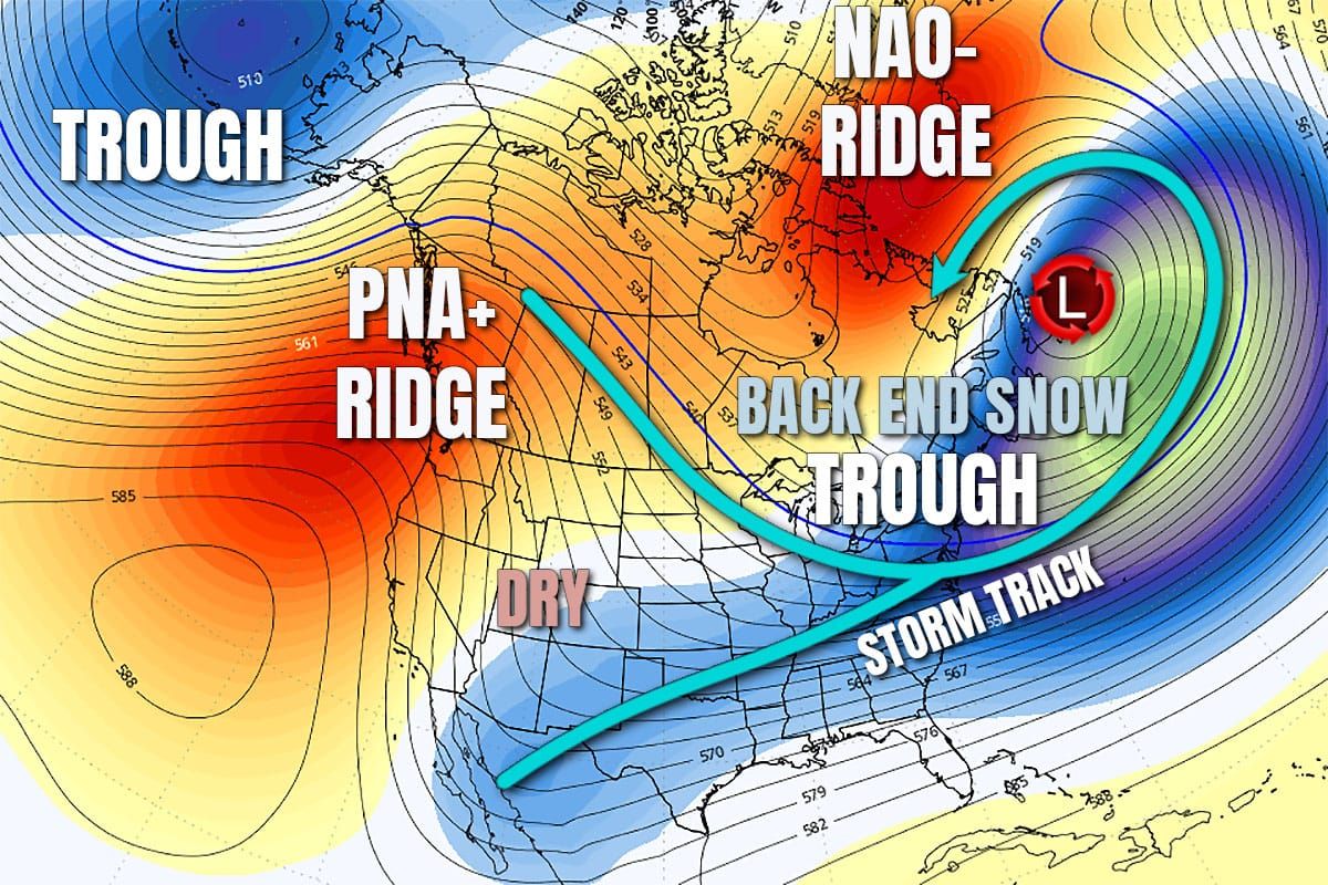
We're entering January with a classic mid-winter pattern that shifts the East Coast storm track south into the Mid Atlantic and brings cold air into the Northeast.
The main feature is the ridge in British Columbia and a ridge near Greenland. While both the PNA+ and NAO- patterns are associated with cold and stormy weather in the Northeast, the ridge out west is a bit too far east for optimal flows, and the ridge near Greenland is shifted back into Northern Quebec, and that's going to put a squeeze on the trough in between and actually create an anti-cyclonic circulation over the Maritimes where storms actually track northeast and then loop back into Quebec.

This brings moisture in waves that orographic lift will turn into snow on the upslope from the St. Lawrence Valley south and into the mountains, and also with the addition of wind some lake effect and lake enhancement also. Right now modeling doesn't suggest this pattern will break for at least 10 days, and that means cold, a storm track mostly around the Mid Atlantic, and little snow in the Northeast beyond the bursts of moisture driven by wind.
I'll walk subscribers through the General Outlook first with a discussion of precipitation (all snow) and temperatures, and then I will will go through Daily Outlooks giving a brief overview of each day with a focus on temperatures, precipitation, and wind.


