It's been a rough week for some of the taller mountains in the Northeast with extreme wind and also cold temperatures but a fabulous week for some less prominent mountains who have benefitted from the back end snow including the likes of Titus with 27" in just 3 days, as well as Song, Labrador, and Greek Peak in Central New York where the streamers from Lake Ontario were directed, Holiday Valley, Peek'n Peak, and Mount Pleasant of Edinboro off of lake Erie, and even down in the Alleghenies of PA where they have received over a foot of snow this week.
Snow did also pelt Northern Vermont quite heavily however due to the wind many actually under-reported their snow and when the wind does let up on Friday you will find much of that snow in the woods and somewhat irregular with deep stashes of softer pow and irregular packed drifts. By Saturday I think channels will get carved out of those irregular pockets making them more widely inviting along with a refresh of snow that morning. Some of those drifts are in fact over your head right now, and it's a technical sort of pow. While they haven't reported a lot of snow in the Whites and the Longfellows, it's been stacking up for the last 10 days at 0"-2" generally per day with some on the trails in more protected areas, and blown into the woods higher up.
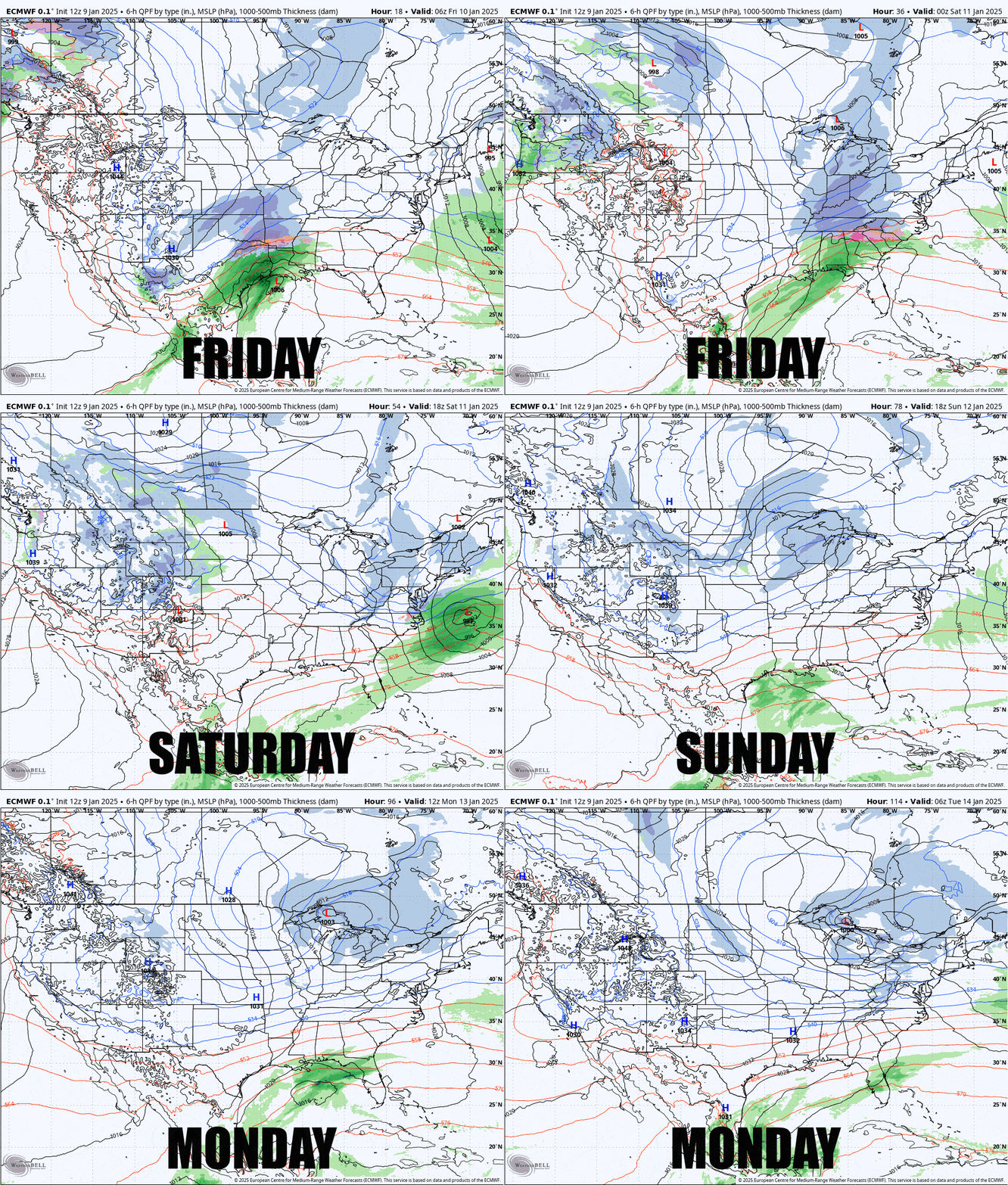
We do have some remaining wind issues on Friday to talk about, as well as a welcomed warmup, but not too warm, and some snow will come again on Saturday that will be widespread. Even where the snow didn't fall deep earlier this week it's going to be fantastic far and wide. Let's take a look at the broad view over the next 4 days to set up the weekend.

I'll cover each day from Friday through Monday focusing on the wind, snow, and temperatures, but to be clear, there will only be some isolated problems on Friday while the rest of the weekend will be fantastic practically everywhere through Monday.


